


 Country:
 City:
City:


Car park at Saint-Vaast de Mametz Church (Contour de l’Église).
(S/E) With your back to the church entrance, head straight ahead and, after 80 metres, join Rue du Moulin and follow it to the right. After about fifty metres, turn left onto Chemin des Ruelles and follow it for 150 metres.
(1) Take the path on the left and you will very quickly reach a small square. Keep well to the right and continue along a good grassy path for 150 metres.
(2) Head slightly uphill to the right (there’s a small metal gate at the entrance). Join Chemin des Ruelles and follow it to the left until you reach a T-junction.
(3) Leave the tarmac road and take the path on the right, crossing the River Lys. Then turn left and follow the river. You’ll come to a Fork in the road opposite a pond.
(4) Turn left and walk alongside the two ponds for 600 metres. You’ll reach the edge of a third pond at a T-junction.
(5) Without joining the D189, turn right between the ponds and join the D189 further on.
Follow it to the right until you reach a crossroads (waymarker).
(6) Head straight on, towards Clarques (D192). At the next fork, turn left immediately onto the D192. Pass some houses on your right and continue for 200 m.
(7) Leave the tarmac road and take the path leading uphill on the right (signposted ‘Gris Mont’). After the house, turn right to enter the Bois du Séchier. Cross the woodland following the main path, which quickly improves (remnants of the war). Shortly after leaving the woodland, you’ll reach a T-junction.
(8) Turn left to join the D190. Follow it for 100 m to the right.
(9) Take the correct path on the left and head towards a four-way junction. Turn left and continue for 350 metres.
(10) Turn sharply to the right: the path is difficult at first but quickly becomes a lovely arched track. After passing a house, you’ll reach a small road. Follow it to the right, towards Ecques, for 200 m.
(11) Just before the cemetery, turn right to cross the square (town hall, school) and reach the D189.
Follow it to the right for about fifty metres, then turn left onto Rue de la Basseville to reach the new cemetery.
(12) Carry on straight ahead until you reach a T-junction with the D190.
(13) Turn left. After 200 metres, you’ll come to a path on the left.
(14) Take this path and, 100 metres further on, you’ll come to a Fork in the road.
(15) Turn right and stay on the path, roughly along the edge of the woodland. You’ll reach a lovely tree-lined avenue. Follow it to the right until you reach the edge of the woodland again, 100 metres further on.
(16) Stay in the woods, turn left and walk along the edge (following theGRP® Tour du Pays de la Lys signposts in the opposite direction). As you leave the woods, continue along the path that descends to join the D 201.
(17) Follow it to the right until you reach the centre of Quiestède (church), at a four-way junction.
(18) Then turn right, keeping to the left-hand side of the well-maintained road, and continue to the roundabout. Turn right onto the D190 and follow it for about 700 m.
(19) Turn onto the first track on the left. Carry on straight ahead until you reach the woods, where you’ll find a good track on the right. Follow it as it zigzags until you reach a four-way junction.
(20) Head straight ahead to reach the hamlet of Ligne. At the T-junction, turn left and continue for 200 m to enter the hamlet.
(21) Take a path leading down to the right (south) and reach a small road. Follow it to the left, then turn right onto the small road until you reach a T-junction with the D917. Turn left for about 100 metres and then turn right onto Rue Warnes d’Amont for 70 metres.
(22) Set off along a well-maintained path on the left. Follow it until you reach a four-way junction. Turn right onto a small road. At the crossroads that follows, continue straight ahead until you reach a T-junction.
(23) Turn right and you’ll come to a farm. Turn left and walk for 100 metres.
(24) Just past the farm, turn right onto a track and join the D197. Follow it to the left for about 300 metres.
(25) Leave the D197 and take a good, tarmac-surfaced track on the left. After a right-angled bend, take the first track on the left. After 250 m, turn right to reach Glomenghem.
(26) At the crossroads, go straight ahead. After a left-hand bend, take the first track on the right.
You will come to a four-way junction.
(27) Turn right to cross the Lys. Follow this track through the marsh to reach the entrance to the campsite.
(28) Follow the small road on the left for about 250 m until you reach a four-way junction.
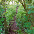
(29) Don’t miss the signposted path that branches off to the right and climbs up to Mametz Church alongside a stream (or through it, depending on the weather). Join the Contour de l’Église to finish the walk (S/E).

 Visorando Member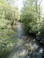
 Easy
Easy 
 Local authority
 Moderate
