Country:

 City:
City:



Park in Verquin in the car park in front of the cemetery.
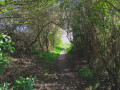
(S/E) Head towards the village and immediately turn left onto the Sentier de l’Égalité. After a few metres, take a narrow, well-hidden path on the right. It bends to the left and leads to a solitary tree. Then turn right into the wasteland towards the house and continue along the small street to reach the T-junction with Rue Alexandre Duflot. Turn left, then immediately right to reach the area near the church. Head towards the church and go round it – either to the right or the left – to find a flight of steps leading down to Rue Constant Martin. Cross at the pedestrian crossing and go under the gate. At the car park, veer left to find a clear path and follow it, ignoring a path on the left. Continue straight on along the narrow track, which is pleasantly lined with barbed wire. You’ll come to a farm where the path becomes a little uneven for a few metres. Once you’ve passed this section, you’ll reach a crossroads.
(1) Take the path furthest to the right, which climbs slightly, until you come to a flight of steps.
(2) Take the path opposite, to the left of the steps. A little further on, head uphill to reach a wider path and follow it to the left until you can see Rue du 4 Septembre.
(3) Just before reaching the street, turn right and you’ll immediately find a path leading uphill to the right.
Take this steeply ascending path to reach the top of the first slag heap. At the top, continue straight on along the correct path, which skirts the summit and eventually veers to the right, descending to the top of the staircase. Go down the staircase and look for another flight of steps leading down to the left.
(2) Take this. At the bottom, go through the ‘tunnel’ on the right and you’ll find yourself overlooking a pond.
(4) Head down towards the pond and walk round it on the left-hand side. At the end, turn left to walk alongside the large white building on your left and join Rue du 4 Septembre.
(5) Follow it to the left until you reach the traffic lights. Cross the road (D937) and take Rue des Déportés opposite.
(6) Leave Rue du Pont on your right (you’ll take this later) and head towards the railway line. Cross it and turn immediately left onto the path. Pass under the A26. When you reach a small road, follow it to the right for a few metres.
(7) Leave this road and take the footpath on the left. At the stadium, head diagonally left towards a large ruined building. Go round it on the left to reach the exit of the sports complex.
(8) Cross the road and take Rue des Jardins, which is almost directly opposite. At the very end, you’ll come face to face with the equestrian centre; turn left onto the path, the entrance to which is slightly hidden. Follow this path carefully as it makes a wide circular loop to the right. After a section that is often very damp, you’ll reach a footbridge.
(9) Cross it, turn immediately left, then right, and you’ll reach a vast grassy area. Follow it to the left, keeping to the higher ground near the hedge: there are ponds below on the right. Look for an opening in the hedge, just after a solitary tree marked with a red arrow (as of December 2024). Take this path and turn left straight away to reach a small road. Cross it to take the straight path opposite and reach a junction facing a wooded area.
(10) Head right and walk past an electricity substation. Just after this, you’ll reach a junction. The entrance to the path is opposite (covered in small gravel). Follow this well-marked path until you reach a housing estate. Turn right before the houses to reach a small road opposite the entrance to the slag heap. Cross the road to enter the slag heap site and go round the playground on the right. At the fork in the road, take the left-hand track and tackle a steep climb. At the top, you’ll reach a junction.
(11) Take the second path on the right, which goes uphill. At the next junction, turn left to reach a large open area. Continue straight ahead on the narrow path (I cleared it recently, in winter 2024) and, after a short descent, you’ll come to a junction. Take the path straight ahead uphill and continue to the steps.
(12) Climb these steps on the left. At the top (summit of the second slag heap), turn right. At the Fork in the road (Caution: it is not very visible), take the left-hand path and follow the correct route straight on until you reach the playground (bumpy terrain for mountain biking opposite).
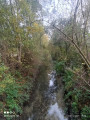
(13) Take the flat path on the right. Follow a stream, then pass in front of the sports ground. Shortly afterwards, at the junction (footbridge on the left), take the first path on the right and you’ll come within sight of a footbridge on the left.
(14) Cross the footbridge and follow the path alongside a pond. At the Fork in the road at the end of the pond, take the grassy path on the left and join Rue Jules Ferry. Follow it to the right for about a hundred metres.
(15) Take a path on the left (the little wagon that used to be at the entrance has gone!) which turns right before a house, then joins Rue de la Chapelle, which you should follow as far as Rue Pasteur.
(16) Follow it for a few metres to the left, then turn right into what looks like a dead end.
Keeping well to the right, find the entrance to a narrow path with the charming name ‘Sentier de la Chapelle du Bel Amour’. At the end, turn right, then immediately left onto the ‘Sentier de la Gare’. At the end of the street, continue along a narrow track that joins a main path. Follow this to the right until you reach the houses you passed on the way there.
(7) Then turn left, go under the motorway and follow the railway line to reach Rue des Déportés; follow this to the right for about a hundred metres until you reach a junction you passed on the way there.
(6) Turn left onto Rue du Pont. Walk past the first sports ground, then on to the second one. Cross it and continue straight ahead to the D937. You can either cross straight away – as there is a central reservation and the traffic lights regulate the flow of traffic well – or turn right to the traffic lights, cross there and retrace your steps (route choice) to the entrance to the slag heap (barrier).
(17) Turn right (a slightly tricky section) and, a few metres further on, follow the path on the right.
A first steep climb, followed by a second, slightly steeper one, leads up to the slag heap where you’ll find a good path.
(18) Follow it for about ten metres to the right, then leave it to follow a narrow track on the left which, via two steep sections, takes you to the summit. Continue due south. The path veers right twice and eventually joins a track that descends steeply to the left.
(19) Take this track.
(20) At the bottom, take a hairpin bend to the right onto a very narrow track which eventually joins a tarmac path; follow this to the road. Follow the road to the right to reach the car park in front of the cemetery (S/E).

 Visorando Member
 Easy
Easy 
 Association / Club / Walk leader