Country:
 City:


Start in Hermaville: small car park at the entrance to Rue de l’Église.
(S/E) Head towards the church. Just after that (at a large blue gate), turn right into Ruelle Galetc and continue to the D54. Follow it to the left.
(1) Shortly after the garage, take the small street on the right. Initially tarmac, it quickly turns into an uphill track. At the junction, carry on straight ahead and, keeping the same direction at each junction, you’ll eventually reach the D339.
(2) Cross it carefully and take Rue de la Ferme opposite. The path slopes gently downwards until you reach a ford over the Gy. Cross via the footbridge (or wade across if the water is shallow). You’ll reach a junction near the church.
(3) Head straight ahead into Rue de l’Enfer. It bends to the right, then becomes a track, and reaches a junction.
(4) Turn left onto the GR®121. You’ll reach the D7. Follow it for a few metres to the right before taking the wide path on the left (still the GR®). Walk past the Montenescourt cemetery and, just after that, you’ll find a lovely path on the right.
(5) Follow this until you reach a T-junction. Follow the road to the left and join the D61.
(6) Turn right to reach a junction. Carry on straight ahead until you reach a second junction.
(7) Turn left into the street. At the Fork in the road, take the left-hand track. The path turns sharply left and, shortly afterwards, you’ll come to a path on the right.
(8) Take this path to reach a T-junction. Turn left and you’ll reach another T-junction.
(9) Then turn right. The path turns sharply left and, 300 metres further on, you’ll come to a grassy track on the right.
(10) Follow this path until you reach a junction. Turn left to reach the D56, at the entrance to Agnez-lès-Duisans.
(11) Follow it to the right for about 300 m, then turn left (just after La Ferme) onto Rue Leflon. Walk past the bakery. Continue straight on, cross the Gy, and reach a T-junction.
(12) Turn left, following the GR® and GRP® trails. Carry on straight ahead, ignoring the turnings to the right and left, until you reach a small road.
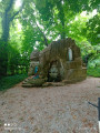
(13) You can take a short detour to the left (twice 50 metres) to the artesian well before rejoining the path.
(14) Follow it to the right until you reach the junction.
(15) Turn right onto Rue du Château d’Eau and join the D339. Follow it to the right for about 200 metres (take care), before turning left. After about 300 metres, you’ll come to a path on the left.
(16) Follow it for about a hundred metres, then turn right onto the grassy path, which slopes gently downwards. It bends to the right, running alongside a small copse, and reaches a T-junction.
(17) Turn left. The path immediately turns right. At the Fork in the road, continue straight ahead and, just before the departmental road, you’ll find a path branching off to the right.
(18) Follow this path, which eventually turns left, to reach the D54. Cross it and head straight on to reach a T-junction.
(19) Then turn left and you’ll reach a junction. Carry straight on, through the fields, until you come out opposite the Bois d’Habarcq.
(20) Take a path on the left, through the fields, which joins the D54. Follow it to the right until you reach the junction with the D61.
(21) On the right, opposite the D61, look for a path along the edge of the woodland. Follow it to a crossroads.
(22) Then take the path on the left, which takes you through the woods. This path isn’t always in very good condition, but it’s easily passable. You’ll eventually reach the western edge of the woods (metal gate).
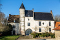
(23) Just past the gate, at the junction, head straight on towards Hermaville Castle and the church. You’ll come to a road branching off to the right.
(24) Follow it straight on to the church and the car park (S/E).

 Association / Club / Walk leader
 Moderate

 Visorando Member
 Easy