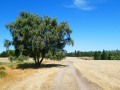
Two bridges and a balcony at the start in Sénéchas

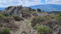
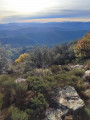
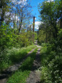
A challenging hike on often stony paths, but the scenery is well worth the effort and the signposting is excellent.
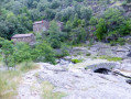
The two old bridges – one over the Cèze, the other over the Homol – are magnificent, and the path running along the cliff edge above the Luech is very pleasant.
Finally, there’s a climb for the fit, but it can be avoided.

Details

53900071
Creation:
Last update:
Last review:
  • Walking
    Activity: Walking
  • ↔
    Distance: 11.22 mi
  • ◔
    Average duration: 7h 10 
  • ▲
    Difficulty: Difficult

  • ⚐
    Back to start: Yes
  • ↗
    Ascent: + 2,326 ft
  • ↘
    Descent: - 2,346 ft

  • ▲
    Highest point: 1,588 ft
  • ▼
    Lowest point: 860 ft

Photos

Description of the walk

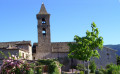
(S/E) Sénéchas in the centre of the village on the D318. Leave the D318 and walk past the beautiful church. At the start of a hairpin bend, leave the road and take a path on the left (yellow and yellow-red markings, barrier). This stony path descends to the Cèze (bridge and old mill: Le Roure).

(1) After the bridge, turn left towards the mill. The correct path, which is well signposted, climbs and joins a small road at the entrance to Aujaguet.

(2) Follow the road straight ahead. At the T-junction, turn right (yellow markings) towards the hamlet. At the fork in the road, turn left, then immediately right to reach another T-junction. Turn left onto a good grassy path. You’ll reach a fork in the road.

(3) Turn right. The path then becomes circular and crosses the Ruisseau du Julian, coming out near a wider track.

(4) Stay on the path to pass in front of the farmhouse inn ‘La Baraque’. You will then come to a wider track. Follow it through the woods until you reach a hairpin bend

(5) Leave the track and take the path opposite towards Chante Perdrix. Follow the yellow markings carefully until you reach the D52 at the hamlet of Chante Perdrix (signpost).

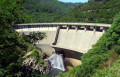
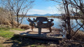
(6) Follow the D52 to the right, downhill, to reach the Sénéchas Dam.

(7) 150 metres after the dam, leave the road and take a path on the right (very well signposted).
This path through the woodland climbs gently and joins the D156.

(8) Follow it to the left. At the first junction, carry on straight ahead until you reach a Fork in the road.

(9) Turn right. At the end of the first bend, you’ll find a good path on the left.

(10) Take this path (yellow markings: La Combe aux Chats). After 50 metres, the path takes a hairpin bend to the right. Continue along this lovely path (which could do with a bit of clearing). A relatively flat section running alongside the Luech Gorges. You’ll reach a hairpin bend on the right.

(11) Take the path opposite, which climbs through the woodland. A gentle climb leads to a junction with a signpost.

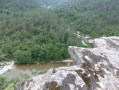
(12) Turn right towards “Le Recul”. This lovely path, very well marked in yellow, runs along a ledge above the Luech. It is not dangerous, but it goes without saying that you should remain cautious. You’ll reach a T-junction: sign for “Le Recul 314 m”.

(13) Turn right (yellow and yellow-red markings). A steep climb, which crosses two wider paths, leads to Tarabias (watch out for the two low electric fences just before the road).

(14) Follow the small road on the left for about 500 metres until you reach a signpost (Le Tribes).

(15) Turn right into the woodland (towards “Le Davaladou, Sénéchas”). After a steep descent of over a kilometre, you’ll reach the Homol and cross it via a magnificent bridge.

(16) After the bridge, continue straight ahead until you reach the D156.
Cross it and take the path opposite (slightly to the right). You’ll soon come to a signpost.
Two options:
- go straight on to reach Sénéchas via a very steep 500-metre climb (this is the route shown on the map). At the top, at the road, turn left to reach the village centre (S/E).
- Turn left to reach Sénéchas via what is likely a gentler climb. At the road, turn right to reach the village centre.

Waypoints

  1. S/E : mi 0 - alt. 1,473 ft - Sénéchas in the village centre on the D 318
  2. 1 : mi 0.92 - alt. 892 ft - Bridge over the - Cèze (rivière)
  3. 2 : mi 1.48 - alt. 1,358 ft - Junction with a minor road
  4. 3 : mi 1.94 - alt. 1,230 ft - Fork
  5. 4 : mi 2.56 - alt. 1,109 ft - Finish line near a wide path
  6. 5 : mi 2.94 - alt. 1,155 ft - Path opposite
  7. 6 : mi 4.74 - alt. 1,266 ft - Junction with the D 52
  8. 7 : mi 5.67 - alt. 938 ft - Path on the right after the dam
  9. 8 : mi 6.08 - alt. 1,161 ft - Junction with the D 156
  10. 9 : mi 6.55 - alt. 1,040 ft - Fork
  11. 10 : mi 6.74 - alt. 1,089 ft - Exit of the bend, balcony path on the - Luech (rivière) - Affluent de la Cèze
  12. 11 : mi 8.01 - alt. 1,063 ft - Lacet
  13. 12 : mi 8.27 - alt. 1,125 ft - Directional post
  14. 13 : mi 8.98 - alt. 1,037 ft - Directional post: Le Recul
  15. 14 : mi 9.52 - alt. 1,558 ft - Tarabias
  16. 15 : mi 9.88 - alt. 1,581 ft - Le Tribes directional signpost
  17. 16 : mi 10.79 - alt. 892 ft - Bridge over the - Homol (ruisseau) - Affluent de la Cèze
  18. S/E : mi 11.22 - alt. 1,473 ft - Sénéchas in the village centre on the D 318

Notes

Essential kit: good walking shoes and at least one walking stick.

To the best of my knowledge, there are no water points along the route (perhaps in Tarabias?)

A summary of the signposting:
- From (S) to (2)PR® andGRP®
- From (2) to (8)PR®
- From (8) to (10) no signposting
- From (10) to (12)PR® andGRP®
- From (12) to (13)PR®
- From (13) to the finish (E)PR® andGRP®

Always be cautious and plan ahead when you're outdoors. Visorando and the author of this route cannot be held responsible for any accidents occurring on this route.

The GR® and PR® markings are the intellectual property of the Fédération Française de Randonnée Pédestre.

Reviews and comments

4.8 / 5
Based on 2 reviews

Reliability of the description
5 / 5
Ease of following the route
5 / 5
Route interest
4.5 / 5
Jean Antoine Martin
Jean Antoine Martin

Overall rating : 5 / 5

Date of your route : Jul 15, 2024
Reliability of the description : ★★★★★ Very good
Ease of following the route : ★★★★★ Very good
Route interest : ★★★★★ Very good
Very busy route : No

A lovely walk to go on in spring

Machine-translated

biot
biot

Overall rating : 4.7 / 5

Date of your route : Jul 04, 2024
Reliability of the description : ★★★★★ Very good
Ease of following the route : ★★★★★ Very good
Route interest : ★★★★☆ Good
Very busy route : No

A pleasant walk along lovely, well-signposted paths, with just a short stretch along the road near the Sénéchas dam
Be warned: there’s a significant climb towards the end of the walk

Machine-translated

Other walks in the area

For more walks, use our search engine .

The GPS track and description are the property of this route's author. Please do not copy them without permission.