


Dominique Louis

 Visorando Member
 Premium user
Sign up:
Published route(s)
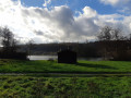
 The Manoir du Hom in Beaumont-le-Roger
 6.13 mi
 +217 ft
 -200 ft
 3h 00
3h 00
 Easy
Easy
 Departure from Beaumont-le-Roger (Eure)
Improved version of the Blue marked route, starting from the Town Hall Square (superbly refurbished) to include a tour of the town, whose heritage is interesting and enhanced by recent developments.
Walk from the Risle to the Forest Park
 3.78 mi
+203 ft
-200 ft
1h 55
Easy
Departure from Beaumontel (Eure)
3.78 mi
+203 ft
-200 ft
1h 55
Easy
Departure from Beaumontel (Eure)
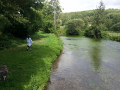
Rivers, meadows, pollarded trees, sunken lanes through the bocage, forest... this peaceful walk offers a real taste of Normandy with beautiful discoveries: green landscapes, heritage sites and a park in a forest.
Short version of the Three Rivers route marked in yellow.
Unpaved paths: 75%
From Val Dallet to Chêne Varin
 11.88 mi
+919 ft
-922 ft
6h 15
11.88 mi
+919 ft
-922 ft
6h 15
 Average
Departure from Brestot (Eure)
Average
Departure from Brestot (Eure)
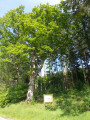
This fitness route takes in some secluded little valleys on the outskirts of the Montfort State Forest. Whilst the forest makes up two-thirds of the route, the Val Dallet also offers views of wooded countryside featuring some very beautiful and very large pollarded trees.
New World walk in Romilly-la-Puthenaye
 3.29 mi
+138 ft
-161 ft
1h 40
Easy
Departure from Romilly-la-Puthenaye (Eure)
3.29 mi
+138 ft
-161 ft
1h 40
Easy
Departure from Romilly-la-Puthenaye (Eure)
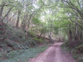
Far from the towns and the hustle and bustle of human activity, enjoy a bucolic stroll through the woods and meadows of Normandy.
Starting from Place de la Noë, 2 km from the village of Romilly-la-Puthenaye, the mainly forest paths offer a very pleasant walk leading to the old Moulin de Bougy mill in the Risle valley.
The little secret valley in Thierville
 5.38 mi
+328 ft
-358 ft
2h 45
Easy
Departure from Thierville (Eure)
5.38 mi
+328 ft
-358 ft
2h 45
Easy
Departure from Thierville (Eure)
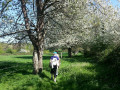
Away from the marked trails lies a small valley with no waterways but full of charm. It is so hidden that the nightjar, a rare bird in Normandy, has been spotted there during its migration. Starting from the pretty village of Thierville, itself set apart from the Risle valley, this route takes you through varied forest environments and offers beautiful encounters such as the remarkable "Four Brothers" tree.
Circular of the Risle lakes at Ponts Gras
 6.72 mi
+525 ft
-495 ft
3h 35
Average
Departure from Condé-sur-Risle (Eure)
6.72 mi
+525 ft
-495 ft
3h 35
Average
Departure from Condé-sur-Risle (Eure)
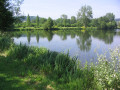
A flat, marshy valley, especially in winter, the Risle valley is bordered by forests on both sides. The ponds dug inthe 20th century alternate with the wet meadows of the ancestral Norman bocage. Encompassing all these landscapes, this route offers one of the few possible crossings of the Risle valley on footpaths.
Claireau forest and medieval walk
 6.19 mi
+394 ft
-371 ft
3h 10
Average
Departure from Montfort-sur-Risle (Eure)
6.19 mi
+394 ft
-371 ft
3h 10
Average
Departure from Montfort-sur-Risle (Eure)
Unmarked route, rich and varied, almost exclusively on paths.
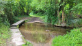
The ruins of the medieval castle and the banks of the Risle at Château la Motte provide a beautiful end to this hike, which offers a wide variety of landscapes, between the national forest and the Claireau valley, as well as elements of natural heritage (remarkable trees) and historical heritage (Château la Motte, 18th-century wash house, etc.).
Saint-Vincent Forest Walk
 6.08 mi
+187 ft
-217 ft
3h 00
Easy
Departure from Glos-sur-Risle (Eure)
6.08 mi
+187 ft
-217 ft
3h 00
Easy
Departure from Glos-sur-Risle (Eure)
In the Montfort National Forest, an extended version of the Yellow-marked trail starting from the Saint-Vincent visitor centre, with a higher proportion of unpaved paths. Combining a wide variety of woodland settings, alternating between narrow paths and wide lanes, this route also offers an escape into a typical Normandy bocage landscape.
A walk as green as an orange.
 3.97 mi
+377 ft
-381 ft
2h 10
Easy
Departure from Fourneville (Calvados)
3.97 mi
+377 ft
-381 ft
2h 10
Easy
Departure from Fourneville (Calvados)
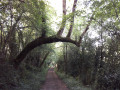
Near Honfleur, the little river called the Orange flows through a preserved valley. The paths run through a landscape of meadows enclosed by hedges with beautiful half-timbered houses, a true essence of Normandy.
Chemin de l'Aubertine
 5.52 mi
+66 ft
-66 ft
2h 35
Easy
Departure from Lieurey (Eure)
5.52 mi
+66 ft
-66 ft
2h 35
Easy
Departure from Lieurey (Eure)
2 possible routes: a short one of 4 km or a long one of 9 km.
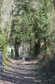
Set in the heart of the bocage countryside, this route is bordered for nearly 60% of its length by embankments and hedgerows that form a well-preserved bocage landscape. Easy and flat, this route offers a lovely walk through typical Normandy countryside, amidst meadows and fields.
Walk in the Véronne valley
 4.97 mi
+495 ft
-502 ft
2h 45
Easy
Departure from Campigny (Eure) (Eure)
4.97 mi
+495 ft
-502 ft
2h 45
Easy
Departure from Campigny (Eure) (Eure)
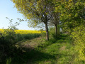
In Normandy, in the countryside near Pont-Audemer, there is a valley that has been preserved from urbanisation. The Véronne valley is ideal for walking along its sunken paths, which offer beautiful rural landscapes, natural sites of great beauty and interesting examples of built heritage.
This unmarked route crosses three official marked routes: one light blue route starting from Campigny (CY), one yellow route and one dark blue route starting from Saint Martin Saint Firmin (SM).
Le Rouge Moulin
 7.94 mi
+354 ft
-377 ft
4h 00
Average
Departure from Ajou (Eure)
7.94 mi
+354 ft
-377 ft
4h 00
Average
Departure from Ajou (Eure)
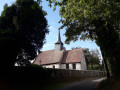
Shortened version of the marked route starting from Ajou, retaining the interesting views of this high valley of the Risle, its mills, including the very pretty Rouge Moulin, the charming village of Champignolles and forest passages that are enjoyable in summer. On the other hand, the 4 km to Ajou are of little interest, hence the suggestion to start from the church of Saint Aubin.
Yellow markings
The path to the donkey pond
 8.31 mi
+374 ft
-367 ft
4h 10
Average
Departure from La Haye-Aubrée (Eure)
8.31 mi
+374 ft
-367 ft
4h 10
Average
Departure from La Haye-Aubrée (Eure)
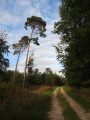
Off the beaten track, this route follows the bottom of a somewhat secluded valley and the edge of the Brotonne State Forest. It also offers a few surprising sights: a chapel in the heart of the countryside, a row of pollarded trees silhouetted against the light at the forest’s edge, and tall beech trees…
Chemin des Longues Vallées
 5.40 mi
+256 ft
-230 ft
2h 40
Easy
Departure from Mauny (Seine-Maritime)
5.40 mi
+256 ft
-230 ft
2h 40
Easy
Departure from Mauny (Seine-Maritime)
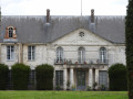
The pretty village of Mauny has a rich heritage with its imposing castle and numerous old houses. The forest covers half of the route and contrasts with the open agricultural plain. The Grotte du Maquis, a sandstone cross and beautiful trees also line this pleasant route.
A shorter version of the yellow marked route starting from Barneville-sur-Seine, retaining its main points of interest but removing the two sections on the fairly busy road.
Forest walk in Sainte-Croix-sur-Aizier
 3.54 mi
+335 ft
-335 ft
1h 55
Easy
Departure from Sainte-Croix-sur-Aizier (Eure)
3.54 mi
+335 ft
-335 ft
1h 55
Easy
Departure from Sainte-Croix-sur-Aizier (Eure)
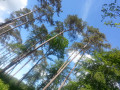
Overlooking the Seine, the pretty village of Sainte-Croix-sur-Aizier borders the Brotonne State Forest, offering a hilly, shaded walk that alternates between the charms of the bocage and the canopy of tall beech trees.
Secret walk to the Fontaine Caillou
 4.33 mi
+456 ft
-472 ft
2h 25
Easy
Departure from Fiquefleur-Équainville (Eure)
4.33 mi
+456 ft
-472 ft
2h 25
Easy
Departure from Fiquefleur-Équainville (Eure)
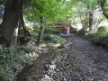
Far from the modern world, a small valley hidden between meadows and forest reveals an intimate and authentic Normandy, with magnificent trees, sunken paths, fresh springs, typical thatched cottages and rolling landscapes. This route is not marked, hence its name "secret walk": geolocation is therefore recommended.
 The young stork takes flight: a short tour of the Marais Vernier
 12.61 mi
+66 ft
-66 ft
1.5 hrs
Easy
Departure from Marais-Vernier (Eure)
12.61 mi
+66 ft
-66 ft
1.5 hrs
Easy
Departure from Marais-Vernier (Eure)
The stork has become the marsh’s iconic symbol: when the young stork takes flight from its family nest, it discovers this unspoilt natural landscape as it circles this ancient circular bend of the Seine, nestled within a vast amphitheatre of greenery. With its wet meadows stretching as far as the eye can see and its pretty thatched cottages, the Marais Vernier offers a landscape unique in Normandy that invites you to take a stroll, particularly in spring when the apple trees are in bloom.
Path along the old railway line in Thierville
 4.63 mi
+427 ft
-446 ft
2h 30
Easy
Departure from Thierville (Eure)
4.63 mi
+427 ft
-446 ft
2h 30
Easy
Departure from Thierville (Eure)
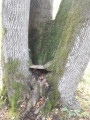
Disused since the 1970s, the old railway line offers a superb elevated view of the Risle Valley. It makes for a lovely walk starting from a quiet, charming village and passing through the Montfort State Forest. Along the way, you’ll come across some remarkable trees, a small valley with a dry riverbed, a lovely patch of wooded countryside and, occasionally, a few cows, goats, hares or roe deer.
Chemin de la Petite Houssaye
 4.08 mi
+197 ft
-210 ft
2h 05
Easy
Departure from La Haye-de-Routot (Eure)
4.08 mi
+197 ft
-210 ft
2h 05
Easy
Departure from La Haye-de-Routot (Eure)
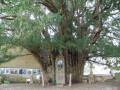
Typically Norman, La Haye-de-Routot is a charming village attached to its traditions and craftsmanship. Starting from the church, an easy route suitable for all ages reveals a varied landscape with a beautiful collection of pollarded trees intertwined with hedges and tall beech trees in the national forest, pretty bocage valleys and views of the agricultural plain.
This route is largely unmarked and shortens the yellow-marked route.
Heather walk in the woods
 5.23 mi
+226 ft
-207 ft
2h 35
Easy
Departure from Theillement (Eure)
5.23 mi
+226 ft
-207 ft
2h 35
Easy
Departure from Theillement (Eure)
There are two possible routes: a short one of 4 km or a long one of 8 km (72% dirt tracks).
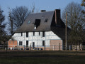
This varied and easy route offers an interesting heritage with the Manoir du Val and its elegant brick dovecote, the small Manoir du Thuit and the Villa des Bruyères, not to mention the church and a typical thatched cottage at the start. Long stretches through the woods alternate with more open landscapes on the agricultural plateau. The occasional disturbance from the nearby motorway is quickly forgotten.
From the banks of the Risle to the hillside of Manneville
 5.92 mi
+400 ft
-423 ft
3h 05
Easy
Departure from Manneville-sur-Risle (Eure)
5.92 mi
+400 ft
-423 ft
3h 05
Easy
Departure from Manneville-sur-Risle (Eure)
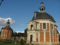
From the banks of the Risle, which have been developed for walking, to the forest bordering the valley, this varied route links the residential village of Manneville and the town of Pont-Audemer. It offers a lovely walk in Normandy between town and country, with interesting heritage sites and beautiful views.
The route is not signposted in its entirety (geolocation recommended with Visorando) but is based in part on theGR® 224 and the yellow-marked Chemin des Résistants.
Circular Besplas near Villasavary
 6.98 mi
+912 ft
-889 ft
4h 00
Average
Departure from Villasavary (Aude)
6.98 mi
+912 ft
-889 ft
4h 00
Average
Departure from Villasavary (Aude)
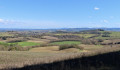
Away from the village of Villasavary, starting from the car park below the Besplas leisure centre (in front of the "Bois de Villasavary" sign), this hike crosses the first hills of La Piège, offering a landscape of meadows, woods and fields.
Follow the yellow markings and the wooden signs for "Besplas" or "route de Besplas".
Circular of the Lampy Valley
 6.60 mi
+791 ft
-794 ft
3h 45
Average
Departure from Cenne-Monestiés (Aude)
6.60 mi
+791 ft
-794 ft
3h 45
Average
Departure from Cenne-Monestiés (Aude)
At the foot of the Montagne Noire, this route passes by the Cenne-Monestiés dam, runs along the Lampy river as it climbs towards the village of Villemagne, before gently descending along a path offering a wide view of the Lauragais.
Mont Carrière loop to Villasavary
 6.36 mi
+994 ft
-1,017 ft
3h 45
Average
Departure from Villasavary (Aude)
6.36 mi
+994 ft
-1,017 ft
3h 45
Average
Departure from Villasavary (Aude)
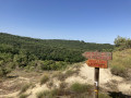
A challenging forest circuit on hilly paths with sweeping views over the first hills of the Piège. It is an ideal training ground for keeping fit or preparing your legs for the mountains. Mont Carrière, the highlight of the walk, has four orientation tables, but it is not the only panoramic viewpoint on this circuit, which offers many beautiful sights.
From the Canal du Midi to the circular village of Bram
 3.06 mi
+26 ft
-26 ft
1h 25
Easy
Departure from Bram (Aude)
3.06 mi
+26 ft
-26 ft
1h 25
Easy
Departure from Bram (Aude)
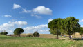
An easy family walk between the preserved centre of the old town of Bram and the Canal du Midi, a UNESCO World Heritage Site. Following a secure greenway between the town and the canal, the route also takes in the canal towpath and a quiet little road. Strolling through the circular village is a pleasure: in this medieval village built in a circle, it is impossible to get lost. This preserved and enhanced heritage site is truly unique.
The Sources de la Preuilhe Circular Loop
 8.52 mi
+863 ft
-892 ft
4h 40
Average
Departure from La Cassaigne (Aude)
8.52 mi
+863 ft
-892 ft
4h 40
Average
Departure from La Cassaigne (Aude)
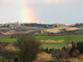
A fairly undulating walk through the hills around the picturesque village of La Cassaigne, half along quiet country lanes and half along footpaths offering lovely views.
Yellow signposting (in the direction described only).
Route du Pech de Mu
 3.19 mi
+361 ft
-367 ft
1h 45
Easy
Departure from Fenouillet-du-Razès (Aude)
3.19 mi
+361 ft
-367 ft
1h 45
Easy
Departure from Fenouillet-du-Razès (Aude)
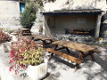
On the Chemin du Piémont, the most Pyrenean route to Santiago de Compostela, between Fanjeaux and Mirepoix, here is a fairly easy circular walk to enjoy the countryside of the Razès, amongst vineyards, fields and woods, starting from a typical hilltop village built in a circular layout.Yellow markings (particularly when walking in the opposite direction).
Chemin des Rauches along the Loire
6.82 mi
+13 ft
-13 ft
3h 10
Average
Departure from Saint-Père-sur-Loire (Loiret)
Alternating between meadows, forests, ponds and farmland, this route presents no difficulties. It begins and ends majestically on the banks of the Loire. This is a shortened version of the former "PR® des Rauches" with 76% of the route on unpaved paths.
Sologne trails starting from Villemurlin
 6.28 mi
+66 ft
-66 ft
2h 55
Average
Departure from Villemurlin (Loiret)
6.28 mi
+66 ft
-66 ft
2h 55
Average
Departure from Villemurlin (Loiret)
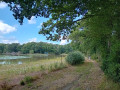
Mainly on dirt, sand or gravel paths, this fairly easy circuit takes you through the peaceful and varied landscapes of the Sologne: ponds, forests, hedgerow-enclosed pastures and interspersed crops. At the start and finish, the pretty village of Villemurlin offers a typical Sologne charm with its brick houses and blue ladders, reminders of a time when the attic was accessed from outside.
Initially shared with the family path of Villemurlin (the "chouette promenade" or "owl walk"), this route then takes a shortened version of the former "PR® des domaines de chasse et cultures" (hunting grounds and farmland), of which a few signs remain.
Sange Valley Circuit
 6.32 mi
+102 ft
-98 ft
3h 00
Average
Departure from Saint-Aignan-le-Jaillard (Loiret)
6.32 mi
+102 ft
-98 ft
3h 00
Average
Departure from Saint-Aignan-le-Jaillard (Loiret)
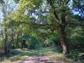
On the edge of the Sologne, this circuit brings together the typical landscapes that make up the charm of this natural region near the Loire: meadows, ponds, forests, interspersed with crops and pretty brick houses. The little river Sange brings it to life and gives it a little relief.
Marked in yellow, this route is also signposted in places as "PR® de la Vallée de la Sange - P 11". Despite two sections on the road, 70% of this circuit is on unpaved paths.
From Chemin de la Plaine to the banks of the Loire: Between the levees
 6.17 mi
+13 ft
-13 ft
2h 50
Easy
Departure from Saint-Père-sur-Loire (Loiret)
6.17 mi
+13 ft
-13 ft
2h 50
Easy
Departure from Saint-Père-sur-Loire (Loiret)
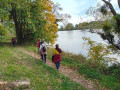
A hike offering great contrasts between the open fields of the first part and the wild banks of the Loire in the second part, with its unspoilt natural site known as "Entre les levées". Proposed by the tourist office as part of the Randonnée des Châtaignes (Chestnut Hike), this route was very popular with hikers.
Petit Leu Walk
 2.90 mi
+20 ft
-20 ft
1h 20
Easy
Departure from Neuvy-en-Sullias (Loiret)
2.90 mi
+20 ft
-20 ft
1h 20
Easy
Departure from Neuvy-en-Sullias (Loiret)
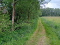
Quite close to the Loire between Sully and Châteauneuf, on the edge of the Sologne region, a family walk in the countryside. Starting from a charming village where a Gallo-Roman treasure was found in the 19th century.
La route du Jongleur
 9.45 mi
+105 ft
-105 ft
4h 25
Average
Departure from Neuvy-en-Sullias (Loiret)
9.45 mi
+105 ft
-105 ft
4h 25
Average
Departure from Neuvy-en-Sullias (Loiret)
The juggler is one of the figures from the Gallo-Roman treasure found at Neuvy-en-Sulias in 1861 and displayed in the permanent exhibition in the garden adjoining the town hall.
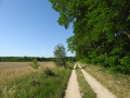
This very pleasant route offers a fine variety of landscapes typical of the Loire and Sologne regions, comprising three interwoven features: the wooded bocage and its meadows, the mixed deciduous and coniferous forest with few straight lines, and the open agricultural plain. The River Loire and the Leu stream provide a refreshing finale to the walk. A wealth of points of interest punctuate and enliven this route: a 16th-century château, the former port of Bouteille, a tile works listed as a historic monument, a windmill…
The route is marked in yellow by the FFR and featured in the guidebook ‘La Sologne à pied’.
Route du Gilloy
 6.12 mi
+856 ft
-1,020 ft
3h 35
Easy
Departure from Neuvy-en-Sullias (Loiret)
6.12 mi
+856 ft
-1,020 ft
3h 35
Easy
Departure from Neuvy-en-Sullias (Loiret)
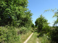
Close to the Loire, this fairly easy route runs alongside the Sologne region with its landscapes of woodland and farmland. Several points of interest (a pond, hedgerows, livestock farms) add a touch of variety to a route largely characterised by its woodland atmosphere. Best avoided during the hunting season from late September to February.
The Trognards Route in Vannes-sur-Cosson
 2.40 mi
+620 ft
-604 ft
1h 40
Easy
Departure from Vannes-sur-Cosson (Loiret)
2.40 mi
+620 ft
-604 ft
1h 40
Easy
Departure from Vannes-sur-Cosson (Loiret)
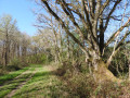
An easy family walk through the typical landscapes of Sologne, featuring several hedgerows of pollarded oaks: these pollarded oaks served as the farmers’ timber supply and formed hedgerows on an embankment enclosing the pastures.