The Vierge de Brumare Trail

Near Brumare Castle, a statue was erected to thank the Virgin for sparing the inhabitants during the War of 1870. Restored and refurbished in the 2010s, it is well worth a visit.
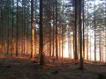
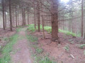
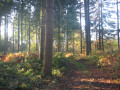
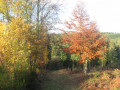
This hilly section of the national forest, somewhat wild and labyrinthine, offers landscapes reminiscent of the Vosges, with a strong presence of conifers on the slopes. Local history permeates the area: the Marquisate Wood, the Virgin’s Oak, the New World, etc.

Unmarked route

Details

n°2769268
Creation:
Last update:
Last review:
  • Walking
    Activity: Walking
  • ↔
    Distance: 3.40 mi
  • ◔
    Average duration: 1h 55 
  • ▲
    Difficulty: Easy

  • ⚐
    Back to start: Yes
  • ↗
    Ascent: + 384 ft
  • ↘
    Descent: - 381 ft

  • ▲
    Highest point: 400 ft
  • ▼
    Lowest point: 161 ft
  • ⚐ Country: France
  • ⚐ City: Brestot (27350)
  • ⚑
    Start/End: N 49.329973° / E 0.671419°
  • ❏
    IGN map(s): Ref. 1812SB, 1911OT
  • Hour-by-hour weather

Photos

Description of the walk

Small car park at the Val Dallet visitor centre.

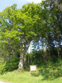
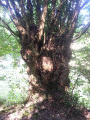
(S/E) Take the RD47 road towards Appeville for 200 metres to visit the ‘Chêne à la Vierge’. Then retrace your steps slightly to take the path that climbs to the right through the woodland.

(1) At the top, just before the Route Forestière du Ruel, turn left onto a path that runs along the hillside. At the end, keep right onto the straighter forest track, which offers a lovely view of the valley in winter.

(2) At the Rond Fleury junction, head down to the left along the Route forestière du Midi and, at the bend, take the path that cuts straight across to cross the valley. Climb back up the opposite side, which is very steep.

(3) Halfway up the other slope, veer to the right to continue climbing on a gentler gradient, making a wide circular loop to the left. At the top, carry on straight ahead until you reach the RD47.

(4) After admiring the Virgin of Brumare, take the small road on your left towards the castle gates. Turn left onto the path about a hundred metres further on. In the forest, follow this path straight on.

(5) On the descent along the small ravine, turn right. 100 metres further on, veer left to descend gently along a small ridge with a distinctly Vosges-like atmosphere. At the end, follow the path to the right, which descends steeply to the Val Dallet rest area (S/E).

Waypoints

  1. S/E : mi 0 - alt. 164 ft - Val Dallet visitor centre
  2. 1 : mi 0.41 - alt. 315 ft - Turn left at the fork before the RF
  3. 2 : mi 1.05 - alt. 308 ft - Rond Fleury crossroads
  4. 3 : mi 1.36 - alt. 269 ft - On the right, halfway up the slope
  5. 4 : mi 2.18 - alt. 374 ft - Vierge de Brumare
  6. 5 : mi 2.77 - alt. 344 ft - Small ravine, on the right
  7. S/E : mi 3.4 - alt. 164 ft - Val Dallet visitor centre

Notes

The Montfort State Forest offers four rest areas for hikers and walkers, each with car parks, picnic tables and information boards showing maps of the marked trails and starting points for walks:
- the Val Dallet rest area: the starting point for the ‘Vierge de Brumare’ walk, as well as the yellow-marked ‘Du Chêne à la Vierge’ route (9.4 km)
- the Rond de Beuvron rest area
- the Saint-Michel rest area
- the Catelier area

Worth a visit

The statue of Our Lady of the Sacred Heart was erected by the countess, owner of the nearby Château de Brumare, following the events of 5 and 6 January 1871. At the edge of the forest, three German cavalrymen (Uhlans) were shot dead by French snipers. Alerted to this, the Count had the bodies of the horsemen and their horses hidden away. The Countess prayed to the Virgin Mary, and snow fell just in time to cover the pools of blood on the path. In gratitude, the Countess had a statue of the Virgin Mary erected near the spot where this miracle took place.

The Virgin’s Oak: a remarkable tree in the state-owned forest, recognised by the ONF. In the past, a pilgrimage would set out from the chapel at Rondemare – also dedicated to the Virgin – with a procession making its way to the oak. Following the restoration of the statue in 1999 by the local council, the ONF erected a sign marking this revered tree.

Reviews and comments

4 / 5
Based on 2 reviews

Reliability of the description
4 / 5
Ease of following the route
4 / 5
Route interest
4 / 5
Glos27
Glos27

Overall rating : 3.7 / 5

Date of your route : Aug 09, 2025
Reliability of the description : ★★★★☆ Good
Ease of following the route : ★★★☆☆ Average
Route interest : ★★★★☆ Good
Very busy route : No

Please note that the start is impassable due to brambles. You will need to take the forest path around it.
There are also brambles in some other areas, but it is possible to pass through. It is best to wear trousers and suitable footwear.

Machine-translated

User 5436218

Overall rating : 4.3 / 5

Date of your route : Jul 17, 2025
Reliability of the description : ★★★★☆ Good
Ease of following the route : ★★★★★ Very good
Route interest : ★★★★☆ Good
Very busy route : No

The start is difficult to find because of the vegetation.
The climb up the valley is a bit steep and the second part, which branches off to the right, is full of brambles.
The highlight of the hike is the statue of the Virgin of Brumaire, halfway along the route, and its history.

Machine-translated

Other walks in the area

For more walks, use our search engine .

The GPS track and description are the property of this route's author. Please do not copy them without permission.