Ridge path through vineyards and woodland in Ajac

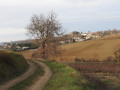
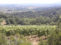
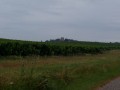
Very close to Limoux, amidst the vineyards producing the famous Blanquette, this is a fairly easy route, though slightly undulating compared to other routes in the region. The ridge offers sweeping panoramic views and the paths wind through varied landscapes, from the grassy valley floors to the woodland on the hilltops.

Yellow markings with a blue dot

Details

n°29969567
Creation:
Last update:
Last review:
  • Walking
    Activity: Walking
  • ↔
    Distance: 4.90 mi
  • ◔
    Average duration: 2h 50 
  • ▲
    Difficulty: Easy

  • ⚐
    Back to start: Yes
  • ↗
    Ascent: + 709 ft
  • ↘
    Descent: - 719 ft

  • ▲
    Highest point: 1,293 ft
  • ▼
    Lowest point: 820 ft
  • ⚐ Country: France
  • ⚐ City: Ajac (11300)
  • ⚑
    Start/End: N 43.048097° / E 2.138677°
  • ❏
    IGN map(s): Ref. 2246E
  • Hour-by-hour weather

Photos

Description of the walk

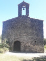
Park near the church.

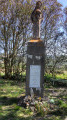
(S/E) Take Rue de la Mairie, which passes in front of the war memorial, then head down to the left along Rue des Horts.

(1) Cross the D620 (Route de Limoux) to head down to the bottom of the valley. As you climb up the other side, take the first path on the left. At the junction halfway up the slope, turn right to continue climbing.

(2) Before reaching the top of the hill, turn left into the vineyards. At the small stone hut, carry on straight ahead, then veer to the right to continue the climb. At the top, keep to the left and take the small tarmac road straight ahead.

(3) In the Bois d’Ajac, ignore the paths on the right. Climb to the top of the hill, then head straight back down.

(4) At the junction on the small pass, take the stony path to the right, then head straight down. At a right-hand bend, take the hairpin bend to the left. At the bottom, turn right again at the hairpin bend.

(5) At the stream, turn right, then cross the bridge in front of the houses and continue along the path at the bottom of the valley, heading downstream.

(6) When you reach a small tarmac road, veer to the right. In the woods, head up to the left. Then, in the vineyards, head left to go back down and enjoy the view towards the village.

(7) As you head downhill, carry on straight ahead. When you reach the first houses in the village, turn left to walk up the Grande Rue.

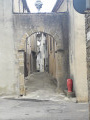
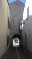
(8) Opposite the town hall, turn right onto Rue de la Mairie, then take the first small street on the left and finally turn right onto Rue des Remparts. Opposite the castle, turn right towards the church (S/E).

Waypoints

  1. S/E : mi 0 - alt. 932 ft - Ajac Church
  2. 1 : mi 0.1 - alt. 866 ft - Chemin de la Fontaine
  3. 2 : mi 1.17 - alt. 1,027 ft - Ridge line
  4. 3 : mi 1.91 - alt. 1,240 ft - Ajac Wood
  5. 4 : mi 2.34 - alt. 1,138 ft - Small pass
  6. 5 : mi 2.98 - alt. 974 ft - Auriol Stream
  7. 6 : mi 3.72 - alt. 863 ft - Short dead-end road
  8. 7 : mi 4.49 - alt. 906 ft - End of the route
  9. 8 : mi 4.8 - alt. 919 ft - Rue de la Mairie
  10. S/E : mi 4.9 - alt. 932 ft - Ajac Church

Reviews and comments

4.2 / 5
Based on 2 reviews

Reliability of the description
4 / 5
Ease of following the route
4 / 5
Route interest
4.5 / 5
HelenSuz
HelenSuz

Overall rating : 4.3 / 5

Date of your route : Aug 28, 2023
Reliability of the description : ★★★★☆ Good
Ease of following the route : ★★★★☆ Good
Route interest : ★★★★★ Very good
Very busy route : No

A very pleasant and easy walk; the signposting put us back on the right track twice at landmarks that are a bit too large on the map and sometimes obscure the change of direction, especially if there’s a hairpin bend! But otherwise, it was a beautiful view, just as promised!

Machine-translated

RFC31500
RFC31500

Overall rating : 4 / 5

Date of your route : Jul 21, 2023
Reliability of the description : ★★★★☆ Good
Ease of following the route : ★★★★☆ Good
Route interest : ★★★★☆ Good
Very busy route : No

A lovely walk on a beautiful July’s day.
The elevation gain and length were just right for us (as octogenarians)
Overall, the description was accurate, though I’d hesitate between a 4 and a 5.
Fortunately, the Visorando app helps you find your way.
Thanks to those who mapped out the route.

Machine-translated

Other walks in the area

For more walks, use our search engine .

The GPS track and description are the property of this route's author. Please do not copy them without permission.