Route du Pech de Mu

On the Chemin du Piémont, the most Pyrenean route to Santiago de Compostela, between Fanjeaux and Mirepoix, here is a fairly easy circular walk to enjoy the countryside of the Razès, amongst vineyards, fields and woods, starting from a typical hilltop village built in a circular layout.
Yellow markings (particularly when walking in the opposite direction).

Details

29083914
Creation:
Last update:
Last review:
  • Walking
    Activity: Walking
  • ↔
    Distance: 3.19 mi
  • ◔
    Average duration: 1h 45 
  • ▲
    Difficulty: Easy

  • ⚐
    Back to start: Yes
  • ↗
    Ascent: + 361 ft
  • ↘
    Descent: - 367 ft

  • ▲
    Highest point: 1,319 ft
  • ▼
    Lowest point: 938 ft

Photos

Description of the walk

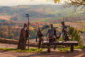
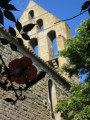
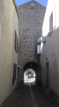
(S/E) Starting from the church in Fenouillet-du-Razès, take a short stroll through the circular village layout via the narrow streets behind the church. Head down to the viewpoint and take the small path leading down to the left of the viewpoint. Cross Rue des Pyrénées and continue down the dirt track.

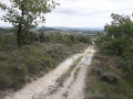
(1) At the end of the track, take the small road opposite and follow it straight on for 1 km, crossing two streams.

(2) At the very tight bend below the Fontazelles hill, turn left onto the dirt track and head straight up. At the top, keep left.

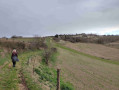
(3) When you reach the small Étang des Brugues, turn left onto the path running alongside the field, which you’ll follow for over 1 km along the edge of the woodland until you reachthe GR®® 78, the Way of St James.

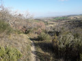
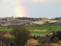
(4) Follow it to the left for about 600 m, enjoying the view over the Razès countryside.

(5) Below the Pech de Mu mast, take the small road leading down to the left. At the junction of signposted paths (picnic area), leave the road and head down the path on the left: you can see the village of Fenouillet; the finish is near.

(6) At the end of the track, take the small road to the left. Reach the village by turning left at the cemetery, then taking the first street on the right towards the Church of Fenouillet-du-Razès (S/E).


Waypoints

  1. S/E : mi 0 - alt. 1,142 ft - Church of Fenouillet-du-Razès
  2. 1 : mi 0.23 - alt. 1,020 ft - Go straight on along the small road
  3. 2 : mi 0.93 - alt. 997 ft - Junction on the uphill path
  4. 3 : mi 1.32 - alt. 1,109 ft - T-junction near the small Étang des Brugues
  5. 4 : mi 2.11 - alt. 1,224 ft - GR 78
  6. 5 : mi 2.56 - alt. 1,319 ft - Beneath the Pech de Mu transmission mast
  7. 6 : mi 2.99 - alt. 1,119 ft - Road junction
  8. S/E : mi 3.19 - alt. 1,142 ft - Church of Fenouillet-du-Razès

Notes

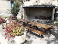
- At the viewpoint in Fenouillet-du-Razès: picnic tables.
- At Pech de Mu: a picnic table at the start of the path, with a breathtaking view.
- Campsite on the banks of the Étang des Brugues (private property).

Worth a visit

- In the village of Fenouillet-du-Razès: the church is open on certain days.
- Orientation board at the viewpoint in the village.

Always be cautious and plan ahead when you're outdoors. Visorando and the author of this route cannot be held responsible for any accidents occurring on this route.

The GR® and PR® markings are the intellectual property of the Fédération Française de Randonnée Pédestre.

Reviews and comments

4.1 / 5
Based on 4 reviews

Reliability of the description
4.3 / 5
Ease of following the route
4 / 5
Route interest
4 / 5
User 25786001

Overall rating : 4 / 5

Date of your route : May 19, 2025
Reliability of the description : ★★★★☆ Good
Ease of following the route : ★★★★☆ Good
Route interest : ★★★★☆ Good
Very busy route : No

A short, easy walk, but there are a few too many stones on one part of the descent.

Machine-translated

azhod
azhod

Overall rating : 4.3 / 5

Date of your route : Apr 22, 2024
Reliability of the description : ★★★★☆ Good
Ease of following the route : ★★★★☆ Good
Route interest : ★★★★★ Very good
Very busy route : No

A tricky start. A lovely view. All in all, a pleasant route.

Machine-translated

jacoux
jacoux

Overall rating : 3.7 / 5

Date of your route : Apr 17, 2023
Reliability of the description : ★★★★☆ Good
Ease of following the route : ★★★☆☆ Average
Route interest : ★★★★☆ Good
Very busy route : No

The signposting at the start of the circular route is poor; a GPS is useful

Machine-translated

Anne-Marie11
Anne-Marie11

Overall rating : 4.3 / 5

Date of your route : Feb 20, 2023
Reliability of the description : ★★★★★ Very good
Ease of following the route : ★★★★★ Very good
Route interest : ★★★☆☆ Average
Very busy route : No

An easy walk. Good directions. Magnificent views. It’s a shame that conventional farming and wine-growing have destroyed biodiversity.

Machine-translated

Other walks in the area

For more walks, use our search engine .

The GPS track and description are the property of this route's author. Please do not copy them without permission.