La route du Jongleur

The juggler is one of the figures from the Gallo-Roman treasure found at Neuvy-en-Sulias in 1861 and displayed in the permanent exhibition in the garden adjoining the town hall.

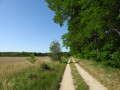
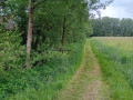
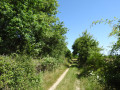
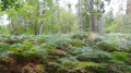
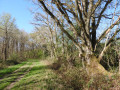
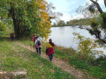
This very pleasant route offers a fine variety of landscapes typical of the Loire and Sologne regions, comprising three interwoven features: the wooded bocage and its meadows, the mixed deciduous and coniferous forest with few straight lines, and the open agricultural plain. The River Loire and the Leu stream provide a refreshing finale to the walk. A wealth of points of interest punctuate and enliven this route: a 16th-century château, the former port of Bouteille, a tile works listed as a historic monument, a windmill…

The route is marked in yellow by the FFR and featured in the guidebook ‘La Sologne à pied’.

Details

101096225
Creation:
Last update:
Last review:
  • Walking
    Activity: Walking
  • ↔
    Distance: 9.45 mi
  • ◔
    Average duration: 4h 25 
  • ▲
    Difficulty: Moderate

  • ⚐
    Back to start: Yes
  • ↗
    Ascent: + 105 ft
  • ↘
    Descent: - 105 ft

  • ▲
    Highest point: 479 ft
  • ▼
    Lowest point: 354 ft

Photos

Description of the walk

(S/E) From the village square, in front of the library and opposite the village café, take the path to the left of the bakery. At the end of this first path, in front of the school, take the pavement to the left.

(1) Cross Rue de Sologne and follow Rue des Moulins straight ahead. Then, at the Fork in the road, turn right onto Rue de la Lande.

(2) Cross the D951 (watch out for traffic) and take the path opposite, continuing straight ahead. At the end of the path, turn right onto the small road. Then, at the bend, follow the path straight ahead towards the plain.

(3) Continue along the small road to the right for 350 metres. Then turn left onto Route de Viglain (take care, as there may be some traffic).

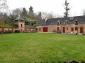
(4) After 440 metres, turn right. Pass in front of the Château de la Brosse and, at the end of the road, veer left, pass in front of the Domaine de l’Orme and carry on straight ahead towards the forest.

(5) At the entrance to the forest, carry on straight ahead along the gravel track. Then, when you reach Château du Gilloy (private property), turn left twice. After the new pond, carry on straight ahead along the main track.

(6) When you reach the road, follow it to the right for 380 metres, then take the first path on the left. Keep following this main path as it crosses the forest.

(7) At the end of this grassy track, turn left onto the white limestone track and follow it for quite some time.

(8) At a place called La Renaissance, turn left onto the GRP® Sentier Historique de la Vallée des Rois (marked in red and yellow) and carry on straight ahead.

(9) Cross the D951 (watch out for traffic) and take the path opposite. At the end of this path, turn right onto Rue du Leu, then left onto Rue des Pêcheurs.

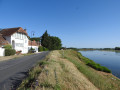
(10) At the pretty port of Bouteille, follow the road to the left: a small path on the embankment on the Loire side offers a bit of safety and a lovely view of the Loire.

(11) At La Tuilerie (a listed historic monument), leave the embankment and continue along the main D107 road to the left. Leave this road and take the limestone track on the left, which passes in front of the Bel Air windmill.

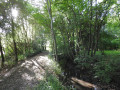
(12) At the end of the limestone track, turn left onto the road. After 300 m along this road, take the path on the right which runs alongside the Ruisseau du Leu for over 2 km, following the GRP® (marked in yellow and red).

(13) Continue straight on along the path that runs alongside the stream. Before the village hall, turn left onto the footbridge and the path that leads directly up to the village square (S/E).

Waypoints

  1. S/E : mi 0 - alt. 374 ft - Place du Bourg
  2. 1 : mi 0.21 - alt. 377 ft - Rue des Moulins
  3. 2 : mi 0.48 - alt. 367 ft - Crossing the RD 951
  4. 3 : mi 1.19 - alt. 377 ft - Rue du Gué Pénillon
  5. 4 : mi 1.58 - alt. 384 ft - Short road to the Château de la Brosse
  6. 5 : mi 2.36 - alt. 394 ft - Straight ahead at the entrance to the woods
  7. 6 : mi 3.49 - alt. 466 ft - Route de Viglain
  8. 7 : mi 4.72 - alt. 420 ft - The limestone path known as the Coulon path
  9. 8 : mi 5.93 - alt. 377 ft - The Renaissance
  10. 9 : mi 6.81 - alt. 374 ft - Cross the RD 951; shortly afterwards, the - Dhuy (rivière) - Affluent du Loiret
  11. 10 : mi 7.05 - alt. 374 ft - Old Port of Bouteille - La Loire
  12. 11 : mi 7.21 - alt. 377 ft - The Tile Works - La Loire
  13. 12 : mi 7.75 - alt. 364 ft - Route de Tournebride - Dhuy (rivière) - Affluent du Loiret
  14. 13 : mi 8.93 - alt. 358 ft - Straight ahead
  15. S/E : mi 9.45 - alt. 374 ft - Place du Bourg

Notes

At the start: public toilets, café and grocery shop.

At the Bel Air windmill: picnic tables.

Worth a visit

Neuvy Treasure: information panels on the history and composition of this archaeological find, made in 1861 in the village. It is one of the most remarkable collections of bronze statues from the Gallic period. It is on display at the Museum of History and Archaeology in the Hôtel Cabu in Orléans. Whilst the centrepiece is a horse over one metre tall, several figurines depict elegant, dynamic poses, such as the juggler or the tall dancer.

Château de la Brosse: surrounded by a moat, this 15th-century castle boasts a remarkable entrance gate (private property; not open to the public).

Ancien Port de Bouteille: overlooking the Loire, this hamlet of boatmen is full of charm with its pretty, traditional houses adorned with flowers, its boat slipway, its former tile works (listed as a Historic Monument) and the Bel Air windmill (another possible starting point).

Other walks in the area

For more walks, use our search engine .

The GPS track and description are the property of this route's author. Please do not copy them without permission.