The Sources de la Preuilhe Circular Loop

A fairly undulating walk through the hills around the picturesque village of La Cassaigne, half along quiet country lanes and half along footpaths offering lovely views.
Yellow signposting (in the direction described only).

Details

20083473
Creation:
Last update:
Last review:
  • Walking
    Activity: Walking
  • ↔
    Distance: 8.52 mi
  • ◔
    Average duration: 4h 40 
  • ▲
    Difficulty: Moderate

  • ⚐
    Back to start: Yes
  • ↗
    Ascent: + 863 ft
  • ↘
    Descent: - 892 ft

  • ▲
    Highest point: 1,165 ft
  • ▼
    Lowest point: 659 ft
  • ⚐ Country: France
  • ⚐ City: La Cassaigne (11270)
  • ⚑
    Start/End: N 43.203172° / E 1.995679°
  • ❏
    IGN map(s): Ref. 2245E, 2246E
  • Hour-by-hour weather

Photos

Description of the walk

Car park and start point at Place de l’Église de la Cassaigne.

(S/E) With your back to the church, head to the right, then immediately left onto Rue du Razès. At the cross dating from 1827, take the path down to the right and cross the Ruisseau de la Preuilhe. Continue to the cemetery.

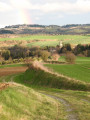
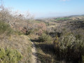
(1) In front of the cemetery, turn left onto the dirt track, which offers lovely views behind you as you walk up the gentle slope.

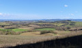
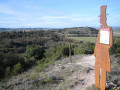
(2) At the top, head left to enjoy the views from this ridge path: as far as the Pic de Bugarach and the Pyrenees. Walk past the old Mailhole mill.

(3) At the end of the track, at a place called Curiège, head down to the left along the RD213 to the picnic area without entering the village. Follow the departmental road. When you can see the picnic area, take the first street on the right called Chemin de la Promenade.

(4) Turn right towards the water tower. Carry on straight ahead past it and follow the small road downhill.

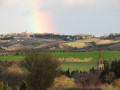
(5) At the bottom, turn right and head uphill for 1 km along this small road, which offers views of La Cassaigne and Fanjeaux.

(6) At the top, turn left twice. Walk past a pretty three-storey house. Then, at thesecond property, turn right. Stay on this small road, which winds its way round a series of bends and joins the red-marked Hille route.

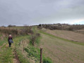
(7) At the end of this small road, after the pumping station, carry on straight ahead along the dirt track, which offers a lovely view of Fanjeaux, then heads down alongside the fields. At the bottom, take the grassy strip to the left.

(8) At the pumping station, take the small road (D15) to the right for about 800 m.

(9) Turn left onto the track and immediately keep left at the Fork in the road. Follow this track straight on, skirting the valley and heading upstream.

(10) At the end of the track, keep left and take the small road straight ahead, which offers a lovely view of the Pyrenees. After the right-hand bend, continue along this road for about 1.6 km.

(11) In front of Montalivet Castle, turn left onto the dirt track which runs past the castle and descends towards the village of La Cassaigne. At the bottom, take the RD and then, just before the church, veer right to head up Rue du Razès back to the starting point (S/E).

Waypoints

  1. S/E : mi 0 - alt. 823 ft - Church Square
  2. 1 : mi 0.15 - alt. 781 ft - Cemetery
  3. 2 : mi 1.11 - alt. 1,155 ft - Ridge path to the left
  4. 3 : mi 2.16 - alt. 1,047 ft - RD213, hamlet of Curiège
  5. 4 : mi 2.83 - alt. 853 ft - Chemin du Moulin
  6. 5 : mi 3.05 - alt. 804 ft - Junction
  7. 6 : mi 3.65 - alt. 994 ft - Top left
  8. 7 : mi 4.79 - alt. 902 ft - Dirt track in front of La Malpauzade
  9. 8 : mi 5.38 - alt. 682 ft - RD15 near the pumping station
  10. 9 : mi 5.89 - alt. 659 ft - Path on the left
  11. 10 : mi 6.72 - alt. 951 ft - Junction on the road
  12. 11 : mi 7.78 - alt. 889 ft - Path to the left - Château de Montalivet
  13. S/E : mi 8.52 - alt. 823 ft - Place de l’Eglise

Notes

- Picnic area and playground on the outskirts of the village on the D213.

Worth a visit

At the start: a church and a typical village with very old half-timbered houses, the old fortification gate and a round corner tower.

Reviews and comments

4.5 / 5
Based on 2 reviews

Reliability of the description
5 / 5
Ease of following the route
5 / 5
Route interest
3.5 / 5
daniel 31
daniel 31

Overall rating : 4.7 / 5

Date of your route : Feb 26, 2023
Reliability of the description : ★★★★★ Very good
Ease of following the route : ★★★★★ Very good
Route interest : ★★★★☆ Good
Very busy route : No

A well-signposted route. No difficulty at all. It’s a shame the Pyrenees were shrouded in cloud.

Machine-translated

tehanie
tehanie

Overall rating : 4.3 / 5

Date of your route : Nov 03, 2022
Reliability of the description : ★★★★★ Very good
Ease of following the route : ★★★★★ Very good
Route interest : ★★★☆☆ Average
Very busy route : No

A very pleasant walk, though with a lot of tarmac road

Machine-translated

Other walks in the area

For more walks, use our search engine .

The GPS track and description are the property of this route's author. Please do not copy them without permission.