Country:
 City:
City:


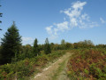
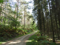
Parking is available in front of Brestot Town Hall, in front of the school (50 m away) or on the large triangular lawn (100 m away)
(S/E) With your back to the town hall, turn right onto Rue du Bourg (D 627), walk past the school, then take the safe footpath on the left running alongside the road. At the Fork in the road, turn left onto Rue Dame Catherine towards Les Godebouts. On the plain, continue straight ahead along Rue de la Cour Carrée.
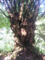
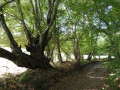
(1) At the end of Les Godebouts, head right towards Les Bourguignons and immediately take the path opposite. In the valley, veer left onto the gully-like path, then take the first path on the right uphill. At the top, the hedge on the left features a fine collection of interlaced pollarded trees. After the electricity pylon, follow the bend to the right to continue along the plain.
(2) Just before the tarmac, with Cauverville church in sight, take the sharp left-hand bend onto the path leading down, then immediately take the path on the left which descends into the valley.
(3) At the bottom, at the crossroads, take thesecond path on the left (yellow markings for the ‘Chemin du Chêne à la Vierge’ starting from Rondemare) which follows the bottom of the Val Dallet. The path is a real scree slope, so be careful and watch your step, but keep an eye on the hedge on the left – you’ll see the finest specimen of anastomosed hornbeam.
(4) At the clearing at the bottom of the slope, turn right and leave the yellow markings behind to continue following the valley. Carry on along the valley floor at the next three junctions.
(5) The landscape opens out onto the plain at the junction where you’ll find the yellow markings again. 300 m further on, head left up into the coniferous woodland via thesecond path on the left (this rather pretty detour can easily be avoided by continuing straight on along the valley floor to the D47).
(6) Further up, take the first path on the right and head into the Vosges countryside. At the four-way junction, turn right to follow the ridge line to the right and eventually descend back into the valley.
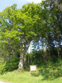
(7) At the Val Dallet rest area (a short stop at the picnic table), take the departmental road to the right (watch out for traffic). Do take a look at the remarkable ‘Chêne à la Vierge’ oak tree at the crossroads.
(8) Walk back 70 metres and head up the path on the right into the forest.
(9) At the top, before the forest road, turn off onto the grassy path on the left. In the pine forest, keep left and, at the end of the path, take the wider forest track to the right
(10) At the Rond Fleury crossroads, carry on almost straight ahead (thesecond path on the right) between plots 35 and 9. Go down to the right of plot 9, then go straight back up and carry on straight ahead along this Allée du Rond Fleury. Please note that this steep path can be slippery after heavy rain.
(11) Turn left between plots 9 and 10. At the end of the grassy track, follow the forest track to the left.
(12) At the bottom of the Route des Cinq Hêtres, turn right and head straight up the path on the right, which is closed to motor vehicles (barrier and sign). As you go uphill, carry on straight ahead.
(13) At the crossroads, turn left onto the Route Forestière de Cahaigne, following the yellow markings (Chemin des Jacinthes starting from Illeville). Before the steep descent (a shortcut is possible), veer right, following the orange markings. At the end of the path, past the large beech trees, head down to the left.
(14) At the bottom, carry on straight ahead up the gently sloping Chemin du Chêne Varin. At the top, admire the Chêne Varin, which marks the entrance to the state-owned forest in this clearing.
(15) Turn left, following the Chemin des Chênes and the yellow markings, keeping straight on.
(16) At the end of the straight stretch, carry on almost straight ahead and leave the yellow markings behind to head back down a steep path. At the bottom, rejoin the yellow markings to the left, then at the pumping station, take the forest road to the right.
(17) At the next clearing, head up the fairly steep stony path on the right, following the yellow markings (Chemin du Chêne à la Vierge starting from Rondemare). At the top, veer right, leaving the yellow markings behind, cross a woodland and emerge onto a street lined with houses.
(18) At the end of this cul-de-sac, called Rue de la Mare du Fil, turn right onto Rue de la Vallée au Maître and then carry on straight ahead. Cross the plain towards the bell tower of Brestot church.
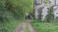
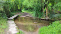
(19) At the crossroads, cross the D 47 (watch out for traffic) and take the path 20 metres to the left of the statue of the Virgin Mary. Continue straight on at the ford to rejoin the lovely sunken path that leads back to the starting village (S/E).




 Visorando Member
 Easy
Easy 
 Tourist office