Country:
 City:


Car park: the square in the hamlet of Rondemare in Appeville-Annebault.
(S/E) From the square, set off along the road called “Chemin de la Bergerie”, following the yellow markings. Stay on this quiet little road, especially on the descent where a marl pit is signposted in the woods (toilet break not recommended). On the way back up, veer left to discover some pretty, typically Norman houses and views of the valley, which is very reminiscent of the Vosges.
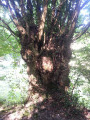
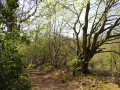
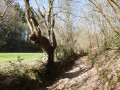
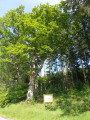
(1) After 1 km, turn left onto Rue à Vert to descend into the valley via a lovely sunken path lined with some fine oak trees: this descent gives you the impression of stepping into the landscape. At the bottom, the path reveals a beech tree with an unusual shape, which can be explained by the fact that it must have been pollarded at a fairly young age.
(2) At the crossroads at the bottom of the valley, turn left and leave the yellow markings behind. Follow this path, bordered on one side by a pretty hedge of pollarded hornbeams and ash trees and on the other by the Montfort State Forest. Make your way up the entire valley, following the thalweg that separates two very distinct landscapes: the bocage and the forest. As the path is very stony, take your time.
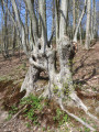
(3) After a remarkable tangle of vines (a true work of entirely natural land art), a clearing reveals some fine, tall beech and oak trees. Continue along the same path at the bottom of the valley, which rejoins the yellow markings and features the most remarkable pollarded tree.
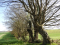
(4) At the four-way junction, turn right: the rather gullied path has a few dozen metres of fairly difficult going. But the beauty of the valley is well worth the effort. At the first crossroads, head up to the left: further up, the path features a fine series of old pollarded trees. The path then bends, skirting the cultivated plain before returning to a more bucolic landscape of hedgerows and pastures.
(5) Before reaching the tarmac road, turn left twice to stay on a path that leads back into the valley, plunging once more into a hedgerow landscape with pollarded trees.
(4) Back at the crossroads, head diagonally right to climb back up towards the hamlet of Rondemare and return to your starting point (S/E)
 Visorando Member

 Moderate
 Tourist office