


Refine your search for walks in Villemer
Villemer walks


 The Villeron Pond and its springs
 Visorando Member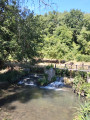
 5.93 mi
 +121 ft
 -98 ft
 2h 50
2h 50
 Easy
Easy
 Departure from Villemer (Seine-et-Marne)
This circular walk, starting from Rebours in the hamlet of Villemer – nestled between countryside and woodland – circles the private Villeron pond and follows the Villeron springs (Puits). This walk follows several sections ofthe PR® andGRP® trails. Please note that at certain times of year, the wetland area is often home to a few biting friends (mosquitoes). Apart from a fairly damp section, most of this circular walk follows small tarmac roads and fairly dry paths.
La Montagne de Trin
 3.68 mi
+223 ft
-217 ft
1h 55
Easy
Departure from Villecerf (Seine-et-Marne)
3.68 mi
+223 ft
-217 ft
1h 55
Easy
Departure from Villecerf (Seine-et-Marne)
A short walk in the hills above Villecerf in the Montagne du Trin and its tower.
Moderator’s note: sections marked as off-limits on the route (see comments dated 15 June 2020 and 4 September 2022).
From Villemarechal to the Lunain Valley via Paley
 6.85 mi
+269 ft
-253 ft
3h 25
6.85 mi
+269 ft
-253 ft
3h 25
 Moderate
Departure from Villemaréchal (Seine-et-Marne)
Moderate
Departure from Villemaréchal (Seine-et-Marne)
An easy walk to explore the Lunain Valley.
The chicken coops of Villemaréchal
 6.60 mi
+167 ft
-167 ft
3h 10
Moderate
Departure from Villemaréchal (Seine-et-Marne)
6.60 mi
+167 ft
-167 ft
3h 10
Moderate
Departure from Villemaréchal (Seine-et-Marne)
Circular route around Villemaréchal, passing the poultry farms at Boiroux, Saint-Ange-le-Viel, La Charmoy and Rue du Tremblay.
Episy, its marsh and the Etang de la Genevraye
 3.49 mi
+10 ft
-7 ft
1h 35
Easy
Departure from Épisy (Seine-et-Marne)
3.49 mi
+10 ft
-7 ft
1h 35
Easy
Departure from Épisy (Seine-et-Marne)
A circular route around the Étang de la Genevraye and a visit to the Marais d'Episy, which presents no difficulty.
From Villemarechal to Nonville
9.66 mi
+272 ft
-266 ft
4h 40
Moderate
Departure from Villemaréchal (Seine-et-Marne)
Villemaréchal to Nonville circular route: a flat route through the plains with plenty of woodland undergrowth. Best avoided in hot weather.
Episy-Ecuelles
 5.03 mi
+125 ft
-125 ft
2h 25
Easy
Departure from Épisy (Seine-et-Marne)
5.03 mi
+125 ft
-125 ft
2h 25
Easy
Departure from Épisy (Seine-et-Marne)
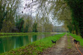
An easy, almost entirely flat hike from Episy to Ecuelles via theGR® de Pays du Lunain, passing behind the Episy aerodrome. The return journey is along the towpath beside the Canal du Loing. This route is easily manageable for a brave child.
Nanteau Forest
3.70 mi
+167 ft
-167 ft
1h 50
Easy
Departure from Nanteau-sur-Lunain (Seine-et-Marne)
A short circular loop through the Nanteau Forest, very suitable for families with children and older people, offering a chance to get some fresh air without too much effort.
The Nanteau Circuit
6.40 mi
+253 ft
-282 ft
3h 10
Easy
Departure from Villemaréchal (Seine-et-Marne)
The Nanteau circuit is very shaded and easy. A circular route through the Nanteau Forest.
The Orvanne between Écuelles and Montarlot
 9.09 mi
+328 ft
-358 ft
4h 30
Moderate
Departure from Écuelles (Seine-et-Marne) (Seine-et-Marne)
9.09 mi
+328 ft
-358 ft
4h 30
Moderate
Departure from Écuelles (Seine-et-Marne) (Seine-et-Marne)
Running parallel to the Orvanne river, this hike takes place mainly through fields, with sections along the edge of woods and through pretty villages.
The Plaine de Sorques and Marion des Roches
 5.26 mi
+141 ft
-148 ft
2h 30
Easy
Departure from Montigny-sur-Loing (Seine-et-Marne)
5.26 mi
+141 ft
-148 ft
2h 30
Easy
Departure from Montigny-sur-Loing (Seine-et-Marne)
After a short climb up Mont Marion, you will skirt around the Plaine de Sorques, which is a sensitive natural area and a bird sanctuary.
From the Sorques Nature Reserve to the Béatrix Cave
 11.69 mi
+869 ft
-869 ft
6h 10
11.69 mi
+869 ft
-869 ft
6h 10
 Difficult
Departure from Montigny-sur-Loing (Seine-et-Marne)
Difficult
Departure from Montigny-sur-Loing (Seine-et-Marne)
This walk takes you along part of the Blue Trail of the Restant du Long Rocher, approaching it from the east.
From the Sorques plain (a nature reserve on the banks of the Loing), it joins Route Blue No. 11 via little-used paths and, along the way, offers a beautiful view of the southern part of the forest with its "Table du Roi", before reaching Haut-Mont (two very different viewpoints).
As is often the case in Bleau, the landscape changes almost at every junction...
The Plaine de Sorques from Montigny-sur-Loing
 8.77 mi
+223 ft
-217 ft
4h 15
Moderate
Departure from Montigny-sur-Loing (Seine-et-Marne)
8.77 mi
+223 ft
-217 ft
4h 15
Moderate
Departure from Montigny-sur-Loing (Seine-et-Marne)
An easy hike with two bird observatories at the Plaine de Sorques, a sensitive natural area.
Bring binoculars.
Three Romanesque churches and five crosses around the Orvanne
 10.88 mi
+400 ft
-400 ft
5h 20
Moderate
Departure from Flagy (Seine-et-Marne) (Seine-et-Marne)
10.88 mi
+400 ft
-400 ft
5h 20
Moderate
Departure from Flagy (Seine-et-Marne) (Seine-et-Marne)
A hike through fields for the most part, which conceals a very rich heritage: three Romanesque churches, an old mill, an old watchtower, a castle and a menhir. Five metal crosses mark the route around the pretty, flower-filled village of Flagy.
From Montigny to Thomery via Long Rocher and Malmontagne
 9.97 mi
+574 ft
-561 ft
5h 05
Difficult
Departure from Montigny-sur-Loing (Seine-et-Marne)
9.97 mi
+574 ft
-561 ft
5h 05
Difficult
Departure from Montigny-sur-Loing (Seine-et-Marne)
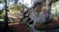
A hike from station to station through the eastern part of the Forest of Fontainebleau, which is not the most popular area of this forest. The forest trail alternates between wide paths and trails that wind through rocky terrain. Several viewpoints offer extensive panoramic views.
From Montigny-sur-Loing to Moret-Veneux-les-Sablons
 8.52 mi
+115 ft
-184 ft
4h 00
Moderate
Departure from Montigny-sur-Loing (Seine-et-Marne)
8.52 mi
+115 ft
-184 ft
4h 00
Moderate
Departure from Montigny-sur-Loing (Seine-et-Marne)
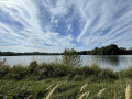
A hike from station to station starting from Montigny-sur-Loing. A varied route through the forest with a few rocks and the banks of the Loing. The Loing valley is an authentic green paradise that can be explored over a medium distance via footpaths, rural tracks and towpaths. This route takes you along the river and the canal of the same name, which flow side by side until they meet the Seine.
 From Moret-Loing-et-Orvanne to Montcourt-Fromonville
 17.65 mi
+30 ft
-30 ft
2 hrs
Easy
Departure from Moret-sur-Loing (Seine-et-Marne)
17.65 mi
+30 ft
-30 ft
2 hrs
Easy
Departure from Moret-sur-Loing (Seine-et-Marne)
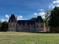
This route, running alongside the Loing Canal from Moret-Loing-et-Orvanne to Montcourt-Fromonville, is a real feast for the eyes, set against a serene waterside backdrop. Swans, grey herons, cormorants and moorhens all add to this sense of tranquillity.
The Pierre Cornoise Menhir between Thoury and Flagy
 5.24 mi
+98 ft
-66 ft
2h 30
Easy
Departure from Thoury-Férottes (Seine-et-Marne)
5.24 mi
+98 ft
-66 ft
2h 30
Easy
Departure from Thoury-Férottes (Seine-et-Marne)
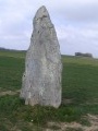
Hike along the banks of the Orvanne from Thoury to Flagy. Discover Flagy and the Pierre Cornoise menhir.
Roche Clothilde trail
3.75 mi
+39 ft
-36 ft
1h 45
Easy
Departure from Fontainebleau (Seine-et-Marne)
Discover the remarkable trees in the Rocher Clotilde and Besnard areas.
From Moret-sur-Loing to Fontainebleau through the forest
 17.27 mi
+640 ft
-617 ft
8h 30
17.27 mi
+640 ft
-617 ft
8h 30
 Very difficult
Departure from Veneux-les-Sablons (Seine-et-Marne)
Very difficult
Departure from Veneux-les-Sablons (Seine-et-Marne)
Twenty-sixth stage of the Grand Tour of Île-de-France via the GR®11, connecting the Moret-Veneux-les-Sablons and Fontainebleau-Avon stations through the Fontainebleau Forest, bypassing the town of Fontainebleau. During this crossing of the forest, we will walk along wide shaded paths, steep trails through sandstone blocks, and a few interesting viewpoints.
From Moret-sur-Loing to Fontainebleau
8.49 mi
+312 ft
-315 ft
4h 10
Moderate
Departure from Veneux-les-Sablons (Seine-et-Marne)
Hike in the Forest of Fontainebleau, with no difficulty except for a short steep climb, away from the busy paths and perfectly marked from start to finish.
The charm of the southern part of the Fontainebleau Forest
 8.72 mi
+682 ft
-623 ft
4h 35
Moderate
Departure from Veneux-les-Sablons (Seine-et-Marne)
8.72 mi
+682 ft
-623 ft
4h 35
Moderate
Departure from Veneux-les-Sablons (Seine-et-Marne)
A day's hike to enjoy the charm of the southern part of the Forest of Fontainebleau, combining rocky trails, beautiful woodland paths and the historical interest of villages and small towns (Bourron-Marlotte, Veneux-les-Sablons).
The Hamlets to the East of Lorrez-le-Bocage
 5.36 mi
+210 ft
-207 ft
2h 40
Easy
Departure from Lorrez-le-Bocage-Préaux (Seine-et-Marne)
5.36 mi
+210 ft
-207 ft
2h 40
Easy
Departure from Lorrez-le-Bocage-Préaux (Seine-et-Marne)
A circuit to the east of Lorrez-le-Bocage, along the Lunain in places with views of Lorrez-le-Bocage both to the south and north. The starting point is the car park in Place de la République in Lorrez-le-Bocage.
At the confluence of the Seine and the Loing
 5.52 mi
+194 ft
-217 ft
2h 45
Moderate
Departure from Saint-Mammès (Seine-et-Marne)
5.52 mi
+194 ft
-217 ft
2h 45
Moderate
Departure from Saint-Mammès (Seine-et-Marne)
Rising between Forterre and Puisaye, and after a course of more than 150 kilometres, the Loing flows into the Seine to the south-east of the Forest of Fontainebleau. This rather short route runs alongside these two rivers and the Canal du Loing for much of its length. A section through the forest adds variety to the landscape. The beautiful old Saint-Mammès Church and a few reproductions of paintings by Alfred Sisley add an undeniable touch of heritage to this walk.
The circular loops around the Restant du Long Rocher
6.57 mi
+505 ft
-499 ft
3h 30
Moderate
Departure from Fontainebleau (Seine-et-Marne)
Two circular loops allow the whole family to take part in just one section of the walk, as we circle round the car park and a playground. The first circular loop is 4.5 km long and takes you through the rocky terrain, followed by a circular loop extending as far as Haut Mont (8 km).
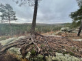
Plaine Verte car park
 6.95 mi
+610 ft
-597 ft
3h 45
Difficult
Departure from Fontainebleau (Seine-et-Marne)
6.95 mi
+610 ft
-597 ft
3h 45
Difficult
Departure from Fontainebleau (Seine-et-Marne)
Flat terrain to warm up, ending with rocks...
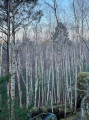
From the Grottes du Loup to the Troglodyte and the Gros Monts
 4.63 mi
+253 ft
-259 ft
2h 20
Moderate
Departure from Nemours (Seine-et-Marne)
4.63 mi
+253 ft
-259 ft
2h 20
Moderate
Departure from Nemours (Seine-et-Marne)
Poligny Forest, at the southern end of the Fontainebleau Forest. A hike of less than 8 km, alternating between rocky and flat terrain. Discover a beautiful panorama of the Loing Valley. A very shaded circuit.
Paths and rocks in the Nemours Forest
4.67 mi
+302 ft
-279 ft
2h 25
Moderate
Departure from Nemours (Seine-et-Marne)
It’s lovely in late summer and early autumn thanks to the golden colours of the leaves and the mild temperatures. Take care on the first part of the route, as there are rocks and tree roots on the paths. You’ll pass a troglodyte cave bearing an inscription of a quote attributed to Saint-Exupéry: “We do not inherit the earth from our ancestors; we borrow it from our children”, a viewpoint over the Loing Valley, the Pierre-le-Sault quarry, and the ‘sea of sand’ which you cross to get back to your cars. There are no significant technical difficulties, so it’s fairly easy, but the ground is littered with pine needles in places, so you need to take particular care on the downhill sections.
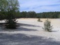
The Tonne Valley and the Sea of Sand
 4.41 mi
+180 ft
-167 ft
2h 10
Moderate
Departure from Nemours (Seine-et-Marne)
4.41 mi
+180 ft
-167 ft
2h 10
Moderate
Departure from Nemours (Seine-et-Marne)
An easy hike in the Nemours National Forest. The path is very sandy and almost always in the shade. In autumn, at the end of the hike, between Les Brulis and La Mer de Sable, if the heather is in bloom, you can enjoy a beautiful rocky landscape.
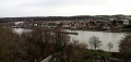
From Vernou-sur-Seine to Fontainebleau via Saint-Mamès and Thomery
 10.25 mi
+495 ft
-463 ft
5h 10
Moderate
Departure from Vernou-la-Celle-sur-Seine (Seine-et-Marne)
10.25 mi
+495 ft
-463 ft
5h 10
Moderate
Departure from Vernou-la-Celle-sur-Seine (Seine-et-Marne)
A very varied hike from station to station. The Chemin des Herces, high up, offers beautiful views of the Seine and the town of Saint-Mammès, where you will find a beautiful Romanesque church. After walking along the Seine, you stroll between the old vine walls of Thomery. You return to the banks of the Seine and the hike ends with a detour into the Fontainebleau National Forest.
Moret-sur-Loing par Loing et Seine au départ de Saint-Mammès
6.98 mi
+184 ft
-180 ft
3h 20
Moderate
Departure from Veneux-les-Sablons (Seine-et-Marne)
Visit the medieval town of Moret-sur-Loing coming from Saint-Mammès along the banks of the Loing. Return along the banks of the Seine. Check the opening hours of the Pont Loup museum.
Please note: on Sunday mornings, there is a market in the car park.
The route has been significantly modified to take into account various passages that have become unusable by pedestrians and to avoid walking along the railway line on the way back, without walking too much on tarmac.
The Rocher des Princes
 4.77 mi
+440 ft
-433 ft
2h 35
Moderate
Departure from Fontainebleau (Seine-et-Marne)
4.77 mi
+440 ft
-433 ft
2h 35
Moderate
Departure from Fontainebleau (Seine-et-Marne)
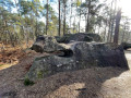
The Rocher des Princes is a medium-difficulty loop in the pretty Fontainebleau Forest. It alternates between fairly steep climbs and descents with flat paths, allowing you to rest between the difficult sections.
Route du Rocher des Princes via Les Ventes Bourbon
7.06 mi
+194 ft
-207 ft
3h 25
Moderate
Departure from Fontainebleau (Seine-et-Marne)
An easy walk suitable for families, taking around half a day.
La Mare aux Fées, La Malmontagne, Le Carrosse and the Grotte Béatrix
 10.05 mi
+804 ft
-787 ft
5h 20
Moderate
Departure from Fontainebleau (Seine-et-Marne)
10.05 mi
+804 ft
-787 ft
5h 20
Moderate
Departure from Fontainebleau (Seine-et-Marne)
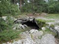
A loop in the heart of Fontainebleau: a magnificent poetic pond, venerable oak trees, four viewpoints, memories of revolutionary battles, a cave, a chasm, sandstone cliffs... and plenty of peace and quiet.
Poligny – Dordives Bridge via the GR®13
 12.28 mi
+427 ft
-482 ft
6h 00
Moderate
Departure from Poligny (Seine-et-Marne) (Seine-et-Marne)
12.28 mi
+427 ft
-482 ft
6h 00
Moderate
Departure from Poligny (Seine-et-Marne) (Seine-et-Marne)
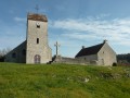
On the way to Santiago de Compostela from Fontainebleau via theGR®®13, to join the Via Lemovicensis at Vézelay.
The Rocher Brûlé and its remarkable trees
5.29 mi
+46 ft
-46 ft
2h 30
Easy
Departure from Fontainebleau (Seine-et-Marne)
Take a walk around the Rocher Brûlé in search of the area’s remarkable trees, listed by the Friends of the Fontainebleau Forest. This path is not signposted, so keep a look out during your walk to spot the trees marked with a Blue Circle.
Le Rocher d'Avon, Le Petit Mont Chauvet and Le Rocher de Bouligny
 9.97 mi
+525 ft
-551 ft
5h 05
Moderate
Departure from Fontainebleau (Seine-et-Marne)
9.97 mi
+525 ft
-551 ft
5h 05
Moderate
Departure from Fontainebleau (Seine-et-Marne)
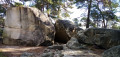
A hike in areas of the Fontainebleau Forest that are not among the most frequented. The forest trail alternates between wide paths and trails that wind through rocky outcrops and vegetation. There are a few points offering extensive views of the forest and the town of Fontainebleau and its castle.
The Château de By and the grape walls of Thomery
 5.60 mi
+164 ft
-148 ft
2h 45
Easy
Departure from Fontainebleau (Seine-et-Marne)
5.60 mi
+164 ft
-148 ft
2h 45
Easy
Departure from Fontainebleau (Seine-et-Marne)
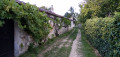
This hike, which begins and ends in the forest of Fontainebleau, takes us on a journey to discover the painter Rosa Bonheur (1822-1899) and the château where she lived and set up her studio. We then stroll among the old vine walls that made Thomery famous in its day. A footpath offers the opportunity for a picturesque walk along the banks of the Seine.
From Thomery to Fontaine-le-Port via the Tour Denecourt and the Rocher de Samois
 11.25 mi
+515 ft
-650 ft
5h 35
Difficult
Departure from Fontainebleau (Seine-et-Marne)
11.25 mi
+515 ft
-650 ft
5h 35
Difficult
Departure from Fontainebleau (Seine-et-Marne)
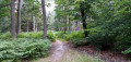
A walk from station to station in the eastern part of the Forest of Fontainebleau. The route alternates between wide paths and trails that wind through the forest. You climb two hills topped by a tower dating from the late 19th century, the summit of one of which offers a sweeping panorama.
The banks of the Lunain from Vaux-sur-Lunain to Le Nid du Corbeau
 4.97 mi
+180 ft
-187 ft
2h 25
Easy
Departure from Vaux-sur-Lunain (Seine-et-Marne)
4.97 mi
+180 ft
-187 ft
2h 25
Easy
Departure from Vaux-sur-Lunain (Seine-et-Marne)
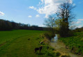
A circular loop between Vaux-sur-Lunain and the hamlet known as "Le Nid du Corbeau", following the banks of the Lunain.
A semi-shaded route, pleasant in the morning, with the return leg with the sun at your back.
At the confluence of the Seine and Yonne rivers
7.38 mi
+16 ft
-16 ft
3h 25
Moderate
Departure from Montereau-Fault-Yonne (Seine-et-Marne)
Hiking around Varenne-sur-Seine. The trails leading to springs, mills and wash houses complete this circuit, passing by the Noue Notre-Dame leisure centre and the botanical garden with its castle.
Where the Seine and Yonne rivers meet, passing through Marolles-sur-Seine
12.55 mi
+39 ft
-39 ft
5h 50
Difficult
Departure from Montereau-Fault-Yonne (Seine-et-Marne)
Passing through the Seiglats Regional Nature Reserve on this hike, you will see a variety of birds, including birds of prey and passerines, as well as locks along the banks of the Seine and Yonne rivers and ponds.
From Montereau-Fault-Yonne to Moret-sur-Loing, from one confluence to another.
 15.76 mi
+492 ft
-456 ft
7h 40
Difficult
Departure from Montereau-Fault-Yonne (Seine-et-Marne)
15.76 mi
+492 ft
-456 ft
7h 40
Difficult
Departure from Montereau-Fault-Yonne (Seine-et-Marne)
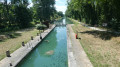
This is the twenty-fifth stage of the Grand Tour of Île-de-France via the GR®11, starting from Montereau station, not far from the confluence of the Seine and the Yonne, and ending at Moret-Veneux-les-Sablons station, not far from the confluence of the Seine and the Loing. The stage, entirely on the GR®11, follows a route on the left bank of the Seine, joining the Orvanne valley a little further south, and returns to Moret-sur-Loing and its beautiful historic centre, following the Canal du Loing on its towpath.
Along the River Yonne from Montereau-Fault-Yonne
11.58 mi
+43 ft
-23 ft
5h 20
Moderate
Departure from Montereau-Fault-Yonne (Seine-et-Marne)
A walking route from station to station, starting at Montereau Fault-Yonne station and ending at Villeneuve-la-Guyard along the River Yonne, allowing you to explore the ponds and marshes near the finish. A peaceful, quiet walk along the water’s edge, passing through the village of Misy-sur-Yonne, which is known for its historic site.
From Montereau to Vernou-sur-Seine via the towpath and the plateau
 8.52 mi
+249 ft
-207 ft
4h 10
Moderate
Departure from Montereau-Fault-Yonne (Seine-et-Marne)
8.52 mi
+249 ft
-207 ft
4h 10
Moderate
Departure from Montereau-Fault-Yonne (Seine-et-Marne)
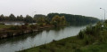
A three-stage walk from station to station. First, you cross the town of Montereau, the highlight being the Gothic collegiate church and the double bridge at the confluence of the Seine and the Yonne. Next, you follow the towpath, which is mostly shaded. Finally, you climb to a higher elevation before descending to Vernou-sur-Seine station.
(Please note) Just before (9), the underpass beneath the railway line is closed (see the comment posted on 21 July 2026). Until this obstruction is cleared, one option is to turn right to find a level crossing. Once you have crossed the tracks safely, follow the D39 to the left until you reach point (9).
From Montereau-Fault-Yonne to Pont-sur-Yonne
 Association / Club / Walk leader
 18.24 mi
+62 ft
-16 ft
10 hrs
Very difficult
Departure from Montereau-Fault-Yonne (Seine-et-Marne)
18.24 mi
+62 ft
-16 ft
10 hrs
Very difficult
Departure from Montereau-Fault-Yonne (Seine-et-Marne)
This is the first stage of the Via Burgundia®, which takes you across the whole of Burgundy from Montereau-Fault-Yonne to Mâcon, south of Saône-et-Loire. This major route, covering almost 500 km, is divided into three sections: the Yonne section, the Morvan section and, finally, the Southern Burgundy section.
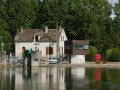
This first section follows the course of the River Yonne from its confluence with the River Seine to Pont-sur-Yonne. It involves very little elevation gain but remains a fairly long stage if you cover it in a single day. The route winds its way along the River Yonne, past fields of cereals and ponds (or ‘noues’), particularly after Bichain.