The chicken coops of Villemaréchal

Circular route around Villemaréchal, passing the poultry farms at Boiroux, Saint-Ange-le-Viel, La Charmoy and Rue du Tremblay.

Details

162626
Creation:
Last update:
Last review:
  • Walking
    Activity: Walking
  • ↔
    Distance: 6.60 mi
  • ◔
    Average duration: 3h 10 
  • ▲
    Difficulty: Moderate

  • ⚐
    Back to start: Yes
  • ↗
    Ascent: + 167 ft
  • ↘
    Descent: - 167 ft

  • ▲
    Highest point: 466 ft
  • ▼
    Lowest point: 308 ft

Photos

Description of the walk

(S) From the car park, with the village hall behind you, take Rue de la Mairie towards the cemetery.

(1) In front of the cemetery, turn onto the path on the left. At the first crossroads where four paths meet, turn left. When you reach the junction with Rue du Silo, cross over and follow Rue des Fossés straight ahead. Cross Rue des Tournelles and continue along Rue du Poirier de Sauge.

(2) Turn onto the path on the right, then take the first path on the right. At the end of the path, turn left, then right, and carry on.

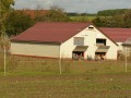
(3) At the third three-way junction in the road, turn right; the path runs alongside a large poultry farm. This path is tarmacked towards the end. You’ll come out onto Rue Grande in the hamlet of Boisroux. Follow this street to the left, then,
a little further on, turn right into Rue Traversière. This continues as Rue de Bourgogne, which you follow to the right. Leave Boisroux.

(4) Take the third track on the right, which joins the D120. Cross the road and continue straight ahead. Follow this track until it joins a small tarmac road. Take this road to the left, then turn immediately into the first track on the right. Follow this track, which bends to the right

(5) Take the track on the right and, at the junction, turn left. Follow this new track, which passes close to the Saint-Ange cemetery on the left. Arrive in Saint-Ange and cross the Route de Villemaréchal (D92).

(6) Head slightly to the left and turn into the alleyway immediately on the right, Rue des Plants. Follow this alleyway, which ends in a path.

(7) At the three-way junction at the entrance to the woods, take the path on the left. This path climbs into the woods and joins another path. Follow this path to the right and head towards La Charmoy. Continue along Route de la Charmoy, which leads onto Route de Lorrez (D218). Cross the road and turn right (caution: very busy road).

(8) At the Croix Rompue, take Rue de Tremblay on the left. You’ll be entering Villemaréchal again. Continue along Rue de Tremblay and take the second path on the right. This path leads to the cemetery and then back to the car park on the left.

Waypoints

  1. S/E : mi 0 - alt. 361 ft
  2. 1 : mi 0.09 - alt. 377 ft - At the cemetery, turn left
  3. 2 : mi 0.72 - alt. 354 ft - Path on the right
  4. 3 : mi 1.7 - alt. 315 ft - Turn right
  5. 4 : mi 2.46 - alt. 341 ft - Path on the right
  6. 5 : mi 4.02 - alt. 364 ft - Path on the right
  7. 6 : mi 4.75 - alt. 400 ft - Opposite, Rue des Plants
  8. 7 : mi 4.9 - alt. 404 ft - At the edge of the woods, take the three-way junction to the left
  9. 8 : mi 5.95 - alt. 440 ft - Croix Rompue, turn left onto “Le Tremblay”
  10. S/E : mi 6.6 - alt. 361 ft

Reviews and comments

3.8 / 5
Based on 4 reviews

Reliability of the description
4.3 / 5
Ease of following the route
4.3 / 5
Route interest
3 / 5
poret
poret

Overall rating : 3 / 5

Date of your route : Nov 25, 2024
Reliability of the description : ★★★☆☆ Average
Ease of following the route : ★★★☆☆ Average
Route interest : ★★★☆☆ Average
Very busy route : No

A very uninteresting and poorly signposted walk

Machine-translated

Phildor
Phildor

Overall rating : 4.3 / 5

Date of your route : Apr 27, 2021
Reliability of the description : ★★★★★ Very good
Ease of following the route : ★★★★★ Very good
Route interest : ★★★☆☆ Average
Very busy route : No

A really lovely, colourful moment with the fields of rapeseed in bloom. However, we didn’t see any hens on the walk. We did come across the structures of a very large henhouse, but there wasn’t a single hen to be seen.

Machine-translated

boucles d'or
boucles d'or

Overall rating : 3.7 / 5

Date of your route : Feb 24, 2021
Reliability of the description : ★★★★☆ Good
Ease of following the route : ★★★★☆ Good
Route interest : ★★★☆☆ Average
Very busy route : No

An easy, leisurely walk, but nothing particularly special to see.
At point 2, when you need to turn right onto the path, be careful not to miss it. It’s situated between two houses, so you could walk right past it without noticing.
At point 4, when you reach the small tarmac road, there’s no need to turn left. You simply need to carry on straight ahead towards the woods. It’s worth noting, incidentally, that this path leads into a small wood.

Machine-translated

ovil
ovil

Overall rating : 4.3 / 5

Date of your route : Oct 03, 2017
Reliability of the description : ★★★★★ Very good
Ease of following the route : ★★★★★ Very good
Route interest : ★★★☆☆ Average

An easy walk through the fields along wide farm tracks or roads with no traffic.
The rain over the last few days has made some sections a bit slippery.
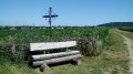
One downside: there are no picnic spots. Just a bench next to the Villemaréchal cemetery.
We rounded off the day with the ‘From Villemaréchal to the Lunain Valley via Paley’ route, which also starts at the cemetery.

Machine-translated

Other walks in the area

For more walks, use our search engine .

The GPS track and description are the property of this route's author. Please do not copy them without permission.