Country:
 City:
City:


The walk starts at Montereau-Fault-Yonne station.From Paris, Gare de Lyon – R train, bound for Montereau.
(S) Turn right as you leave the station and follow Rue Léo Lagrange on your right. At the traffic lights, cross Avenue du 8 mai 1945, then Avenue du Maréchal de Lattre de Tassigny and Rue Paul Jozon, continuing straight on until you reach the roundabout. Go round the roundabout on the right, then, immediately afterwards, turn right onto the cycle path.
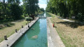
(1) Take the path leading uphill to the left and cross the footbridge alongside the Pont de Moscou, then cross the River Yonne. Once at the end of the footbridge, head down to the left to join the towpath, which carries both the cycle path and the GR®2. Turn left onto it, continuing through the woodland alongside the River Yonne until you reach the Cannes lock dam.
(2) Carry on along the towpath, pass under the 8 May 1945 Bridge and leave the GR®2. Continue along the riverbank on the PR® route, passing through the Prés des Bordes and following the meander of the River Yonne.
(3) Leave the path on your left and head straight on until you reach the vicinity of Lock No. 16 at La Brosse.
(4) Turn off onto the path that heads left between woods and fields. Turn left at a 90° angle along the path to go round the Prés Hauts pond.
(5) At the junction, take the sharp right-hand bend along the Ru des Prés Hauts, cross it and you’ll come to a crossroads with a side path.
(6) Turn right, walk for about a hundred metres, then head left to rejoin the banks of the Yonne and the towpath.
(7) Carry on straight ahead, ignoring the path on the left leading to the village of Barbey, pass the Fosse d’Enfer dam and arrive at the entrance to Misy-sur-Yonne.
(8) Stay on the towpath, passing the stadium, and arrive at the bridge.
(9) Turn right to cross the bridge, then continue carefullyalong the D103 for about 1 km.
After the sharp right-hand bend, turn right, following the ponds alongside a wire fence. Leave the Chemin de la Noue on your left and carry on straight ahead into the woodland.
(11) Turn left at a right angle, pass between two ponds and reach a junction.
(12) First turn right then left, pass between the Garenne ponds and come out onto Rue Antoine Laurent de Lavoisier.
(13) Turn left, walk alongside the Garenne Business Park and reach the junction with Route de Misy (D103). Turn right, cross the railway bridge, then turn left onto Avenue de la Gare to reach the station (S/E).
 Association / Club / Walk leader
 Very difficult
  Visorando Member
 Difficult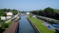
 Easy
Easy