La Montagne de Trin

A short walk in the hills above Villecerf in the Montagne du Trin and its tower.

Moderator’s note: sections marked as off-limits on the route (see comments dated 15 June 2020 and 4 September 2022).

Details

210595
Creation:
Last update:
Last review:
  • Walking
    Activity: Walking
  • ↔
    Distance: 3.68 mi
  • ◔
    Average duration: 1h 55 
  • ▲
    Difficulty: Easy

  • ⚐
    Back to start: Yes
  • ↗
    Ascent: + 223 ft
  • ↘
    Descent: - 217 ft

  • ▲
    Highest point: 463 ft
  • ▼
    Lowest point: 217 ft

Photos

Description of the walk

Park in the car park at Villecerf Cemetery, Rue de l’Eglise.

(S/E) Head off to the right, north-west, with the cemetery entrance behind you.

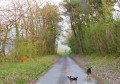
(1) Take the path on the left, just before the sign marking the exit from the village of Villecerf. Continue along this path, which climbs quite steeply to start with.

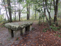
(2) At the junction at the top of the path, turn right to follow the short circular path that passes at the foot of the Montagne du Trin Tower. The path is little used and therefore poorly marked on the ground, especially in autumn. Stay on the ridge, following the path. Return to the junction.

(2) Turn right onto the path.

(3) At the three-way junction, veer to the right; do the same at the next junction and head down to a Fork in the road.

(4) Turn right and continue to the right again at the next fork.

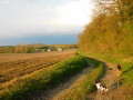
(5) Turn onto the second path on the left. At the T-junction at the edge of the woods, turn right and follow the path along the edge of the woods; the path then bends sharply to the right at a 90° angle. Follow the edge of the woods.

(6) Turn left to follow the dual signposting mentioned above, which leads back to the cemetery (S/E).


Waypoints

  1. S/E : mi 0 - alt. 325 ft - Villecerf Cemetery
  2. 1 : mi 0.09 - alt. 318 ft - Turn left
  3. 2 : mi 0.24 - alt. 430 ft - At the junction, turn right
  4. 3 : mi 1.04 - alt. 446 ft - Three-way junction: turn right
  5. 4 : mi 1.68 - alt. 384 ft - At the fork in the road, turn right
  6. 5 : mi 2.01 - alt. 322 ft - Turn left
  7. 6 : mi 3.1 - alt. 226 ft - Edge of the woodland, turn left
  8. S/E : mi 3.68 - alt. 325 ft - Villecerf Cemetery

Reviews and comments

3.7 / 5
Based on 5 reviews

Reliability of the description
4 / 5
Ease of following the route
2.8 / 5
Route interest
4.4 / 5
boucles d'or
boucles d'or

Overall rating : 4.5 / 5

Date of your route : Apr 15, 2023
Reliability of the description : Not used / Not applicable
Ease of following the route : ★★★★☆ Good
Route interest : ★★★★★ Very good
Very busy route : No

A short, leisurely walk. It climbs a little at the start, just long enough to reach the tower. The rest of the route is very straightforward. A very pleasant atmosphere and I didn’t meet a soul.
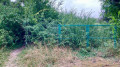
However, part of the route is not, or is no longer, accessible. At point 5, where you’re supposed to turn left, the path isn’t very well maintained and is then completely blocked by a fallen tree.
I retraced my steps and tried to find the path from the other direction. But there too, the path is blocked by a small chain.
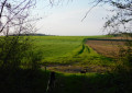
So, from point 5, do not turn left; carry on straight ahead to rejoin the route at the fields.

Machine-translated

Dousyl
Dousyl

Overall rating : 4.7 / 5

Date of your route : Mar 16, 2023
Reliability of the description : ★★★★★ Very good
Ease of following the route : ★★★★★ Very good
Route interest : ★★★★☆ Good
Very busy route : No

A nice route, very easy. A lovely tower.

Machine-translated

Martine Saigre
Martine Saigre

Overall rating : 2.3 / 5

Date of your route : Sep 04, 2022
Reliability of the description : ★★☆☆☆ Disappointing
Ease of following the route : ★☆☆☆☆ Very disappointing
Route interest : ★★★★☆ Good
Very busy route : No

We did the route the other way round, but there are two places where you have to climb over barriers!
For the first one, we tried to go round it, but the paths were impassable! So we turned back and climbed over the fence!
Then another fence after we’d made our way through some very overgrown paths!
Then there were signs saying we were on private property – not that it was off-limits, but we were walking right through the middle of the beehives!
The view from the tower is magnificent; the whole route is very beautiful.
With planes flying overhead for almost the entire hike!

Machine-translated

garrigle
garrigle

Overall rating : 3 / 5

Date of your route : Jun 10, 2020
Reliability of the description : ★★★★☆ Good
Ease of following the route : ★☆☆☆☆ Very disappointing
Route interest : ★★★★☆ Good
Very busy route : No

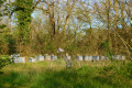
The walk was impassable; between points 3 and 4, the path is closed (signposted and blocked by a red and white tape) because a beekeeper has placed a large number of beehives directly on the path and in the immediate vicinity. It was impossible to continue, so we had to turn back.

Machine-translated

jemicel
jemicel

Overall rating : 4.3 / 5

Date of your route : Nov 27, 2016
Reliability of the description : ★★★★★ Very good
Ease of following the route : ★★★☆☆ Average
Route interest : ★★★★★ Very good

.all done... with a little detour... Thank you.

Machine-translated

Other walks in the area

For more walks, use our search engine .

The GPS track and description are the property of this route's author. Please do not copy them without permission.