Country:
 City:
City:




Starting point and access: Montereau railway station.
- Transilien – Line R, terminus of a section from Paris-Gare de Lyon via Saint-Mammès and a section from Melun via Héricy.
- TER – Line between Paris-Gare de Lyon and Laroche-Migennes.
Take the Place Pierre Semard exit.
No signposting
(S) With your back to the station, turn slightly right, cross Rue Léo Lagrange on the right-hand side and follow Avenue du Général de Gaulle. At the traffic lights, turn left onto Avenue de la Libération. Continue straight ahead and, atthe second junction, turn right into Rue de Varennes. At the ‘Stop’ sign, go straight on into Rue Pierre Brosselette and walk alongside a park on your left. At the next junction, continue straight ahead onto Rue de la Faïencerie.
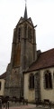
(1) At the traffic lights, turn left and walk past a long brick building on your right. At the end, cross a square and turn right onto Rue du Calvaire. At the end, cross diagonally to the left across Place du Marché au Blé. Then turn right onto Rue Danielle Casanova. Just before the end of this street, turn right into the narrow Rue de l’Hôtel Dieu. You’ll emerge onto Rue Jean Jaurès in front of the façade of Montereau Collegiate Church.
(2) Turn left and walk alongside the church on your right. Cross the bridge over the Yonne, pass by the equestrian statue of Napoleon and cross the bridge over the Seine.
Red and white + yellow markings
(3) As you leave the bridge, head down to the left along the D39, towards Champagne-sur-Seine.
Yellow markings (rare)
After a bus stop, continue straight on along the Quai de Seine (let theGR®® branch off to the right). Choose between a wide grassy verge on the left and a concrete pavement on the right.
(4) At number 58, just after passing a small brick building on the left, turn left onto a small road to stay as close as possible to the river. Walk past an industrial site on your right that appears to be disused. Directly beneath a power line, the tarmac gives way to a shaded path. Further on, pass under a railway bridge.
No signposting
You’re supposed to continue along aPR®® but there’s no sign of any markings.
(5) About 300 m after the bridge, turn right to go round a pond on the right-hand side. At a T-junction, turn left. Pass under a power line and carry on straight ahead until you reach a metal barrier.
Yellow + Green signposting
(6) You’ll come out onto a small road (note the distant silhouette of La Grande Paroisse church opposite) and follow it to the left. Pass under the power line again. Join the towpath (tarmac) and follow it to the right. Take a zigzag path to get past a metal gate and walk alongside the Varennes Lock.
Green signposting
(7) At the bridge, go straight on, pass a chain and then a hairpin bend next to a gate, and continue along the towpath (grassy). Ignore a path branching off to the right, keep going straight on and pass under a power line.
(8) Pass under asecond power line and walk along a narrow strip of land between the Seine on the left and the lake at a leisure centre on the right. After about 1 km, near a sign for the leisure centre, you’ll come to two almost parallel paths: take the wider one on the right and head towards a telephone pole. Then pass under the railway line and turn left to head up a grassy path (ignore the steps). At the top, cross the road carefully (no pedestrian crossing).
(9) Then take a small road sloping off to the right and head uphill. After about a hundred metres, turn left (at the bollards). At the next junction (bollards again), follow a small road uphill to the left. At the end, continue along the pavement of a main road and climb more gently.
(10) Just after crossing the C11 road on the right-hand side, turn left (two signs give two different names: Chemin dit du Grand Chemin and Chemin de la Folie). Pass a shed on the right-hand side and, at the Fork in the road that appears immediately, take the track on the left. Continue straight ahead and pass under (very) numerous high-voltage power lines.
(11) Between the last two power lines, turn right onto a path (be careful to spot this discreet, unmarked turn-off). Head downhill, pass the base of a pylon on the left and go under the high-voltage power line (do not follow the track on the right that goes down under the line itself). Descend steeply until you reach a small road at a place called Moulin de l’Église.
Red and white + yellow markings
(12) First turn right then left, and cross a stream. Pass a gate on your right and walk between the house on your right and a vegetable garden on your left. Turn left and walk up a grassy path. At the top (sign for “Le Chesnoy” on the right-hand side), cross a road and continue straight ahead along a path between the fields (note the cemetery on the left).
(13) You’ll come out onto the cemetery road; follow it to the right. Go round the roundabout on the left and continue straight ahead along Rue des Écoles. Walk past a school, a care home and the media library on your left. At the junction, turn left onto Rue de la Mairie.
(14) Keep the church on your left. After the war memorial, leave theGR®® briefly and follow the yellow markings to the left down a narrow lane. At the end, turn left onto Rue de la Mairie and rejoin the GR®®. Cross Rue des Cars on the left-hand side and continue straight down. At the bottom, turn left and you’ll immediately find Vernou-sur-Seine station on your right (E).
To get back home:
- Transilien – Line R, towards Montereau (immediate access) or Melun and Paris (cross the tracks carefully using the designated crossing).



 Association / Club / Walk leader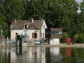
 Very difficult
  Visorando Member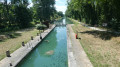
 Difficult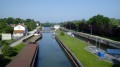
 Easy
Easy