Roche Clothilde trail

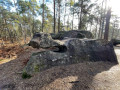
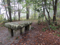
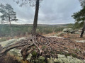
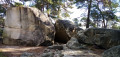
Discover the remarkable trees in the Rocher Clotilde and Besnard areas.

Details

18469924
Creation:
Last update:
Last review:
  • Walking
    Activity: Walking
  • ↔
    Distance: 3.75 mi
  • ◔
    Average duration: 1h 45 
  • ▲
    Difficulty: Easy

  • ⚐
    Back to start: Yes
  • ↗
    Ascent: + 39 ft
  • ↘
    Descent: - 36 ft

  • ▲
    Highest point: 341 ft
  • ▼
    Lowest point: 276 ft

Description of the walk

Park at the junction of the D148 and the Route Forestière du Bois Prieur.

(S/E) Take the Route Forestière du Bois Prieur. A few metres on, you’ll find a superb two-stemmed oak. After the junction with theGR® path (red and white), on the left within the plot, there is another oak, this time with three stems, and next to it a ‘Shingle’ Scots pine. Continue to the next junction, following theGR® path.

(1) At the junction, take Route Desquinemare on the right, heading due south, and, before the next junction, on the left is a grafted pine. Now turn left to find an oak, then another oak; next, keep turning left onto Route Lefoin and then left again onto Route de la Plaine, where you’ll see two three-stemmed oaks. You’ll find yourself back at the junction from the outward journey.

(1) Turn right and follow theGR® again; not far on, you’ll see a beautiful beech tree.

(2) At the next crossroads, turn right onto Route du Genévrier. Continue along this road, cross Route du Rocher Marion des Roches and carry on until you reach a Fork in the road; take the right-hand fork to pass in front of Rocher Besnard. Continue on to reach Route de Zamet with its two-stemmed oak.

(3) Then turn left onto the Route de Zamet; further on, follow the little Sentier de la Roche Clotilde to see the rock of the same name with its twin-trunked pine nearby, then rejoin the Route du Rocher Besnard.

(4) : Follow the Route du Rocher Besnard to the left, where you’ll come across, in turn, one oak tree, then another, and yet another – all remarkable specimens. Once you reach the Route des Sablons, turn left.

(5) Continue back to the car park, passing the beech tree you saw earlier (S/E).

Waypoints

  1. S/E : mi 0 - alt. 302 ft - Small car park on the D148
  2. 1 : mi 0.27 - alt. 292 ft - Junction of the Desquinemare and de la Plaine roads
  3. 2 : mi 1.45 - alt. 308 ft - Junction of the Lefoin and Genevrier roads
  4. 3 : mi 2.04 - alt. 302 ft - Junction of the Zamet and du Piqueur roads
  5. 4 : mi 2.48 - alt. 295 ft - Junction of the Besnard, Piqueur and Roche Clotilde roads
  6. 5 : mi 3.04 - alt. 305 ft - Junction of Route Marion des Roches and the GR
  7. S/E : mi 3.75 - alt. 305 ft - Small car park on the D148

Notes

This entire route is taken from booklet no. 5 on remarkable trees published by the Friends of the Fontainebleau Forest.

No water or refreshments available.

Worth a visit

If you’d like to know the approximate age of the trees you come across:
Take a piece of string 5–6 metres long, mark it at 1.00 m, 0.50 m and 0.25 m intervals, and set off.
Once there, measure the circumference of the trunk at a height of approximately 1.40m and divide this measurement by 3.14.
Then multiply by 2.5 (more details on the website).
https://www.promessedefleurs.com/conseil....

Always be cautious and plan ahead when you're outdoors. Visorando and the author of this route cannot be held responsible for any accidents occurring on this route.

The GR® and PR® markings are the intellectual property of the Fédération Française de Randonnée Pédestre.

Reviews and comments

4.1 / 5
Based on 3 reviews

Reliability of the description
4 / 5
Ease of following the route
4.3 / 5
Route interest
4 / 5
User 26469065

Overall rating : 4 / 5

Date of your route : Nov 09, 2025
Reliability of the description : ★★★★☆ Good
Ease of following the route : ★★★★☆ Good
Route interest : ★★★★☆ Good
Very busy route : No

Enjoy your hike

Machine-translated

Falgoux Serge
Falgoux Serge

Overall rating : 4.3 / 5

Date of your route : Mar 10, 2025
Reliability of the description : ★★★★☆ Good
Ease of following the route : ★★★★★ Very good
Route interest : ★★★★☆ Good
Very busy route : No

Depending on the weather conditions, the route includes some tricky sections (mud, watch out for slippery patches – and make sure you have the right kit, of course)

Machine-translated

polo77
polo77

Overall rating : 4 / 5

Date of your route : Sep 07, 2023
Reliability of the description : ★★★★☆ Good
Ease of following the route : ★★★★☆ Good
Route interest : ★★★★☆ Good
Very busy route : No

Hello,
For my first time on a hiking route, I really enjoyed this short route. Well, it’s true that I set off in the opposite direction to the route described at , but once I’d got to grips with the software, everything fell into place.
Lovely paths and trails in the shade of the woodland. I didn’t really get to appreciate the variety of trees – I was too busy following my GPS. The final circular loop was a bit uninteresting.
A lovely breath of fresh air, in any case.

Machine-translated

Other walks in the area

For more walks, use our search engine .

The GPS track and description are the property of this route's author. Please do not copy them without permission.