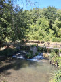
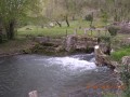
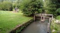
The Villeron Pond and its springs

This circular walk, starting from Rebours in the hamlet of Villemer – nestled between countryside and woodland – circles the private Villeron pond and follows the Villeron springs (Puits). This walk follows several sections ofthe PR® andGRP® trails. Please note that at certain times of year, the wetland area is often home to a few biting friends (mosquitoes). Apart from a fairly damp section, most of this circular walk follows small tarmac roads and fairly dry paths.

Details

250461
Creation:
Last update:
Last review:
  • Walking
    Activity: Walking
  • ↔
    Distance: 5.93 mi
  • ◔
    Average duration: 2h 50 
  • ▲
    Difficulty: Easy

  • ⚐
    Back to start: Yes
  • ↗
    Ascent: + 121 ft
  • ↘
    Descent: - 98 ft

  • ▲
    Highest point: 318 ft
  • ▼
    Lowest point: 180 ft
  • ⚐ Country: France
  • ⚐ City: Villemer (77250)
  • ⚑
    Start/End: N 48.311439° / E 2.814372°
  • ❏
    IGN map(s): Ref. 2417OT, 2417OTR
  • Hour-by-hour weather

Photos

Description of the walk

The starting point is actually Rue Germaine Bouret, a small car park signposted by the “Amis de l’Atelier” centre in Rebours (Villemer medical care home).

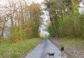
(S/E) With your back to Rue Germaine Bouret, turn left into Rue du Château. Opposite, take the dead-end track, Chemin des Roches. You are now on a yellow-marked route, which is rarely signposted.
Under the power line, continue along the path on the left after the bend, ignoring a path on the left. Continue along the same path, which eventually runs alongside the Étang de Villeron on the left, hidden by the vegetation.

(1) Take the road on the left. You are now on theGRP® du Lunain, marked with both yellow/red and blue signs. At the junction, turn right, following the same markings.

(2) In Villeron, follow the blue and yellow markings, turn right and then immediately left onto a small tarmac path. Take a left-hand bend and cross a small bridge (ford) over the Lunain.

(3) At Cugny, at the junction, turn left. Then turn left straight away onto the path. This path was poorly signposted when I did this walk. It is just past plot 17 of a new housing development (I hope this path will still be there).

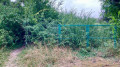
(4) At the edge of the woods, take the path on the right. This path leads onto a track which you should follow to the left. You’ll walk alongside a fenced-off area on the left; these are the Villeron springs and pumping wells.
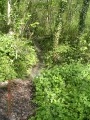
Further on, the path marked on the right on the map is not there. Carry straight on, crossing a rather marshy area for about 250 metres whilst winding your way through the woods, until you reach a small tarmac road.

(5) Carry on to the left. Turn left at the Moulin de la Coutière and continue along this small road, passing over the Lunain. Take the first small road on the left again and head towards a junction.

(6) Cross the road and take the path opposite. Continue straight ahead along this path at the junction with other paths. At the end, it takes a 90° left-hand bend and leads to a small road.

(7) Follow the road to the right, passing through Le Coudray. At the three-way junction, take the small road on the left.

(8) At the stop sign, turn right onto the road. Pass Le Lunain again, then take the path on the right immediately afterwards (Allée des cavaliers). At the end of the lane, turn left to return to the street where you started (S/E).


Waypoints

  1. S/E : mi 0 - alt. 223 ft - Rue Germaine Bouret
  2. 1 : mi 1.35 - alt. 203 ft - Turn left, Etang de Villeron
  3. 2 : mi 1.81 - alt. 203 ft - Villeron: turn right, then immediately left - Villeron
  4. 3 : mi 2.48 - alt. 190 ft - Gugny, turn left
  5. 4 : mi 2.58 - alt. 190 ft - Turn right
  6. 5 : mi 3.51 - alt. 220 ft - A small tarmac road; turn left towards the - Lunain (rivière) - Affluent du Loing
  7. 6 : mi 3.89 - alt. 210 ft - Straight on
  8. 7 : mi 4.73 - alt. 318 ft - Turn right
  9. 8 : mi 5.46 - alt. 233 ft - Turn left
  10. S/E : mi 5.93 - alt. 223 ft - Rue Germaine Bouret

Worth a visit

(6) On the left is the hamlet of Le Huat. There is a park with wild animals. These animals are trained for the cinema. If you are tall, you may be able to spot black or white wolves as you approach.

Always be cautious and plan ahead when you're outdoors. Visorando and the author of this route cannot be held responsible for any accidents occurring on this route.

The GR® and PR® markings are the intellectual property of the Fédération Française de Randonnée Pédestre.

Reviews and comments

4.4 / 5
Based on 3 reviews

Reliability of the description
4.3 / 5
Ease of following the route
4.3 / 5
Route interest
4.7 / 5
boucles d'or
boucles d'or

Overall rating : 4.3 / 5

Date of your route : Apr 20, 2021
Reliability of the description : ★★★★☆ Good
Ease of following the route : ★★★★☆ Good
Route interest : ★★★★★ Very good
Very busy route : No

A lovely, enjoyable walk.
At point (2), the little bridge over the Lunain is under repair and is impassable. To continue the walk, you’ll need to cross the Lunain. The water is cool
At point (3), the little path to the left no longer exists (as you feared). You must carry on along the road and take the first path on the left, then the small track immediately on the left to rejoin the original route.
At point (4), the marshy area becomes difficult to navigate.

Machine-translated

gégé77phenix
gégé77phenix

Overall rating : 4.3 / 5

Date of your route : Jan 16, 2020
Reliability of the description : ★★★★☆ Good
Ease of following the route : ★★★★☆ Good
Route interest : ★★★★★ Very good

We had a lovely outing in glorious sunshine.
We made a detour to visit the brewery in Cugny.
Towards the end of the walk, we passed through the hamlet of Le Luat.
This gave us the chance to spot a few birds of prey in an enclosure.

Machine-translated

phx
phx

Overall rating : 4.7 / 5

Date of your route : Apr 19, 2017
Reliability of the description : ★★★★★ Very good
Ease of following the route : ★★★★★ Very good
Route interest : ★★★★☆ Good

A very muddy area near the springs; difficult to access
Otherwise, a very lovely walk

Machine-translated

Other walks in the area

For more walks, use our search engine .

The GPS track and description are the property of this route's author. Please do not copy them without permission.