


Refine your search for walks in Riehen
Riehen walks


 The hills of Basel, Hörnli, Saint-Chrischona and Inzlingen Castle
 Visorando Member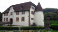
 9.42 mi
 +955 ft
 -951 ft
 5h 10
5h 10
 Moderate
 Departure from Riehen (Basel-Stadt)
A walk straddling the Swiss and German border on the hills above Basel (Basel in German).
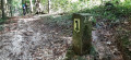
You’ll cross from Switzerland into Germany almost without realising it. You’ll know you’ve crossed when you see the border markers on whichever side you’re on.
The route takes you past the Saint-Chrischona telecoms tower and its church, then on to the pretty castle at Inzlingen, surrounded by lovely moats.
Obertüllingen and Burg Rötteln
 8.43 mi
+1,027 ft
-1,027 ft
4h 45
Moderate
Departure from Lörrach (Regierungsbezirk Freiburg)
8.43 mi
+1,027 ft
-1,027 ft
4h 45
Moderate
Departure from Lörrach (Regierungsbezirk Freiburg)
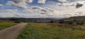
Discover the southern tip of the Black Forest, with the hill overlooking the beginning of the Alsace plain to the west, the town of Lörrach and Germany to the east, and the city of Basel and Switzerland to the south. You can also visit the magnificent Burg Rötteln, a 14th-century fortified castle, the most south-westerly in Germany.
Obertüllingen, Tüllinger Berg, Daur Hütte
 2.83 mi
+197 ft
-194 ft
1h 30
2.83 mi
+197 ft
-194 ft
1h 30
 Easy
Departure from Lörrach (Regierungsbezirk Freiburg)
Easy
Departure from Lörrach (Regierungsbezirk Freiburg)
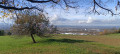
A pleasant little route through the forest, going from Obertüllingen to the Daur Hütte and back. Magnificent panoramic views from the car park over Basel, the Jura, the Alsatian villages and the Kembs-Loechlé lock, the Vosges... On the way back, views of the villages of the Black Forest foothills, Lörrach, Rötteln Castle, the Wiesental, Riehen and St. Chrischona with its tower and, depending on the weather, a few Alpine peaks can be seen to the east through the gap in the hills.
The Chemin des Pierres-Frontière, starting from Grenzach
 2.76 mi
+482 ft
-476 ft
1h 40
Easy
Departure from Grenzach-Wyhlen (Regierungsbezirk Freiburg)
2.76 mi
+482 ft
-476 ft
1h 40
Easy
Departure from Grenzach-Wyhlen (Regierungsbezirk Freiburg)
A short walk, mainly through woodland, on the hills above Grenzach. To the west of the forest, there is a magnificent view of the Rhine, the hydroelectric power station and the locks, as well as the port of Birsfelden, the city of Basel, the Swiss Jura and Alsace. On the way back, we walk alongside the border and its boundary markers for two kilometres. At the eastern edge of the forest, there is a lovely view of St-Chrischona before heading back down to the car park, skirting the small gardens. The route is signposted throughout along wide paths; it is pleasant and easy.
Weil, Otterbach, Wiese and Dreiländergarten
3.28 mi
+33 ft
-49 ft
1h 30
Easy
Departure from Weil am Rhein (Regierungsbezirk Freiburg)
A short, picturesque and exotic route from Weil am Rhein to the Wiese (in Switzerland) via the Dreiländergarten.
Weil am Rhein and the Beyeler Foundation
5.90 mi
+453 ft
-443 ft
3h 05
Moderate
Departure from Weil am Rhein (Regierungsbezirk Freiburg)
Departure from Vitra Campus Weil am Rhein. The route connects the Beyeler Foundation in Switzerland through the vineyards. Round trip itinerary
Wasserschloss and Erstelweg starting from Inzlingen
 3.25 mi
+420 ft
-404 ft
1h 50
Easy
Departure from Inzlingen (Regierungsbezirk Freiburg)
3.25 mi
+420 ft
-404 ft
1h 50
Easy
Departure from Inzlingen (Regierungsbezirk Freiburg)
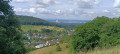
A pleasant little stroll through Inzlingen, going round the castle and then up towards the Eiserne Hand with a snack break in the shelter of the Buttenberg. Return via the Erstelweg and the sports facilities on the heights of Inzlingen.
Ruschbachtal and Saint-Chrischona starting from Wyhlen
 6.54 mi
+1,198 ft
-1,194 ft
4h 05
Moderate
Departure from Grenzach-Wyhlen (Regierungsbezirk Freiburg)
6.54 mi
+1,198 ft
-1,194 ft
4h 05
Moderate
Departure from Grenzach-Wyhlen (Regierungsbezirk Freiburg)
Discover the Ruschbachtal (Nature Reserve) with its pretty wild stream and waterfalls to reach Saint-Chrischona, a small hamlet in the Swiss canton of Basel-Stadt. It is situated at the highest point in the canton, 522 metres above sea level, and is home to Switzerland’s tallest television tower (250 m). From there, you’ll have a superb view of the Jura and the Alps.
From Rührberg in Germany to Sankt Chrischona in Switzerland
 3.06 mi
+374 ft
-344 ft
1h 45
Easy
Departure from Grenzach-Wyhlen (Regierungsbezirk Freiburg)
3.06 mi
+374 ft
-344 ft
1h 45
Easy
Departure from Grenzach-Wyhlen (Regierungsbezirk Freiburg)
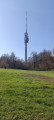
On the itinerary: a panoramic view, the highest point in the canton of Basel-Stadt, the tallest tower in Switzerland, an evangelical mission, two restaurants, the countryside and tranquillity close to the city. We first descend through woods and fields before climbing back up to the charming Bettingen district of Sankt Chrischona, at an altitude of 522 metres. Numerous paths and benches invite us to stroll around and discover this peaceful spot.
One river and three canals from Huningue
 10.20 mi
+36 ft
-36 ft
4h 45
Moderate
Departure from Huningue (Haut-Rhin)
10.20 mi
+36 ft
-36 ft
4h 45
Moderate
Departure from Huningue (Haut-Rhin)
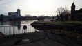
A lovely walk along the Rhine and the Grand Canal d’Alsace, the drainage canal and the Huningue Canal (the decommissioned Rhône–Rhine Canal). Very gentle in terms of elevation, but a bit long in distance (due to having to go round the port area, which is off-limits to the public).
It offers the chance to discover the beauty and rich river heritage of the Three Borders region.
The Three Countries Poets' Trail
 4.12 mi
+30 ft
-30 ft
1h 55
Easy
Departure from Huningue (Haut-Rhin)
4.12 mi
+30 ft
-30 ft
1h 55
Easy
Departure from Huningue (Haut-Rhin)
This short walk takes you through three countries on foot and enriches the mind as you read the texts by French, Swiss and German poets displayed on the boundary stones.You will pass from France to Switzerland and then back through Germany.No need to take your passport to travel, an identity card will suffice.
 The Rhine and its locks
 21.08 mi
+52 ft
-52 ft
2 hrs
Easy
Departure from Huningue (Haut-Rhin)
21.08 mi
+52 ft
-52 ft
2 hrs
Easy
Departure from Huningue (Haut-Rhin)
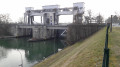
A short cycle ride along both banks of the Rhine, exploring hydroelectric and river engineering structures.
An easy cycle ride on a virtually flat route.
Basel SBB Station – Birsfelden Power Station circular loop
4.90 mi
+98 ft
-98 ft
2h 20
Easy
Departure from Basel (Basel-Stadt)
A short, peaceful stroll in Basel along the Rhine. Start and finish on the forecourt of Basel SBB station. It is a superb walk with the Rhine as its central feature. There are plenty of benches along the route where you can rest and enjoy the magnificent Basel landscape.
Rümminger Moos Dünert Binzerweg
 3.41 mi
+410 ft
-427 ft
1h 55
Easy
Departure from Lörrach (Regierungsbezirk Freiburg)
3.41 mi
+410 ft
-427 ft
1h 55
Easy
Departure from Lörrach (Regierungsbezirk Freiburg)
A pleasant walk entirely through the forest on wide, shaded paths. There are numerous benches along the Moosweg. Beautiful views from the Fohrenbuck car park towards Lörrach, as well as from points (2) and (4) over the Alsatian villages of the Sundgau and the Rhine plain.
Through the vineyards from Binzen to Fischingen
3.50 mi
+236 ft
-233 ft
1h 50
Easy
Departure from Binzen (Regierungsbezirk Freiburg)
The entire route is open country through vineyards with beautiful views of Basel, the Jura, Alsace, the Vosges and the Piedmont hills of the Black Forest. The outward journey is mostly along the Wiiwegli (wine trail), while the return journey is mostly along a local trail marked with yellow diamond signs.
Märkt, Rhine and Kander
3.16 mi
+69 ft
-69 ft
1h 30
Easy
Departure from Weil am Rhein (Regierungsbezirk Freiburg)
The landscapes are very varied as you walk along the Rhine and then the Kander, passing through Eimeldingen. They are urban but also bucolic: the village of Märkt, the bridge over the A5 motorway, the gravel pit, the path along the Rhine, the mouth of the Kander, the path along the Kander with two small bridges, the fish pass and the forest.
Rötteln Castle and Southern Black Forest Nature Park
2.90 mi
+207 ft
-203 ft
1h 30
Easy
Departure from Lörrach (Regierungsbezirk Freiburg)
A pleasant walk, mainly through the forest. Panoramic view from the castle, which is open to visitors: see § practical information. Restaurant, terrace in good weather. Rötteln Castle car park, 120 spaces.
Outing in Sallneck
28.43 mi
+2,717 ft
-2,697 ft
5 hrs
 Difficult
Departure from Lörrach (Regierungsbezirk Freiburg)
Difficult
Departure from Lörrach (Regierungsbezirk Freiburg)
Departure from Haagen near Lörrach. A beautiful route through the Kleines Wiesental valley to Sallneck, with a detour via Raich. However, I would like to point out that there are gradients of 8% in some places.
Walk in the old bed of the Rhine: around the Petit Rhin
 6.80 mi
+157 ft
-154 ft
3h 15
Easy
Departure from Weil am Rhein (Regierungsbezirk Freiburg)
6.80 mi
+157 ft
-154 ft
3h 15
Easy
Departure from Weil am Rhein (Regierungsbezirk Freiburg)
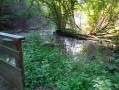
The extensive renaturation project on the Île du Rhin, which began in 2013, is drawing to a close. A new river, the Petit Rhin, has emerged between the Grand Canal and the Vieux Rhin. The surrounding land and aquatic environment has been completely transformed and will enable the return or continued presence of numerous plant and animal species.This walk therefore takes place against the backdrop of a natural environment undergoing profound change, where everything is set to change for the great benefit of biodiversity.
Hauingen Soormattbach Rechberg
4.16 mi
+633 ft
-640 ft
2h 30
Easy
Departure from Lörrach (Regierungsbezirk Freiburg)
Set amongst deep forests, clearings, sun-drenched pastures, streams and ponds, this route offers varied and contrasting landscapes. The paths are wide and signposted, except for the picturesque trail along the Soormattbach stream, between the start and the point (1). This walk is best undertaken in dry weather, as the Soormattbach stream, which we will follow, sometimes to the right, sometimes to the left, can burst its banks during rainy or stormy periods. To cross the village and reach the Schützenhaus restaurant as well as the Hauingen shooting club’s premises in the middle of the forest, we will walk along tarmac roads.
Rechberg via Dornhalde and Haberackerweg
 3.05 mi
+545 ft
-545 ft
1h 55
Easy
Departure from Lörrach (Regierungsbezirk Freiburg)
3.05 mi
+545 ft
-545 ft
1h 55
Easy
Departure from Lörrach (Regierungsbezirk Freiburg)
The route runs partly through woodland and partly through open countryside, and involves a steep climb up the Dornhalde slope. There are stunning views from this same slope towards Basel, Chrischona, the Wiese Valley and even the Alps, weather permitting. You can stop for a break halfway along the route at Café Hygge on the Rechberg.
Vineyards and mountains around Fischingen
 3.23 mi
+358 ft
-348 ft
1h 50
Easy
Departure from Fischingen (Regierungsbezirk Freiburg)
3.23 mi
+358 ft
-348 ft
1h 50
Easy
Departure from Fischingen (Regierungsbezirk Freiburg)
This walk crosses the vineyards between Hartberg and Hummelberg, follows the ridge line between the vineyards and the plain, runs alongside the Läufelberg and the Reckholder, skirts around Fischingen and finally leads to a meal at the Fünfschilling inn. Beautiful views along the route towards Alsace, the Jura and the Black Forest.
The Saint Louis Neuweg neighbourhood and its discovery trail
 4.04 mi
+13 ft
-13 ft
1h 50
Easy
Departure from Saint-Louis (Haut-Rhin) (Haut-Rhin)
4.04 mi
+13 ft
-13 ft
1h 50
Easy
Departure from Saint-Louis (Haut-Rhin) (Haut-Rhin)
On the edge of the Petite Camargue Alsacienne is a quiet residential area that is part of the Saint-Louis conurbation: Neuweg. It is well worth a visit and, at the end of the walk, you will come to a small forest where you can learn more about water along a discovery trail.
Above Arlesheim
 7.21 mi
+1,460 ft
-1,470 ft
4h 35
Moderate
Departure from Arlesheim (Basel-Landschaft)
7.21 mi
+1,460 ft
-1,470 ft
4h 35
Moderate
Departure from Arlesheim (Basel-Landschaft)
A route allowing you to see the heights of Arlesheim via several castles, the Kirschenland (cherry country), the Schartenflue (with its panoramic tower) as well as the Goetheanum and quaint picturesque houses in Dornach.
From Steinen to Albbruck in the Black Forest
 101.23 mi
+17,323 ft
-17,313 ft
9 days
Difficult
Departure from Steinen (Regierungsbezirk Freiburg)
101.23 mi
+17,323 ft
-17,313 ft
9 days
Difficult
Departure from Steinen (Regierungsbezirk Freiburg)
This nine-day route allows you to discover different aspects of the southern Black Forest.Starting from Steinen in the Kleines Wiesental, you will cross beautiful forests to reach the pretty village of Kandern. Then, for four days, you will follow the Schwarzwald Westweg trail, passing through the highest peaks of the Black Forest: Belchen, Feldberg and Herzogenhorn.You will also stop off at Titisee, a pleasant lakeside resort. The second part of the route is devoted to the Albsteig, a trail that follows the River Alb from its source at the foot of the Feldberg to Albbruck, where the River Alb flows into the Rhine. On the way, you will stop at Sankt Blasien, a remarkable town with a magnificent cathedral and cloister.
Steinen - Kandern
 10.34 mi
+1,450 ft
-1,365 ft
6h 00
Moderate
Departure from Steinen (Regierungsbezirk Freiburg)
10.34 mi
+1,450 ft
-1,365 ft
6h 00
Moderate
Departure from Steinen (Regierungsbezirk Freiburg)
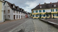
This first stage will take you from Steinen to Kandern. Starting from Steinen in the Kleines Wiesental, you will cross beautiful forests to reach the Black Forest trail: the Westweg Schwarzwald in the pretty village of Kandern.
Old Rhine, Isteiner Klotz and vineyards
 6.42 mi
+545 ft
-522 ft
3h 25
Easy
Departure from Efringen-Kirchen (Regierungsbezirk Freiburg)
6.42 mi
+545 ft
-522 ft
3h 25
Easy
Departure from Efringen-Kirchen (Regierungsbezirk Freiburg)
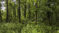
A lovely and varied circular walk starting in Efringen-Kirchen, first through the village, then through a small wooded area and along the Old Rhine. From there, the route takes you to the Isteiner Klotzerfelsen rock formation with the St Veit Chapel, which is situated in a rock niche. The rest of the walk takes you through vineyards, offering frequent beautiful, sweeping views of the surrounding mountains.
La Petite Camargue by Rosenau
 3.98 mi
+13 ft
-13 ft
1h 50
Easy
Departure from Haut-Rhin
3.98 mi
+13 ft
-13 ft
1h 50
Easy
Departure from Haut-Rhin
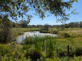
Do you live in the urban area of the three borders and want to get away from it all without travelling dozens of kilometres? Come and discover the Petite Camargue to get some fresh air and observe many species of birds and plants in a well-preserved area. Leaving from the pretty village of Rosenau, you'll find it hard to believe that you're only 4 kilometres away from the airport as the crow flies.
Walk in the old bed of the Rhine: the Petite Camargue Alsacienne
 4.36 mi
+30 ft
-30 ft
2h 00
Easy
Departure from Bartenheim (Haut-Rhin)
4.36 mi
+30 ft
-30 ft
2h 00
Easy
Departure from Bartenheim (Haut-Rhin)
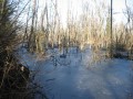
A national nature reserve, the Petite Camargue Alsacienne now covers 904 hectares, including nearly 200 hectares of water. Originally, in 1982, it covered 120 hectares around the buildings of the Imperial Fish Farm (1852). It is here, in the wild heart of the Au wetland plain, that you can walk along some of its most beautiful paths and discover the exceptional flora and fauna of this marshland landscape, thanks to the groundwater.
Above Hägelberg: Schöne Aussicht and Saatschulhütte
 2.95 mi
+341 ft
-328 ft
1h 40
Easy
Departure from Steinen (Regierungsbezirk Freiburg)
2.95 mi
+341 ft
-328 ft
1h 40
Easy
Departure from Steinen (Regierungsbezirk Freiburg)
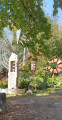
A walk mainly through woodland on the heights of Hägelberg. As the car park is situated almost at the highest point, the walk initially descends slightly towards the village across open ground, offering stunning views of the Alps in good weather. The paths are wide and signposted, except for the first section.
Kembs lock between the Grand Canal d'Alsace and the Old Rhine
 3.26 mi
+52 ft
-52 ft
1h 35
Easy
Departure from Haut-Rhin
3.26 mi
+52 ft
-52 ft
1h 35
Easy
Departure from Haut-Rhin
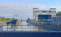
A short walk between the wild Old Rhine and the tamed canal, with its array of industrial installations: the locks, the German motorway which you cannot see but can hear, the high-voltage power lines you pass under at the start of the route, as well as its natural beauty: the winding, sand-filled Rhine, exposed at the Barre d’Istein. To make the most of the views of the Rhine, the route is best enjoyed in winter when the trees are still bare.
Isteiner Klotz, Huttingen and Römerstrasse through the vineyards
 3.77 mi
+486 ft
-492 ft
2h 10
Easy
Departure from Efringen-Kirchen (Regierungsbezirk Freiburg)
3.77 mi
+486 ft
-492 ft
2h 10
Easy
Departure from Efringen-Kirchen (Regierungsbezirk Freiburg)
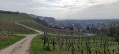
The route is mainly open, winding through the vineyards. There are stunning views throughout the route of the villages in the Rhine Valley, the Jura, the Vosges and Istein. There are numerous benches and picnic tables along the route. Information boards (in German) on wine, history and geology are dotted along the route. From the car park, information boards and the Saint-Vit Chapel opposite, set in the rock, herald the richness of the route, which is “to be savoured”.
Between the vineyards and orchards of Huttingen and Blansingen
3.70 mi
+233 ft
-220 ft
1h 55
Easy
Departure from Efringen-Kirchen (Regierungsbezirk Freiburg)
A very beautiful short hike through vineyards and orchards with breathtaking views of the Alps, the Jura, the city of Basel, the Alsatian villages of Sundgau, the Rhine Valley and Kembs just opposite on the way there, and the Black Forest and Blauen on the way back. In the first half of the route, follow the Wiiwegli (wine trail) markings, red diamond with a yellow bunch of grapes, towards Blansingen. The markings are present at each fork. However, you will need to be vigilant at the start of the route and look out for the markings so as not to give in to the temptation to continue straight ahead on a more visible path. Our path branches off twice to the right between the orchards and then twice with a left-right turn on grassy paths.