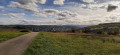
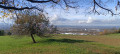
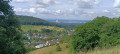
The hills of Basel, Hörnli, Saint-Chrischona and Inzlingen Castle

A walk straddling the Swiss and German border on the hills above Basel (Basel in German).
You’ll cross from Switzerland into Germany almost without realising it. You’ll know you’ve crossed when you see the border markers on whichever side you’re on.
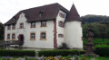
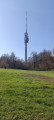
The route takes you past the Saint-Chrischona telecoms tower and its church, then on to the pretty castle at Inzlingen, surrounded by lovely moats.

Details

1446258
Creation:
Last update:
Last review:
  • Walking
    Activity: Walking
  • ↔
    Distance: 9.42 mi
  • ◔
    Average duration: 5h 10 
  • ▲
    Difficulty: Moderate

  • ⚐
    Back to start: Yes
  • ↗
    Ascent: + 955 ft
  • ↘
    Descent: - 951 ft

  • ▲
    Highest point: 1,680 ft
  • ▼
    Lowest point: 928 ft

Photos

Description of the walk

Park in the car park at the back of Hörnli Cemetery (Grenzacherweg).

(S/E) Head south towards the Rhine until you reach the end of the street.

(1) Take the tarmac path which climbs to the left, skirting the cemetery along the edge of the forest. The tarmac gives way to a gravel path; continue to the junction.

(2) Turn right and stay on the main track which climbs through the forest.

(3) Head off to the right and join a path. At this junction, continue to the left.
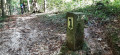
We can see numerous boundary markers, which means we are on the Swiss–German border; follow this until you emerge from the forest.

(4) Follow the narrow path that branches off to the right (on the right are German gardens and on the left are Swiss meadows).
Once back on the tarmac, follow the road (do not take the paths leading downhill) and stay on the higher part; the road turns back into a path.

(5) Head back into the forest.

(6) At the crossroads, turn right towards the telecoms tower.
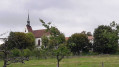
Retrace your steps and, before the restaurant, turn right towards the church, which you can visit or walk around.

(7) Walk down the path that leads into the forest and comes out onto a meadow on the left.
Carry on and walk alongside the woodland, then follow the stream on your left to reach the tarmac road (you are now in Germany). Continue downwards to the left.

(8) After the farm buildings, take the road on the right signposted ‘Wasserschloss’, which leads to a car park. Carry on to reach Inzlingen Castle (you can go inside to walk around the moat and have a bite to eat if you need to).

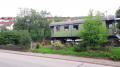
(9) From the castle, walk down the main street until you reach the railway carriage on display on the right.

(10) From there, turn right and then immediately left onto the road that goes uphill.

(11) After the Maienbühl farm (Switzerland) at the junction, turn left down onto the road. Once back on the main road, continue along the pavement on the left.

(12) Just before the level crossing, take the street on the left.

(13) After walking alongside the railway line, at the level crossing, carry on along the street until you return to the starting point (just after the small roundabout) (S/E).

Waypoints

  1. S/E : mi 0 - alt. 955 ft - Car park at the rear of the cemetery
  2. 1 : mi 0.25 - alt. 951 ft - Tarmacked path, on the left
  3. 2 : mi 0.89 - alt. 1,243 ft - Junction, turn right
  4. 3 : mi 1.69 - alt. 1,463 ft - Junction, turn right
  5. 4 : mi 2.25 - alt. 1,463 ft - Narrow path on the right
  6. 5 : mi 2.77 - alt. 1,503 ft - Entrance to the forest
  7. 6 : mi 3.31 - alt. 1,611 ft - Turn right towards the telecoms tower.
  8. 7 : mi 4.04 - alt. 1,680 ft - Turn right on the downhill stretch
  9. 8 : mi 4.98 - alt. 1,243 ft - Street on the right
  10. 9 : mi 5.68 - alt. 1,243 ft - “Wasserschloss” Inzlingen
  11. 10 : mi 6.54 - alt. 1,119 ft - Railway carriage
  12. 11 : mi 7 - alt. 1,286 ft - Road on the left
  13. 12 : mi 7.94 - alt. 942 ft - Street on the left
  14. 13 : mi 8.52 - alt. 932 ft - Level crossing
  15. S/E : mi 9.42 - alt. 955 ft - Car park at the rear of the cemetery

Reviews and comments

4 / 5
Based on 3 reviews

Reliability of the description
3.7 / 5
Ease of following the route
4 / 5
Route interest
4.3 / 5
michel stocky
michel stocky

Overall rating : 3.7 / 5

Date of your route : Mar 11, 2020
Reliability of the description : ★★★☆☆ Average
Ease of following the route : ★★★★☆ Good
Route interest : ★★★★☆ Good

from the outset, parking problems in terms of duration the car park indicated is in the blue zone (3 hours maximum)

Machine-translated

CHOQUET
CHOQUET

Overall rating : 4 / 5

Date of your route : Mar 09, 2020
Reliability of the description : ★★★★☆ Good
Ease of following the route : ★★★★☆ Good
Route interest : ★★★★☆ Good

Pleasant walk

Machine-translated

jean-claude.martin
jean-claude.martin

Overall rating : 4.3 / 5

Date of your route : Apr 23, 2019
Reliability of the description : ★★★★☆ Good
Ease of following the route : ★★★★☆ Good
Route interest : ★★★★★ Very good

On the return journey from point 10, orientation would be easier if the street names were indicated.

Machine-translated

Other walks in the area

For more walks, use our search engine .

The GPS track and description are the property of this route's author. Please do not copy them without permission.