Above Arlesheim

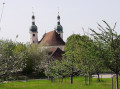
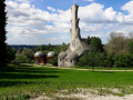
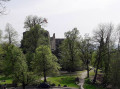
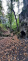
A route allowing you to see the heights of Arlesheim via several castles, the Kirschenland (cherry country), the Schartenflue (with its panoramic tower) as well as the Goetheanum and quaint picturesque houses in Dornach.

Details

2003162
Creation:
Last update:
Last review:
  • Walking
    Activity: Walking
  • ↔
    Distance: 7.21 mi
  • ◔
    Average duration: 4h 35 
  • ▲
    Difficulty: Moderate

  • ⚐
    Back to start: Yes
  • ↗
    Ascent: + 1,460 ft
  • ↘
    Descent: - 1,470 ft

  • ▲
    Highest point: 2,500 ft
  • ▼
    Lowest point: 1,132 ft

Photos

Description of the walk

The starting point is on Wanngartenweg, behind Arlesheim Cathedral (Dom), where parking is fairly easy.

(S/E) Head north towards Mühlenbodenweg, then turn right onto the tarmac road, which turns into a gravel track.
Cross the bridge, squeeze through a narrow passage between two houses, cross the road and head up the small path branching off to the left, towards the Proserpina Grotto.
Take the stairs on the right to reach a network of paths; continue uphill, following the signs for Schloss.

(1) At the “paillote”, continue to the left, following the wall that runs beneath Birseck Castle.
Continue along the path which descends onto a tarmac road.
Turn left for about 20 metres, then head back up the road to the right towards Burg Reichenstein, a 10th-century neo-feudal fortress.
Retrace your steps to take the small Elsa Heierli Weg path towards Gstüd – Ränggersmatt.
The path climbs through some remarkable holly bushes.
Please note: Ermitage – Chilchholz nature reserve.

(2) Head down to the right. At the end of the path, veer slightly to the left and, at the signpost, turn right towards Eichmatt.
Walk alongside the forest; at the bench, turn left into the woods and immediately turn right to head up a path with old boundary stones in the middle.
Join a tarmac road; follow it to the right to reach a junction where a signpost points towards Schönmatt. Follow hiking trail 32 (Via Surprise). Continue uphill for about 50 metres.
Turn right onto the small path that climbs in steps between the orchards. At the top, follow the road to the right, passing the Schönmatt restaurant.
You are now in Kirschenland (Cherry Country). Stay on this road until you reach Stollenhauser.

(3) Follow the “Via Surprise”, heading south then south-west. You’ll come to a fork in the path.

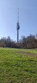
(4) Head up to the left to reach the Gempenturm restaurant, the panoramic tower and a 360° viewpoint.

(5) Retrace your steps.

(4) At the junction, take the path leading down to the left towards Schloss Dorneck – Dornach.
When you reach a track, follow it down to the left, heading north.

(6) Take the path on the right and, further down, at the Schartenmatt sign, continue to follow signs for Schloss Dorneck.

(7) Carry on straight ahead, passing the mineral water station.

(8) Cross the road, head straight on along the path opposite, rejoin it and turn left (south-west) towards the Schlosshof restaurant.
Carry on downhill to visit Schloss Dorneck, a fortified castle now in ruins.
Retrace your steps, cross the road and turn left (north-west) onto the path running alongside Schlossweg.

(9) Turn right onto Dorneckstrasse, then turn right onto Juraweg and you’ll start to see some picturesque houses.

(10) Turn right to reach the Goetheanum, walk round the building on your left, and continue for about 300 metres down Hügelweg.

(11) On the right, take the path that crosses over the stream and leads onto Rue Auf der Höhe.
At the end of the street, turn right, then left to return to the starting point. (S/E)

Waypoints

  1. S/E : mi 0 - alt. 1,152 ft - Car park at the rear of Arlesheim Cathedral
  2. 1 : mi 0.36 - alt. 1,247 ft - At the “Paillote”, on the left
  3. 2 : mi 1.3 - alt. 1,873 ft - On the right, heading downhill
  4. 3 : mi 3.04 - alt. 2,156 ft - "Via Surprise"
  5. 4 : mi 3.86 - alt. 2,464 ft - Junction. Return trip to the tower and restaurant
  6. 5 : mi 4 - alt. 2,470 ft - Panoramic tower. Restaurant. 360° viewpoint
  7. 6 : mi 4.44 - alt. 2,149 ft - Path on the right
  8. 7 : mi 4.96 - alt. 1,919 ft - Straight ahead
  9. 8 : mi 5.1 - alt. 1,811 ft - Road crossing
  10. 9 : mi 6.04 - alt. 1,404 ft - On the right is Dorneckstrasse
  11. 10 : mi 6.55 - alt. 1,194 ft - Turn right towards the Goetheanum
  12. 11 : mi 6.88 - alt. 1,142 ft - Path on the right
  13. S/E : mi 7.21 - alt. 1,152 ft - Car park at the rear of Arlesheim Cathedral

Notes

Refreshments available at Schönmatt, Gempenturm, Schlosshof

Worth a visit

Visit Arlesheim Cathedral, Schloss Dorneck and the Goetheanum

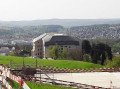
(10) The Goetheanum is a building situated on the hill at Dornach. It serves as the headquarters of the General Anthroposophical Society and the School of Spiritual Science, both founded by Rudolf Steiner, who named it in honour of the works of Johann Wolfgang von Goethe. The current building was constructed between 1925 and 1928 from concrete, without a single right angle. Despite its imposing appearance and vast overhanging roof, the Goetheanum and its ancillary buildings blend seamlessly into the landscape, forming a cohesive complex surrounded by a large park. It was here that the complete work *Faust* by Goethe was premiered in 1938 (excerpts from myswitzerland.com).

Reviews and comments

4.6 / 5
Based on 10 reviews

Reliability of the description
4.4 / 5
Ease of following the route
4.6 / 5
Route interest
4.9 / 5
lemarcheur65
lemarcheur65 ★

Hello Positiver68
Thank you for your comment.
Description updated and a work item added

Machine-translated

Positiver68
Positiver68

Overall rating : 3.7 / 5

Date of your route : Jul 28, 2026
Reliability of the description : ★★★☆☆ Average
Ease of following the route : ★★★★☆ Good
Route interest : ★★★★☆ Good
Very busy route : No

Hello
The comments in point 3 correspond to point 4.
Thank you for sharing

Machine-translated

LaurineGt
LaurineGt

Overall rating : 4.3 / 5

Date of your route : Oct 05, 2025
Reliability of the description : ★★★★☆ Good
Ease of following the route : ★★★★☆ Good
Route interest : ★★★★★ Very good
Very busy route : No

A fantastic, varied hike with castles, vineyards, views and beautiful forests! The hike can be adapted to make a shorter circular loop. Apart from a few people at the first castle, the area is very peaceful.

Machine-translated

F8BAE
F8BAE

Overall rating : 5 / 5

Date of your route : Dec 01, 2025
Reliability of the description : ★★★★★ Very good
Ease of following the route : ★★★★★ Very good
Route interest : ★★★★★ Very good
Very busy route : No

Very good, reliable and easy-to-use application

Machine-translated

boyard
boyard
• Edited:

Overall rating : 5 / 5

Date of your route : Aug 10, 2023
Reliability of the description : Not used / Not applicable
Ease of following the route : Not used / Not applicable
Route interest : ★★★★★ Very good
Very busy route : No

Hello,
There were no signposts on the ground, and Visorando’s route description was useless without a map or GPS! In short, a failed hike. Fortunately, there were plenty of remarkable sites along the way (castles, the Dom d’Arlesheim and the Goetheanum). We visited them, as we couldn’t follow the suggested route to the letter. We’ll be back with the necessary navigation equipment!!! Right then, no hard feelings.

Machine-translated

anniz
anniz

Overall rating : 4.3 / 5

Date of your route : Apr 23, 2023
Reliability of the description : ★★★★☆ Good
Ease of following the route : ★★★★☆ Good
Route interest : ★★★★★ Very good
Very busy route : No

Superb walk that has everything you need: a bit of climbing for sport, very pretty views, superb monuments (the castles are magnificent - we'll try to go back to visit them), a great mix of paths (between the cherry trees, for example, which are in flower at this time of year) and forest tracks... I really recommend

Machine-translated

Josiane BILDSTEIN
Josiane BILDSTEIN
• Edited:

Overall rating : 5 / 5

Date of your route : Feb 05, 2022
Reliability of the description : ★★★★★ Very good
Ease of following the route : ★★★★★ Very good
Route interest : ★★★★★ Very good
Very busy route : No

A great tour to do again in spring when the cherry trees are in bloom and Burg Birseck is open to visitors (closed in winter).
Beautiful sunset and magnificent view from the top of the Gempenturm.

Machine-translated

jean jacques zwibel
jean jacques zwibel

Overall rating : 4.3 / 5

Date of your route : Jan 03, 2022
Reliability of the description : ★★★★☆ Good
Ease of following the route : ★★★★☆ Good
Route interest : ★★★★★ Very good
Very busy route : No

i'd already done the hike two years ago and wanted to do it again with friends, but didn't have the route in mind
hence the impression. but i remember a very nice hike up to the gempenturm where the view is splendid (not forgetting the blueberry pie in the bistro) and the return via the original houses.
the blueberry tart in the bistro) and the return through the original houses of Arlesheim. A hike to be recommended.
jjz

Machine-translated

le pozo
le pozo

Overall rating : 5 / 5

Date of your route : Apr 04, 2021
Reliability of the description : ★★★★★ Very good
Ease of following the route : ★★★★★ Very good
Route interest : ★★★★★ Very good
Very busy route : Yes

We enjoyed this very interesting hike for its cultural aspects and its magnificent scenery.
Thank you for showing me such a lovely part of the Basel region.

Machine-translated

81wi0834
81wi0834
• Edited:

Overall rating : 5 / 5

Date of your route : Aug 14, 2019
Reliability of the description : ★★★★★ Very good
Ease of following the route : ★★★★★ Very good
Route interest : ★★★★★ Very good

A very nice walk to recommend...
We did this walk with a walking group from Saint-Louis.
GF

Machine-translated

23011939
23011939
• Edited:

Overall rating : 5 / 5

Date of your route : May 27, 2019
Reliability of the description : ★★★★★ Very good
Ease of following the route : ★★★★★ Very good
Route interest : ★★★★★ Very good

Hello,
We've just done a reconnaissance of this route. It is very interesting in terms of its route and the landscapes we have discovered. We'll be planning this tour for our association in February 2020.
You always come up with original and very well-documented routes. The Lerchenbergrando association of Mulhouse-Dornach
uses some of your suggestions for the pleasure of hikers.
Thank you and keep up the good work?
Sincerely
M. Kempff

Machine-translated

Other walks in the area

For more walks, use our search engine .

The GPS track and description are the property of this route's author. Please do not copy them without permission.