The Rhine and its locks

A short cycle ride along both banks of the Rhine, exploring hydroelectric and river engineering structures.
An easy cycle ride on a virtually flat route.

Details

941222
Creation:
Last update:
Last review:
  • Touring/Gravel
    Activity: Touring/Gravel
  • ↔
    Distance: 21.08 mi
  • ◔
    Duration according to the author: 2 hrs 
  • ▲
    Difficulty: Easy

  • ⚐
    Back to start: Yes
  • ↗
    Ascent: + 52 ft
  • ↘
    Descent: - 52 ft

  • ▲
    Highest point: 827 ft
  • ▼
    Lowest point: 764 ft
  • ⚐ Country: France
  • ⚐ City: Huningue (68330)
  • ⚑
    Start/End: N 47.587819° / E 7.585345°
  • ❏
    IGN map(s): Ref. 3720ET, 3721ET

  • ◶
    Type of surface:
  •  
     
     
     33% Road  34% Byway  33% Path
  • Hour-by-hour weather

Photos

Description of the route

Park in the car park next to the Protestant church in Huningue.

(S/E) Cross the small bridge at the entrance to the Huningue Canal, turn right and follow the Rhine to the ‘3 Frontières’ footbridge; cross it to find yourself in Germany. Head to the roundabout, then turn left and continue to the next roundabout.

(1) Turn left onto Alte Strasse. Take the cycle path that runs alongside the road as far as the sewage treatment works.

(2) Cross the road towards the Rhine; at the restaurant, turn right and continue to the Kembs-Märkt dam (this is the start of the ‘Old Rhine’).

(3) Cross the weir to reach France. Follow the cycle path (please note: on weekdays, there may be EDF service vehicles).

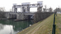
(4) Pass through the double locks (the final lock for boats travelling up the Rhine to reach Basel’s river port), then continue to the hydroelectric dam.

(5) Follow the road to the ‘Energie’ roundabout.

(6) Turn right onto the EDF road.

(7) Just before the roundabout, turn right onto the cycle path which passes under the road to join the southern branch of the Rhône–Rhine Canal. Continue to the lock.

(8) Cross the bridge on the left (watch out for the planks – they can be slippery). Turn left to head back south, past the gravelly, grassy path. Once back on the tarmac road, carry on and rejoin the main road to the right. After the town hall, turn left onto the street leading down to the drawbridge.

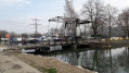
(9) Do not cross it; instead, turn right and follow the Huningue Canal. Walk alongside the canal, passing under several bridges. You’ll arrive at Rosenau.

(10) Cross the bridge on the left and continue along the canal on the opposite bank. This is the start of the ‘Path of the Planets’, which leads to the outskirts of Huningue (Sun). Follow the path and change banks at the lock keeper’s house, which serves as an information point for the Petite Camargue Alsacienne nature reserve.

(11) Walk along the canal and pass under several bridges (take care as visibility is poor due to two-way traffic and pedestrians).

(12) Once you reach “Soleil”, take care as this is the entrance to the Parc des Eaux Vives in Huningue (bicycles, pedestrians and children in the play areas). Go under the bridge next to the large lock and head back to the starting car park (S/E).

Waypoints

  1. S/E : mi 0 - alt. 817 ft - Car park next to the Protestant church - Rhin (fleuve)
  2. 1 : mi 1.29 - alt. 810 ft - Roundabout
  3. 2 : mi 2.61 - alt. 804 ft - Wastewater treatment plant
  4. 3 : mi 3.23 - alt. 807 ft - Kembs-Märkt Dam
  5. 4 : mi 6.59 - alt. 807 ft - Double lock - Grand canal d'Alsace
  6. 5 : mi 6.97 - alt. 807 ft - Hydroelectric dam
  7. 6 : mi 7.52 - alt. 778 ft - Énergie roundabout. Bridge over the - Augraben (rivière)
  8. 7 : mi 10.31 - alt. 787 ft - Northern roundabout at Kembs
  9. 8 : mi 11.22 - alt. 784 ft - Lock leading to the Mulhouse river port
  10. 9 : mi 13 - alt. 774 ft - Drawbridge - Camping de Kembs
  11. 10 : mi 16.75 - alt. 791 ft - Start of the Planets Trail
  12. 11 : mi 18.15 - alt. 797 ft - Lock keeper’s house - Canal de Huningue
  13. 12 : mi 20.41 - alt. 804 ft - Soleil
  14. S/E : mi 21.08 - alt. 817 ft - Car park next to the Protestant church

Notes

Don’t forget to bring proof of identity, even though there are no visible border posts.

Reviews and comments

4.3 / 5
Based on 2 reviews

Reliability of the description
4 / 5
Ease of following the route
4 / 5
Route interest
5 / 5
rol6
rol6

Overall rating : 5 / 5

Date of your route : Jul 21, 2020
Reliability of the description : ★★★★★ Very good
Ease of following the route : ★★★★★ Very good
Route interest : ★★★★★ Very good
Very busy route : No

A very pleasant ride. In Germany, watch out for the railway tracks – your wheels can get caught in them.

Machine-translated

FJ6888
FJ6888 ★

@randonene

The EDF road between points (6) and (7) is indeed dangerous, particularly at times when cross-border workers are travelling.
There are two possible alternatives
1) At point (6), go round the ‘Energie’ roundabout to find the ‘Rheinweg’ – a tarmac path marked with the Blue Ring symbol – before the bridge over the Huningue Canal; this will take you to the Kembs campsite. From there, continue along the right bank of the canal on the cycle path to point (7).
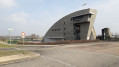
2) Alternatively, at point (6), you can turn right after the roundabout to join the Grand Canal d’Alsace and follow it along the left bank to reach the Le Corbusier lock before point (8).

Kind regards

Machine-translated

randonene
randonene

Overall rating : 3.7 / 5

Date of your route : Aug 13, 2019
Reliability of the description : ★★★☆☆ Average
Ease of following the route : ★★★☆☆ Average
Route interest : ★★★★★ Very good

The EDF road is a dangerous road that is best avoided. The signposting is unclear at this point. Otherwise, the rest of the route is magnificent.

Machine-translated

For more walks, use our search engine .

The GPS track and description are the property of this route's author. Please do not copy them without permission.