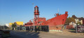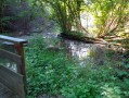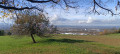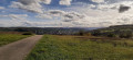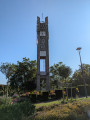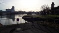
One river and three canals from Huningue

A lovely walk along the Rhine and the Grand Canal d’Alsace, the drainage canal and the Huningue Canal (the decommissioned Rhône–Rhine Canal). Very gentle in terms of elevation, but a bit long in distance (due to having to go round the port area, which is off-limits to the public).
It offers the chance to discover the beauty and rich river heritage of the Three Borders region.

Details

n°926734
Creation:
Last update:
–
Last review:
  • Walking
    Activity: Walking
  • ↔
    Distance: 10.20 mi
  • ◔
    Average duration: 4h 45 
  • ▲
    Difficulty: Moderate

  • ⚐
    Back to start: Yes
  • ↗
    Ascent: + 36 ft
  • ↘
    Descent: - 36 ft

  • ▲
    Highest point: 820 ft
  • ▼
    Lowest point: 778 ft
  • ⚐ Country: France
  • ⚐ City: Huningue (68330)
  • ⚑
    Start/End: N 47.591828° / E 7.587834°
  • ❏
    IGN map(s): Ref. 3721ET
  • Hour-by-hour weather

Photos

Description of the walk

Start at the foot of the Three Countries Footbridge (Huningue side).

(S/E) Head north along the Rhine, going round the small harbour and the campsite.

(1) From there, go round the harbour area. Turn left to reach Rue du Fort and, at the end, turn left onto Rue du Rhin. Turn right onto Avenue d’Alsace, which you’ll follow for a long way, staying on the right-hand pavement.

(2) Go round the Palmrain roundabout (which leads to Germany), continuing in the same direction. Walk past the chemical plant and carry on until you see a sign on the right indicating the “Piste du Rhin”.

(3) Turn right to reach the Rhine and follow the river downstream. At the sewage treatment works, the Grand Canal d’Alsace begins; on the opposite bank you can see the dam where the “Vieux Rhin” continues.

(4) Head down to the left along the third path. You’ll now find yourself alongside the drainage canal, which you follow to the right, in the direction of the current.

(5) Cross the canal via the small bridge to reach the Rosenau–Kembs road. Turn left and walk past the Jean de Loisy memorial (commemorating the first Allied tank to reach the Rhine during the Second World War).

(6) Enter Rosenau. Turn right, and at the mill, take Rue du Ruisseau on the left.
At the end of the street, take the sharp right-hand bend and, at the small square, turn left onto Rue de Savigneux until you reach the canal.

(7) Turn onto the path on the left before the bridge. This is the start of the Chemin des Planètes.
Follow the Canal de Huningue as it winds its way upstream (Chemin du Spires).

(8) At the lock-keeper’s house (information on the Petite Camargue Alsacienne nature reserve), cross the bridge to switch sides and continue upstream.

(9) When you reach Village Neuf, go under the bridge on Rue de Saint-Louis and carry on straight ahead.

(10) Pass under the D105 bridge and continue along the canal.

(11) At the “soleil” (end of the Chemin des Planètes), follow the canal, passing under the bridges on Rue de Saint-Louis and the railway line. Here is the Parc des Eaux Vives in Huningue.

(12) Go under the bridge on Avenue de Bâle, turn left to cross the canal (entrance to the Huningue Canal) and head right, going round the Nef de la Petite Enfance (day-care centre).
From there, stay on the Quai de la République or go down the steps to follow the “beach” and admire the aquatic ballet of the swans and ducks (feeding them is prohibited and may result in a fine).

Head back up to the street and you’ll find yourself back at the starting point by the footbridge (S/E).

Waypoints

  1. S/E : mi 0 - alt. 814 ft - Three Countries Footbridge - Rhin (fleuve)
  2. 1 : mi 0.26 - alt. 810 ft - Camping
  3. 2 : mi 1.03 - alt. 807 ft - Palmrain roundabout
  4. 3 : mi 1.99 - alt. 797 ft - Towards the Piste du Rhin
  5. 4 : mi 3.49 - alt. 804 ft - From the drainage canal to the - Grand canal d'Alsace
  6. 5 : mi 4.82 - alt. 778 ft - Small bridge
  7. 6 : mi 4.94 - alt. 784 ft - Mémorial Jean de Loisy
  8. 7 : mi 5.53 - alt. 791 ft - Start of the Chemin des Planètes
  9. 8 : mi 6.92 - alt. 797 ft - Lock-keeper’s house - Canal de Huningue
  10. 9 : mi 8.25 - alt. 794 ft - Rue de Saint-Louis Bridge (Village Neuf)
  11. 10 : mi 8.84 - alt. 794 ft - D105 Bridge
  12. 11 : mi 9.18 - alt. 810 ft - Sun
  13. 12 : mi 9.82 - alt. 820 ft - Bridge on Avenue de Bâle
  14. S/E : mi 10.2 - alt. 814 ft - Three Countries Footbridge

Notes

For the start of the walk, it’s best to park in the underground car park beneath Place Abbatucci, as parking is restricted next to the footbridge.

Reviews and comments

5 / 5
Based on 1 review

Reliability of the description
5 / 5
Ease of following the route
5 / 5
Route interest
5 / 5
DOPPLER Bernard
DOPPLER Bernard

Overall rating : 5 / 5

Date of your route : Oct 13, 2021
Reliability of the description : ★★★★★ Very good
Ease of following the route : ★★★★★ Very good
Route interest : ★★★★★ Very good
Very busy route : No

A lovely, very flat route for those looking to enjoy nature and aquatic wildlife; it’s a bit of a challenge given the distance.
A route well worth recommending

Machine-translated

Other walks in the area

For more walks, use our search engine .

The GPS track and description are the property of this route's author. Please do not copy them without permission.