Old Rhine, Isteiner Klotz and vineyards

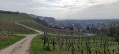
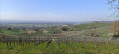
A lovely and varied circular walk starting in Efringen-Kirchen, first through the village, then through a small wooded area and along the Old Rhine. From there, the route takes you to the Isteiner Klotzerfelsen rock formation with the St Veit Chapel, which is situated in a rock niche. The rest of the walk takes you through vineyards, offering frequent beautiful, sweeping views of the surrounding mountains.

Details

50816965
Creation:
Last update:
Last review:
  • Walking
    Activity: Walking
  • ↔
    Distance: 6.42 mi
  • ◔
    Average duration: 3h 25 
  • ▲
    Difficulty: Easy

  • ⚐
    Back to start: Yes
  • ↗
    Ascent: + 545 ft
  • ↘
    Descent: - 522 ft

  • ▲
    Highest point: 1,240 ft
  • ▼
    Lowest point: 764 ft

Photos

Description of the walk

Start: Efringen-Kirchen railway station, Bahnhofstraße 23, 79588 Efringen-Kirchen. Free parking is available here.

Signpost: Yellow diamond

(S/E) From the station, we first head towards Hauptstraße and follow it to the left. At the junction with Friedrich-Rottra-Straße, we keep to the right and continue along Hauptstraße. We walk through the village, soon crossing Isteiner Straße and the Feuerbach.

(1) At the signpost for “Kirchen Stapflehus”, we turn right and follow Gutenau Street.

(2) About 200 m further on, at the signpost for “Gutenau”, we turn right and continue to follow the yellow diamond. We now leave the village via a dirt track and soon reach the Feuerbach stream. We turn left and walk along the stream. Our route now takes us through a small wooded area.

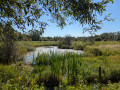
(3) Soon, a path leads off to the right over a bridge. However, we continue slightly to the left and pass a fish pond. The path takes us onto a road and we pass under the A5 motorway. We cross a car park and then reach the Old Rhine.

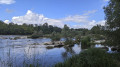
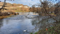
(4) Here we turn right and follow the Rheinauenweg along the riverbank. Here we can admire the Isteiner Schwellen, the rapids in the Rhine, and anyone who wishes can walk down a little towards the water and use this idyllic spot for a first break. The path now takes us along the Old Rhine for a while.

(5) At the signpost marked “Altrhein Istein”, just before a lovely bench right by the Old Rhine, our path branches off to the right and we cross the A5 again. We then carefully cross the L137 and turn left onto a sandy path that takes us past some tennis courts. We cross the Hodbach stream and reach the Kapellenweg.

(6) We are now standing in front of the Isteiner Klotz. If we walk a little to the left, we can admire this striking ridge. Anyone who wishes can also walk up to the Sankt Veit Chapel. We continue our walk either via the cemetery or along the Kapellenweg.

(7) At the signpost for “Istein Stapflehus”, we turn left and now walk through the vineyards.

(8) The path soon leads back into a wooded area; we do not follow the path to the right, but keep straight on along the narrow path through the woods.

(9) We reach a viewpoint overlooking the Isteiner Klotz. We continue to the signpost for “Isteiner Klotz” and keep to the right.

(10) At the signpost for “Klotzenweg”, we turn right, leave the woodland and head right along the edge of the forest. Then the yellow diamond leads us left back into the vineyards. We go straight on at the next junction and then reach a T-junction.

(11) We turn right and then immediately keep to the left.

(12) We reach the road “Am Kehrenweg” and cross it carefully. On the other side, we either continue along the vineyards or walk parallel to them through the woodland.

Signpost: Markgräfler Wiiwegli

(13) We reach the signpost for “Kirschanlage” and turn right. We now follow the signs for the Markgräfler Wiiwegli towards Efringen-Kirchen railway station. To our left is the Efringen-Kirchen quarry.

(14) Our path then branches off to the right and leads us downhill.

(15) We reach a bench with a panoramic display and can enjoy the fantastic view one last time here before heading back down to the village. The Wiiwegli signposts now lead us downhill through the meadows.

(16) At the next crossroads, we see another viewpoint on the left. However, our path continues straight on downhill through the meadows. At the next crossroads, we turn briefly to the right and then immediately back to the left, reaching the Gehrenweg in Efringen-Kirchen. We follow this to Engeltalstraße, turn right here and leave the road to the right at the left-hand bend. We then turn left onto the footpath alongside the railway tracks and cross them.

(S/E) This brings us back to the station, the starting point of our walk.

Waypoints

  1. S/E : mi 0 - alt. 840 ft - Efringen-Kirchen railway station
  2. 1 : mi 0.63 - alt. 804 ft - Signpost location: “Kirchen Stapflehus”
  3. 2 : mi 0.77 - alt. 791 ft - Signpost location: “Gutenau”
  4. 3 : mi 1.35 - alt. 778 ft - Bridge
  5. 4 : mi 1.83 - alt. 778 ft - Old Rhine/Rheinauenweg
  6. 5 : mi 2.96 - alt. 774 ft - Signpost location: “Altrhein Istein”
  7. 6 : mi 3.33 - alt. 781 ft - Isteiner Klotz
  8. 7 : mi 3.65 - alt. 810 ft - Signpost location: “Istein Stapflehus”
  9. 8 : mi 3.89 - alt. 942 ft - Wooded section
  10. 9 : mi 3.99 - alt. 1,030 ft - Isteiner Klotz viewpoint
  11. 10 : mi 4.12 - alt. 1,079 ft - Signpost location: “Klotzenweg”
  12. 11 : mi 4.56 - alt. 1,050 ft - T-junction, turn right
  13. 12 : mi 4.93 - alt. 1,037 ft - Street “Am Kehrenweg”
  14. 13 : mi 5.16 - alt. 1,142 ft - Signpost location: “Kirschanlage”
  15. 14 : mi 5.61 - alt. 1,240 ft - Turn off to the right
  16. 15 : mi 5.79 - alt. 1,122 ft - Bench with a panoramic display
  17. 16 : mi 5.89 - alt. 1,070 ft - Crossing, viewpoint
  18. S/E : mi 6.42 - alt. 840 ft - Efringen-Kirchen railway station

Notes

No special equipment is required for the walk. Simple trainers are sufficient.
In summer, you should take plenty to drink and perhaps a few snacks with you.

In Efringen-Kirchen, you can stock up on provisions at the bakery or supermarket before setting off or at the end of the walk.

On the section along the Old Rhine, the route runs parallel to the motorway. This isn’t particularly pleasant in terms of noise levels, but the beautiful Isteiner Schwellen soon make you forget the unpleasant background noise.

Worth a visit

Reviews and comments

4.4 / 5
Based on 3 reviews

Reliability of the description
4.3 / 5
Ease of following the route
4.3 / 5
Route interest
4.7 / 5
bernard senne
bernard senne

Overall rating : 3.3 / 5

Date of your route : Apr 27, 2026
Reliability of the description : ★★★☆☆ Average
Ease of following the route : ★★★☆☆ Average
Route interest : ★★★★☆ Good
Very busy route : No

.

Machine-translated

User 1033496

Overall rating : 5 / 5

Date of your route : Sep 01, 2025
Reliability of the description : ★★★★★ Very good
Ease of following the route : ★★★★★ Very good
Route interest : ★★★★★ Very good
Very busy route : No

the route is a bit long, especially as it was parish specific to Brittany and very hot
you should definitely bring your swimsuit and towel to cool off in the Old Rhine
then explore the karst hill
Finally, a walk through the vineyards above Istein, then back to Effringen (vineyards and orchards), with a lovely view of the Vosges, the Black Forest, and the Vosges, and incidentally, the ballet of take-offs and landings at EuroAirport Basel-Mulhouse-Freiburg.
Note that we stopped for lunch at a "Biergarten" at the Istein football ground

Machine-translated

laika1963
laika1963

Overall rating : 5 / 5

Date of your route : Aug 06, 2025
Reliability of the description : ★★★★★ Very good
Ease of following the route : ★★★★★ Very good
Route interest : ★★★★★ Very good
Very busy route : No

Sun tour

Machine-translated

Other walks in the area

For more walks, use our search engine .

The GPS track and description are the property of this route's author. Please do not copy them without permission.