


Refine your search for walks in Mérigny
Mérigny walks


 Between the cliffs and hillsides of the Anglin in Mérigny, Rocher de la Dube
 Visorando Member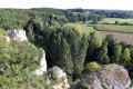
 7.32 mi
 +472 ft
 -459 ft
 3h 45
3h 45
 Moderate
 Departure from Mérigny (Indre)
The cliffs of the Anglin Valley, dominated by the Rocher de la Dube near Mérigny, set the scene for this route, which offers views of the limestone plateau and the river as it follows small paths lined with dry stone walls. Near Rives, you will also discover the Grotte du Rocher Saint-Berthomé, another remnant of the former limestone quarry used for the manufacture of sarcophagi, and the mysterious site of the old Moulin de Braud mill.
Walk in Fontgombault, from the left bank to the right bank of the Creuse
 7.42 mi
+210 ft
-180 ft
3h 35
Moderate
Departure from Fontgombault (Indre)
7.42 mi
+210 ft
-180 ft
3h 35
Moderate
Departure from Fontgombault (Indre)
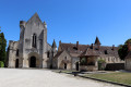
This very pleasant hike starts on the left bank of the Creuse River in Fontgombault. It takes you to the site of the Saint-Julien Chapel and its caves, which date back to the hermit Gombaud in the 11th century. The trail then runs along impressive limestone cliffs. After passing through the village of Le Village du Bois, you arrive at Lurais and its beach. You then cross to the right bank to reach Preuilly-la-Ville and the mysterious Bois des Dubes. Finally, you will discover the unmissable Fontgombault Abbey.
Les Certeaux in Angles-sur-l'Anglin
 Tourist office
 4.04 mi
+246 ft
-217 ft
2h 05
4.04 mi
+246 ft
-217 ft
2h 05
 Easy
Departure from Angles-sur-l'Anglin (Vienne)
Easy
Departure from Angles-sur-l'Anglin (Vienne)
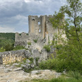
A hike not to be missed! Walking along the banks of the Anglin, you will discover the village from the lower town viewpoint, then find yourself on a wooded, bucolic path, ending up at the superb Château des Certeaux!
The Salleron valley near Concremiers
 6.12 mi
+315 ft
-335 ft
3h 05
Moderate
Departure from Concremiers (Indre)
6.12 mi
+315 ft
-335 ft
3h 05
Moderate
Departure from Concremiers (Indre)
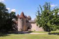
This walk in the Brenne Regional Nature Park will allow you to discover the Salleron valley near the village of Concremiers and the magnificent15th-century (private) Château de Forges, through a variety of bucolic landscapes.(This walk is not recommended during periods of heavy rain due to a ford: in such cases, follow the alternative route suggested in the "Practical Information" section)
The Val d'Angles and the Chemin Vert in Angles-sur-l'Anglin
 2.68 mi
+171 ft
-164 ft
1h 25
Easy
Departure from Angles-sur-l'Anglin (Vienne)
2.68 mi
+171 ft
-164 ft
1h 25
Easy
Departure from Angles-sur-l'Anglin (Vienne)
A short walk through woods and fields.
Hike suggested by the Vienne General Council.
Between Gartempe and Anglin
 7.82 mi
+289 ft
-269 ft
3h 50
Moderate
Departure from Saint-Pierre-de-Maillé (Vienne)
7.82 mi
+289 ft
-269 ft
3h 50
Moderate
Departure from Saint-Pierre-de-Maillé (Vienne)
A circular route that starts by following the Gartempe, mostly from a distance. You then head up its tributary, the Anglin, to reach the foot of the superb village of Angles-sur-l'Anglin. The return journey takes you through fields and woods.
Abbey and Gartempe in Saint-Savin
 5.92 mi
+141 ft
-157 ft
2h 50
Easy
Departure from Saint-Savin (Vienne) (Vienne)
5.92 mi
+141 ft
-157 ft
2h 50
Easy
Departure from Saint-Savin (Vienne) (Vienne)
This walk allows you to discover the village of Saint-Savin and the Gartempe valley. Beautiful views of the abbey. The abbey is a UNESCO World Heritage Site.
This hike follows the marked trails "La vigne aux moines" (yellow markings).
The tour of Villemort
 7.59 mi
+135 ft
-115 ft
3h 35
Moderate
Departure from Villemort (Vienne)
7.59 mi
+135 ft
-115 ft
3h 35
Moderate
Departure from Villemort (Vienne)
A easy route that circles the village of Villemort, passing by the Chökhor Ling monastic centre.
Circular route through the Suin Valley at Pouligny-Saint-Pierre
 4.91 mi
+135 ft
-144 ft
2h 25
Easy
Departure from Pouligny-Saint-Pierre (Indre)
4.91 mi
+135 ft
-144 ft
2h 25
Easy
Departure from Pouligny-Saint-Pierre (Indre)
A walk through the countryside around Pouligny-Saint-Pierre and the Suin Valley. The route alternates between fields, woods and hamlets. The section crossing the Suin valley after La Boudinière can be wet in autumn and winter, and may even be impassable without wellington boots following prolonged rainfall. The walk can also be started from the centre of Pouligny-Saint-Pierre by heading on foot towards Champ Cornu, then turning left instead of right on the return journey at the end of Rue Ernest Dupont.
From the Gartempe to the Anglin via the plateau at Vicq
 7.00 mi
+203 ft
-200 ft
3h 25
Moderate
Departure from Vicq-sur-Gartempe (Vienne)
7.00 mi
+203 ft
-200 ft
3h 25
Moderate
Departure from Vicq-sur-Gartempe (Vienne)
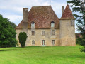
This pleasant hike takes you from the banks of the Gartempe to the outskirts of Angles-sur-l'Anglin via the plateau, passing by the superb Château de la Brosse.
The hills and villages of Vicq-sur-Gartempe
7.76 mi
+279 ft
-279 ft
3h 50
Moderate
Departure from Vicq-sur-Gartempe (Vienne)
Set amongst plains and hills, discover charming little villages and breathtaking views along beautiful grassy paths around this picturesque village!
Route des étangs starting from La Puye
3.52 mi
+69 ft
-79 ft
1h 40
Easy
Departure from La Puye (Vienne)
The ponds route will allow you to stroll along the banks of two ponds in the commune of La Puye that are almost a thousand years old.During your walk, you’ll be able to see the water ram and view the Fontevrist monastery at La Puye from various angles; it is now the mother house of the Congregation of the Daughters of the Cross.
The Val d’Anglin in Mauvières
 4.87 mi
+75 ft
-75 ft
2h 20
Easy
Departure from Mauvières (Indre)
4.87 mi
+75 ft
-75 ft
2h 20
Easy
Departure from Mauvières (Indre)
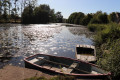
A lovely walk in Mauvières within the Brenne Regional Nature Park, offering the chance to explore the surrounding area, notably the hamlet of Villiers, which has preserved its historic buildings, and the Val d’Anglin, with a stunning view of the Château d’Aigues Joignant on the opposite bank.
Douadic Route: Le Suin, from limestone to clay
 6.21 mi
+115 ft
-108 ft
2h 55
Easy
Departure from Douadic (Indre)
6.21 mi
+115 ft
-108 ft
2h 55
Easy
Departure from Douadic (Indre)
This walk takes you along paths and small roads through the countryside surrounding Douadic, a village situated in the Brenne Regional Nature Park. Among other things, you’ll discover the Suin Valley and the Étang de la Hire.
Around Fleix
 4.98 mi
+98 ft
-98 ft
2h 25
Easy
Departure from Fleix (Vienne)
4.98 mi
+98 ft
-98 ft
2h 25
Easy
Departure from Fleix (Vienne)
This route, starting from the charming little village of Fleix, will take you through the beautiful countryside near the town of Chauvigny, where the rail bike runs along the former railway line within the town. You’ll follow part of the old Roman road and will also be close to the Mareuil State Forest.
La Nauraie
6.88 mi
+98 ft
-105 ft
3h 15
Moderate
Departure from Pleumartin (Vienne)
You’ll walk along part of the old railway line linking Pleumartin to Yzeures-sur-Creuse and come across a few wayside crucifixes.
The Medieval Town of La Roche-Posay
2.11 mi
+72 ft
-102 ft
1h 00
Easy
Departure from La Roche-Posay (Vienne)
The Medieval Town Circular Tour takes you on a historical tour of La Roche-Posay, taking in the Porte Bourbon, the keep and the ramparts.
Please note: some areas are prone to flooding!
Towards the confluence of the Gartempe and the Creuse
 2.46 mi
+46 ft
-69 ft
1h 10
Easy
Departure from La Roche-Posay (Vienne)
2.46 mi
+46 ft
-69 ft
1h 10
Easy
Departure from La Roche-Posay (Vienne)
This circular walk starts in the centre of La Roche-Posay and leads to the confluence of the Gartempe and the Creuse. It follows the riverbanks, crosses the old railway bridge and the main bridge to reach the keep and the church.
Route in Brenne at Bélâbre: water, earth, air and fire
 5.59 mi
+276 ft
-256 ft
2h 50
Easy
Departure from Bélâbre (Indre)
5.59 mi
+276 ft
-256 ft
2h 50
Easy
Departure from Bélâbre (Indre)
Bélâbre, situated in the Brenne Regional Nature Park in the Indre department, enjoyed a period of prosperity in the 19th century thanks to these four elements used in its tile works, potteries and forges. Earth for raw materials (clay and ore), water to wash and moisten them and to generate energy, air to dry the moulded clay, and fire for firing. This walk offers you the chance, amongst other things, to discover some remnants of this past.
La Creusette as seen from Leigné-les-Bois
9.04 mi
+272 ft
-266 ft
4h 25
Moderate
Departure from Leigné-les-Bois (Vienne)
This route will take you on a tour of the Bois des Marineaux and the former estate of the Marquis Pérusse des Cars!
Amidst fields and woods around Leigné-les-Bois
6.66 mi
+164 ft
-171 ft
3h 10
Moderate
Departure from Leigné-les-Bois (Vienne)
Explore the area around Leigné-les-Bois, along farm tracks and woodland paths, to discover the north-eastern side of the village – a peaceful, gently undulating landscape criss-crossed by small streams.
Leigné-les-Bois Pleasure Walk
6.10 mi
+167 ft
-167 ft
2h 55
Easy
Departure from Leigné-les-Bois (Vienne)
Come and discover the beautiful views over the villages of Leigné-les-Bois and Coussay-les-Bois, and stop for a relaxing break by the Saint-Rémy Fountain!
On the trail of the pink castle from Bossay-sur-Claise
 Local authority
 7.41 mi
+331 ft
-312 ft
3h 40
Moderate
Departure from Bossay-sur-Claise (Indre-et-Loire)
7.41 mi
+331 ft
-312 ft
3h 40
Moderate
Departure from Bossay-sur-Claise (Indre-et-Loire)
Welcome to the third largest commune in Touraine: Bossay-sur-Claise. Its vast territory offers a beautiful diversity of landscapes, including fields, forests, clearings and valleys, with a pink castle as the highlight!
Between fields and forests from the Bois des Chênes Froids
3.91 mi
+194 ft
-187 ft
2h 00
Easy
Departure from Coussay-les-Bois (Vienne)
A short route to explore outside the village centre with beautiful passages through the undergrowth and lovely panoramic views of the surrounding countryside. The village of Coussay-les-Bois is notable for its bell tower, which you can see after your walk.
Les Rabottes
5.48 mi
+276 ft
-279 ft
2h 45
Easy
Departure from Coussay-les-Bois (Vienne)
A lovely, varied route under pleasant trees, interspersed with views of the countryside. Take the time to observe the local heritage. Coussay-les-Bois is unusual in that it has two churches a few metres apart, one of which has a twisted bell tower.
Circular Brenne in Saint-Michel-en-Brenne
 9.21 mi
+85 ft
-85 ft
4h 20
Moderate
Departure from Saint-Michel-en-Brenne (Indre)
9.21 mi
+85 ft
-85 ft
4h 20
Moderate
Departure from Saint-Michel-en-Brenne (Indre)
This walk near Saint-Michel-en-Brenne is a variation of route no. 60 proposed by the Brenne Regional Nature Park, entitled “Saint-Cyran-en-Brenne”.It follows small roads and paths, allowing you to discover, amongst other things, the Abbey of Saint-Cyran, built in the 7th century, and the bucolic, wooded landscapes of the Brenne, before leading to the Étang des Essarts observatory in the Chérine Reserve.