Route des étangs starting from La Puye

The ponds route will allow you to stroll along the banks of two ponds in the commune of La Puye that are almost a thousand years old.
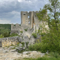
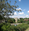
During your walk, you’ll be able to see the water ram and view the Fontevrist monastery at La Puye from various angles; it is now the mother house of the Congregation of the Daughters of the Cross.

Details

29065299
Creation:
Last update:
Last review:
  • Walking
    Activity: Walking
  • ↔
    Distance: 3.52 mi
  • ◔
    Average duration: 1h 40 
  • ▲
    Difficulty: Easy

  • ⚐
    Back to start: Yes
  • ↗
    Ascent: + 69 ft
  • ↘
    Descent: - 79 ft

  • ▲
    Highest point: 427 ft
  • ▼
    Lowest point: 354 ft
  • ⚐ Country: France
  • ⚐ City: La Puye (86260)
  • ⚑
    Start/End: N 46.642827° / E 0.753095°
  • ❏
    IGN map(s): Ref. 1926SB, 1927SB
  • Hour-by-hour weather

Description of the walk

Park in the car park at the Place de la Mairie in La Puye.

(S/E) Head north-east and then north to reach the Petit Étang at the Montgolfier brothers’ ram.

(1) Walk along the left-hand side to go round it, first along the right bank and then the left. Head back to the leisure centre.

(2) Continue along the right-hand side of the road leading uphill towards La Bussière until you reach the Carthauderie crossroads.

(3) Turn right to reach the Grand Étang embankment.

(4) Take the track on the left to go round the Grand Étang, first along the right bank and then the left. Join the path that crosses the lake.

(5) Turn right onto this path to cross the lake, then veer right and return to the embankment; turn left to walk alongside the car park and then through the woods to the cemetery.

(6) Cross the road carefully and take the path running alongside the Soussy stream, opposite.
When you reach the bridge, take the street on the right and head back up towards the village centre.
Turn right towards the monastery, then continue up Rue du Moulin, followed by Rue du Cours Saint-Michel. Carry on straight ahead, veering slightly to the right, to reach the Petit Étang and the ram.

(1) Turn left and retrace your steps along the route you took on the way there to return to the town hall car park (S/E).

Waypoints

  1. S/E : mi 0 - alt. 384 ft - Car park at the town hall square
  2. 1 : mi 0.07 - alt. 377 ft - The Montgolfier brothers’ ram - Le Petit Étang (La Puye)
  3. 2 : mi 0.56 - alt. 394 ft - Leisure Centre
  4. 3 : mi 1.33 - alt. 427 ft - La Carthauderie
  5. 4 : mi 1.52 - alt. 374 ft - Fishing trail - Le Grand Étang (La Puye)
  6. 5 : mi 1.92 - alt. 374 ft - Crossing the pond
  7. 6 : mi 2.86 - alt. 361 ft - Cemetery
  8. S/E : mi 3.52 - alt. 384 ft - Car park at the town hall square

Worth a visit

Le Petit Étang: owned by the local council, this is a natural area, part of which has been developed as a leisure zone with a swimming area, beach, playground and catering facilities. Right at the foot of the spillway, you can admire the hydraulic ram invented by the Montgolfier brothers in the 18th century, which was used to lift water to a reservoir supplying the monastery gardens.

Between (2) and (3), enjoy the view of the monastery throughout this section of the route.

(4) The Grand Étang is owned by the Vienne Departmental Federation for Fishing and the Protection of Aquatic Environments, and features a family-friendly fishing area. Please respect the peace and quiet of the area and keep your pets on a lead. If you are quiet enough, you may well hear the great reed warbler, a small passerine commonly found in thickets of common reed, and spot several species of duck.

After (6), opposite the school, look to your right at the chasm that once served as an outlet for the mill’s water.

Reviews and comments

4 / 5
Based on 4 reviews

Reliability of the description
4.3 / 5
Ease of following the route
4.3 / 5
Route interest
3.5 / 5
VB01
VB01

Overall rating : 4.7 / 5

Date of your route : Jun 04, 2026
Reliability of the description : ★★★★★ Very good
Ease of following the route : ★★★★★ Very good
Route interest : ★★★★☆ Good
Very busy route : No

A pleasant, easy route that offers plenty of opportunities to enjoy the natural surroundings.

Machine-translated

User 26030054

Overall rating : 4.7 / 5

Date of your route : Apr 27, 2026
Reliability of the description : ★★★★★ Very good
Ease of following the route : ★★★★★ Very good
Route interest : ★★★★☆ Good
Very busy route : No

Avoid visiting during very hot weather as there is little shade.

Machine-translated

User 6247523

Overall rating : 3.7 / 5

Date of your route : Aug 25, 2025
Reliability of the description : ★★★★☆ Good
Ease of following the route : ★★★★☆ Good
Route interest : ★★★☆☆ Average
Very busy route : No

I have completed this route.
It is easy and presents no technical difficulties.
The only downside, in my opinion, is that you have to walk along the road once you leave the swimming pond to reach the fishing pond.
This route cannot therefore be classified as a family outing.
However, one solution is to drive between the two ponds, especially as the fishing pond is quite large.

Machine-translated

Amis de la Nature
Amis de la Nature

Overall rating : 3 / 5

Date of your route : Sep 04, 2023
Reliability of the description : ★★★☆☆ Average
Ease of following the route : ★★★☆☆ Average
Route interest : ★★★☆☆ Average
Very busy route : No

The first lake has dried up and development work is being carried out there, so it’s difficult to walk round it

Machine-translated

Other walks in the area

For more walks, use our search engine .

The GPS track and description are the property of this route's author. Please do not copy them without permission.