Country:
 City:
City:


Starting point: Champ Cornu, a hamlet of Pouligny. If you have a car, take care not to block the way.
(S/E) Take the path on the left between the buildings and continue until the path joins another, running at right angles, near the hamlet known as Le Reclus.
(1) Turn right, walk past the buildings at Le Reclus, ignore the first path on the right and take the next one towards the Suin valley.
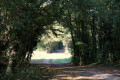
(2) Head down into the valley along a shaded path, then pass the sign for “Roche à la Velue” on your left. Head back up the valley, turning left as you leave the woods to reach the hamlet of La Chaume.
(3) Walk through the hamlet, then take a grassy path on the right just before you leave it, and follow it until it joins the D60.
(4) Follow it to the right until you reach the D975.
(5) Cross it carefully: be aware that it is quite busy. Continue straight ahead to enter the hamlet of La Boudinière.
(6) Carry on through the hamlet and take a track on the right towards Pouligny. Follow this tarmac track which branches off to the right, then pass a signpost for a walking trail on your left and continue along a grassy section, which joins another track leading back down into the Suin valley.
(7) On the descent, pass the Croix de Chagnats on your left and reach the Suin. The path is dry most of the time but can be damp in autumn and winter, or evenimpassable without wellies after prolonged rain.
(8) Walk up the valley to reach the top.
(9) Turn left at the edge of the woods towards the hamlet of La Josière; cross over, following a narrow road that joins the Route de Douadic to Pouligny (D43) near a silo.
(10) Continue to the right along the edge of the D43 until you reach the Pouligny cemetery.
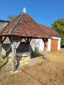
(11) Turn right onto the unpaved track alongside the cemetery, carefully cross the D975 again and turn onto Rue Ernest Dupont. At the end of the street, turn right onto Rue des Aubiers, pass the old well on the right at the junction with Rue des Thuyas, and reach Champ Cornu a few metres further on (S/E).
 Visorando Member
 Moderate
 Tourist office