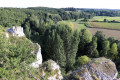
The hills and villages of Vicq-sur-Gartempe

Set amongst plains and hills, discover charming little villages and breathtaking views along beautiful grassy paths around this picturesque village!

Details

n°3216971
Creation:
Last update:
Last review:
  • Walking
    Activity: Walking
  • ↔
    Distance: 7.76 mi
  • ◔
    Average duration: 3h 50 
  • ▲
    Difficulty: Moderate

  • ⚐
    Back to start: Yes
  • ↗
    Ascent: + 279 ft
  • ↘
    Descent: - 279 ft

  • ▲
    Highest point: 443 ft
  • ▼
    Lowest point: 210 ft

Description of the walk

Park on the Place du Bourg, in the car park near the grocery shop.

(S/E) Turn left towards La Roche-Posay. After 40 metres, at the corner of the ‘Maison du Patriote’ (1871), turn right onto the small Route des Bouchauds, towards Monconseil. Pass a detached house called ‘Le Pré de la Fontaine’ on your right and continue to the next crossroads.

(1) Take the path on the left, through the fields, then turn right onto a grassier path and continue to the village of Varennes.

(2) Turn left in the village, cross the D5 with care, carry on, pass an agricultural co-operative and reach the D14.

(3) Cross the D14 carefully, then turn left, joining the path on the right. Continue along this path until you reach the hamlet of Montin and pass through it.

(4) Turn left, walk past a lodge and, at the three-way junction, turn left again.

(5) At the end of the road, turn right and then, immediately, left onto the road running through the fields, towards La Serenne.

(6) Turn right into the village, carry on straight ahead and, at the crossroads, head straight on towards Les Hautes Métairies.

(7) Leave the hamlet on your right and turn left onto a dirt track. Stay on this path for 1 km, passing through copses and fields.

(8) Cross the road in the middle of the woods and head towards Les Tardes. Walk past the hamlet’s only house and take a path on the left, between the hedge on the left and the field on the right. Continue to follow theGR®48for 700 m until you reach La Berthomière.

(9) Turn right, passing the houses in this small hamlet. Carry on straight ahead along the grassy track, then turn left immediately and continue to the road (D11).

(10) Cross with care, continue along the path opposite and, at the next junction, turn left then, straight away, right (150 m). Turn left again after 300 m to reach the River Gartempe

(11) Walk alongside it, leaving the road on your left which leads up towards the church, and carry on straight ahead. After 600 m, head up the narrow lane on the left, towards the village centre, until you reach the junction near the town hall. Turn right into the Grand Rue and carry on straight ahead until you reach the Place du Bourg (S/E).

Waypoints

  1. S/E : mi 0 - alt. 253 ft - Village square, car park near the grocery shop
  2. 1 : mi 0.86 - alt. 243 ft - T-junction on the path between the fields
  3. 2 : mi 1.76 - alt. 256 ft - Varennes
  4. 3 : mi 2.75 - alt. 262 ft - D14
  5. 4 : mi 3.84 - alt. 430 ft - Montin
  6. 5 : mi 4.05 - alt. 361 ft - Turn right/left onto the road
  7. 6 : mi 4.46 - alt. 341 ft - La Serenne
  8. 7 : mi 4.65 - alt. 390 ft - Les Hautes Dairy Farms
  9. 8 : mi 5.23 - alt. 440 ft - Woodland towards Les Tardes
  10. 9 : mi 6.37 - alt. 259 ft - La Berthomière
  11. 10 : mi 6.67 - alt. 230 ft - D11
  12. 11 : mi 7.15 - alt. 217 ft - The - Gartempe (rivière)
  13. S/E : mi 7.76 - alt. 253 ft - Village square, car park near the grocery shop

Notes

Local amenities:
- Grocery shop.
- Restaurant.
- Serenity Biscuits.

Worth a visit

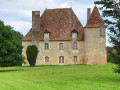
- Château de la Brosse.
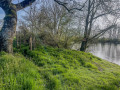
- The banks of the Gartempe.

Always be cautious and plan ahead when you're outdoors. Visorando and the author of this route cannot be held responsible for any accidents occurring on this route.

The GR® and PR® markings are the intellectual property of the Fédération Française de Randonnée Pédestre.

Reviews and comments

3.8 / 5
Based on 2 reviews

Reliability of the description
4.5 / 5
Ease of following the route
4.5 / 5
Route interest
2.5 / 5
Ptigris21
Ptigris21

Overall rating : 3.7 / 5

Date of your route : Jan 29, 2024
Reliability of the description : ★★★★☆ Good
Ease of following the route : ★★★★☆ Good
Route interest : ★★★☆☆ Average
Very busy route : No

The second half of this route is a pleasant walk through the woods towards Montin, right up to the finish. Before that, the route takes you across the plain, amongst the cultivated fields. At the junction of two tracks, a signpost or similar would be welcome. The route is generally well signposted.

Machine-translated

AYRAULT DANIELLE
AYRAULT DANIELLE

Overall rating : 4 / 5

Date of your route : Sep 28, 2021
Reliability of the description : ★★★★★ Very good
Ease of following the route : ★★★★★ Very good
Route interest : ★★☆☆☆ Disappointing
Very busy route : No

I’m disappointed!!! The few paths there are run through fields, and there are too many roads and no shade

Machine-translated

Other walks in the area

For more walks, use our search engine .

The GPS track and description are the property of this route's author. Please do not copy them without permission.