The Val d’Anglin in Mauvières

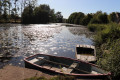
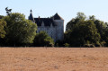
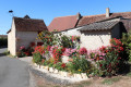
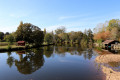
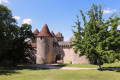
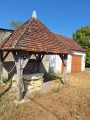
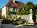
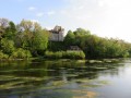
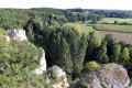
A lovely walk in Mauvières within the Brenne Regional Nature Park, offering the chance to explore the surrounding area, notably the hamlet of Villiers, which has preserved its historic buildings, and the Val d’Anglin, with a stunning view of the Château d’Aigues Joignant on the opposite bank.

Details

2552454
Creation:
Last update:
Last review:
  • Walking
    Activity: Walking
  • ↔
    Distance: 4.87 mi
  • ◔
    Average duration: 2h 20 
  • ▲
    Difficulty: Easy

  • ⚐
    Back to start: Yes
  • ↗
    Ascent: + 75 ft
  • ↘
    Descent: - 75 ft

  • ▲
    Highest point: 371 ft
  • ▼
    Lowest point: 279 ft
  • ⚐ Country: France
  • ⚐ City: Mauvières (36370)
  • ⚑
    Start/End: N 46.57416° / E 1.088712°
  • ❏
    IGN map(s): Ref. 1927SB, 2027O
  • Hour-by-hour weather

Photos

Description of the walk

The start is at the town hall car park. The route is marked in yellow (No. 39 on the Brenne Regional Nature Park walking trails).

(S/E) Turn left onto the D54 heading north-west.

(1) At the second junction, turn right onto the D88, then turn right onto a track and, at the junction you’ll soon come to, carry on straight ahead until the next junction.

(2) At the crossroads, carry on straight ahead until you reach the junction with the D88.

(3) Carry on straight ahead northwards on this road, then turn left towards Villiers just before a junction.

(4) At the second junction, turn left onto Allée de la Vouivre. After the bend, turn right onto Allée des Groges, then carry on straight ahead and take the road on the left.

(5) Turn onto the track on the left (GRP® de la Brenne). Follow it until you reach the D54.

(6) Turn right, then immediately turn left onto the track leading down towards the Anglin.
Pass a path on your left; you’ll see the (private) Château d’Aigues Joignant on the opposite bank, and reach the banks of the Anglin at the first houses of the hamlet of Les Poulets.

(7) Walk up the street on the left, carry on straight ahead until you reach the D54, then turn right.

(8) Ignore the path running perpendicular to the road on the right and take the one that runs diagonally along the gardens. A little further on, it rejoins the road at the junction you passed on the way out.

(1) Return to the starting point (S/E) by following the D54.

Waypoints

  1. S/E : mi 0 - alt. 295 ft - Town Hall car park
  2. 1 : mi 0.27 - alt. 302 ft - Crossroads at the end of the circular loop
  3. 2 : mi 1.11 - alt. 361 ft - Crossroads
  4. 3 : mi 1.43 - alt. 351 ft - Junction with the D88
  5. 4 : mi 2 - alt. 367 ft - In Villiers, turn left
  6. 5 : mi 2.31 - alt. 351 ft - Brenne GRP on the left
  7. 6 : mi 2.83 - alt. 305 ft - Take the D54 to the right, then the path to the left
  8. 7 : mi 4.35 - alt. 282 ft - Bank of the Anglin at Les Poulets
  9. 8 : mi 4.45 - alt. 302 ft - Path veering slightly to the right towards the gardens
  10. S/E : mi 4.87 - alt. 295 ft - Town Hall car park

Notes

No water sources; no difficulties.

Worth a visit

Reviews and comments

4.2 / 5
Based on 3 reviews

Reliability of the description
4.3 / 5
Ease of following the route
4.3 / 5
Route interest
4 / 5
User 16470746

Overall rating : 3.7 / 5

Date of your route : May 19, 2025
Reliability of the description : ★★★★☆ Good
Ease of following the route : ★★★★☆ Good
Route interest : ★★★☆☆ Average
Very busy route : No

Too much tarmac – what a shame.

Machine-translated

Christi19
Christi19

Overall rating : 5 / 5

Date of your route : Jun 29, 2024
Reliability of the description : ★★★★★ Very good
Ease of following the route : ★★★★★ Very good
Route interest : ★★★★★ Very good
Very busy route : No

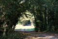
A lovely, varied walk. The first section, between 1 and 2, is well shaded. Unfortunately, there’s a bit of tarmac further on, but the final stretch is back on a pleasant path. Except that on this particular day, we had to take a detour, because after managing to get past a few very marshy sections, the path was completely and deeply flooded from the Château d’Aigues Joignant onwards. Nevertheless, it’s a route I’d recommend.

Machine-translated

LesBobolas
LesBobolas

Overall rating : 4 / 5

Date of your route : Jan 25, 2021
Reliability of the description : ★★★★☆ Good
Ease of following the route : ★★★★☆ Good
Route interest : ★★★★☆ Good
Very busy route : No

A lovely route to do in winter; the Anglin wasn’t in flood, but do check before you set off as the river might ‘cut off’ the path!

Machine-translated

Other walks in the area

For more walks, use our search engine .

The GPS track and description are the property of this route's author. Please do not copy them without permission.