Towards the confluence of the Gartempe and the Creuse

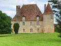
This circular walk starts in the centre of La Roche-Posay and leads to the confluence of the Gartempe and the Creuse. It follows the riverbanks, crosses the old railway bridge and the main bridge to reach the keep and the church.

Details

n°71839649
Creation:
Last update:
Last review:
  • Walking
    Activity: Walking
  • ↔
    Distance: 2.46 mi
  • ◔
    Average duration: 1h 10 
  • ▲
    Difficulty: Easy

  • ⚐
    Back to start: Yes
  • ↗
    Ascent: + 46 ft
  • ↘
    Descent: - 69 ft

  • ▲
    Highest point: 240 ft
  • ▼
    Lowest point: 180 ft

Photos

Description of the walk

The route starts at the town hall on Place de la République, in the centre of La Roche-Posay. There are several parking options available, as well as a bus stop (line 24 from Châtellerault railway station).

(S/E) Head to the Cours Pasteur roundabout and turn left towards the Porte Bourbon. Take Rue Bourbon, then turn right onto Rue Notre-Dame. Next, head down Rue des Remparts on the left until it starts to climb.

(1) Follow the country path on the left, alongside the River Creuse, until you reach the bridge.

(2) Go under the bridge and turn right up the steps. Then follow the greenway on your left until you reach the junction (D5). At this point, take the left-hand pavement and continue straight on towards the river, passing the football pitch.

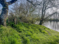
(3) Before reaching the Gartempe, look for a path through the fence on the left to follow the riverbank. Follow the paths, which include two further passages along the riverbank,where you can see the confluence of the Gartempe and the Creuse on your right. Continue to the bridge you crossed on the way there.

(2) Take the steps up to the bridge, then cross the bridge over the Creuse.

(4) After the bridge, head down to the left and continue along the road to the right until you reach the junction with the D725.

(5) Turn left, cross over the River Creuse to return to Place de la République (S/E).

Waypoints

  1. S/E : mi 0 - alt. 236 ft - Parking de l'Arceau
  2. 1 : mi 0.27 - alt. 200 ft - Junction - Creuse (rivière)
  3. 2 : mi 0.55 - alt. 197 ft - Where the two circular loops meet - Creuse (rivière)
  4. 3 : mi 1.19 - alt. 194 ft - Gartempe (rivière)
  5. 4 : mi 1.81 - alt. 197 ft - Junction
  6. 5 : mi 2.11 - alt. 200 ft - D725
  7. S/E : mi 2.46 - alt. 226 ft - Parking de l'Arceau

Notes

Make sure you wear suitable footwear for walking along the riverbanks and avoid taking this route in the event of flooding.

Please respect the peace and quiet of the anglers along the banks of the Creuse.

Worth a visit

Reviews and comments

5 / 5
Based on 1 review

Reliability of the description
5 / 5
Ease of following the route
5 / 5
Route interest
5 / 5
Clothilde Ci
Clothilde Ci

Overall rating : 5 / 5

Date of your route : May 12, 2025
Reliability of the description : ★★★★★ Very good
Ease of following the route : ★★★★★ Very good
Route interest : ★★★★★ Very good
Very busy route : No

This route isn’t very busy on the unmarked section where it runs alongside the meadow, but it is busy near La Roche-Posay

Machine-translated

Other walks in the area

For more walks, use our search engine .

The GPS track and description are the property of this route's author. Please do not copy them without permission.