Around Fleix

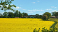
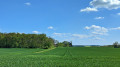
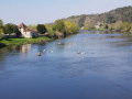
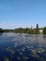
This route, starting from the charming little village of Fleix, will take you through the beautiful countryside near the town of Chauvigny, where the rail bike runs along the former railway line within the town. You’ll follow part of the old Roman road and will also be close to the Mareuil State Forest.

Details

30297944
Creation:
Last update:
Last review:
  • Walking
    Activity: Walking
  • ↔
    Distance: 4.98 mi
  • ◔
    Average duration: 2h 25 
  • ▲
    Difficulty: Easy

  • ⚐
    Back to start: Yes
  • ↗
    Ascent: + 98 ft
  • ↘
    Descent: - 98 ft

  • ▲
    Highest point: 456 ft
  • ▼
    Lowest point: 367 ft
  • ⚐ Country: France
  • ⚐ City: Fleix (86300)
  • ⚑
    Start/End: N 46.553873° / E 0.745604°
  • ❏
    IGN map(s): Ref. 1927SB
  • Hour-by-hour weather

Photos

Description of the walk

Park in the car park opposite the town hall.

:: S/E: Head due north along Rue de la Vallée des Charmes.

(1) At the Fork in the road, take the cul-de-sac on the right and then the path on the right. Follow it due east until the next junction at the former hamlet of Bois Gigon.

(2) Turn right onto the track which joins a road near La Boitaudière.

(3) Continue to the right as far as La Roche.

(4) Follow the road to the left until you reach the old Roman road.

(5) Turn right onto this track, continue straight on, crossing two tarmac roads, and arrive at the Bois de la Sœur.

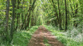
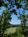
(6) Take the path on the right into the woods and walk through them. On emerging, continue due north along a grassy track until you reach a road.

(7) Turn right onto this road and follow it to the church and the cemetery.

(8) Continue left along the road leading to the church, then turn right to return to the junction you passed on the way out.

(1) Follow the route in reverse to return to the car park opposite the town hall (S/E).

Waypoints

  1. S/E : mi 0 - alt. 413 ft - Car park opposite Fleix Town Hall.
  2. 1 : mi 0.09 - alt. 420 ft - Crossroads at the end of the circular loop
  3. 2 : mi 0.71 - alt. 413 ft - Turn right at the fork
  4. 3 : mi 1.11 - alt. 436 ft - The hamlet of La Boitaudière
  5. 4 : mi 1.36 - alt. 440 ft - The hamlet of La Roche
  6. 5 : mi 1.7 - alt. 449 ft - Roman Road
  7. 6 : mi 3.23 - alt. 404 ft - Bois de la Sœur
  8. 7 : mi 4.27 - alt. 453 ft - Tarmac road
  9. 8 : mi 4.49 - alt. 456 ft - Cemetery - Église Saint-Barthélemy (Fleix)
  10. S/E : mi 4.98 - alt. 413 ft - Town hall car park

Notes

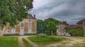
During the route, you’ll see a superb country estate, Le Charrault.
At the end of the walk, you’ll come to the little church with its adjoining cemetery.

Reviews and comments

3.9 / 5
Based on 4 reviews

Reliability of the description
4 / 5
Ease of following the route
4 / 5
Route interest
3.8 / 5
User 26749664

Overall rating : 3.7 / 5

Date of your route : Jul 29, 2025
Reliability of the description : ★★★★☆ Good
Ease of following the route : ★★★★☆ Good
Route interest : ★★★☆☆ Average
Very busy route : No

Pleasant morning hike. Lots of fields... Point 6 in the forest was inaccessible due to tall grass, so we turned back along the road leading out of the forest and returned the same way. It's a bit of a shame...

Machine-translated

bcornu
bcornu

Overall rating : 4.3 / 5

Date of your route : Feb 04, 2024
Reliability of the description : ★★★★☆ Good
Ease of following the route : ★★★★☆ Good
Route interest : ★★★★★ Very good
Very busy route : No

A pleasant, easy walk through countryside and woodland. We did it after heavy rain; one section was completely flooded, so we had to take a 200-metre detour through the woods, but it was actually quite fun!

Machine-translated

AYRAULT DANIELLE
AYRAULT DANIELLE

Overall rating : 3.7 / 5

Date of your route : May 01, 2023
Reliability of the description : ★★★★☆ Good
Ease of following the route : ★★★★☆ Good
Route interest : ★★★☆☆ Average
Very busy route : No

Not great – nothing like it

Machine-translated

regisapieds
regisapieds
• Edited:

Overall rating : 4 / 5

Date of your route : Apr 30, 2023
Reliability of the description : ★★★★☆ Good
Ease of following the route : ★★★★☆ Good
Route interest : ★★★★☆ Good
Very busy route : No

Fleix local council. A very pleasant route through beautiful, gently rolling countryside in the heart of spring. The signposting is perfect, except at point 6, where the signs should be clearer about continuing the route to the right; otherwise, you risk heading straight on, where there is no signposted way out (which is exactly what happened to me!).

Machine-translated

Other walks in the area

For more walks, use our search engine .

The GPS track and description are the property of this route's author. Please do not copy them without permission.