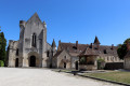
Between Gartempe and Anglin

A circular route that starts by following the Gartempe, mostly from a distance. You then head up its tributary, the Anglin, to reach the foot of the superb village of Angles-sur-l'Anglin. The return journey takes you through fields and woods.

Details

34637031
Creation:
Last update:
Last review:
  • Walking
    Activity: Walking
  • ↔
    Distance: 7.82 mi
  • ◔
    Average duration: 3h 50 
  • ▲
    Difficulty: Moderate

  • ⚐
    Back to start: Yes
  • ↗
    Ascent: + 289 ft
  • ↘
    Descent: - 269 ft

  • ▲
    Highest point: 381 ft
  • ▼
    Lowest point: 220 ft

Photos

Description of the walk

Start from Place de l’Étoile, in the centre of the village (war memorial, hiking signpost, car park along the square).

Regardless of the number, the yellow signposting is one-way, in the direction of this description.

Yellow signpost no. 6

(S/E) Facing the hiking sign, turn left and walk along a small triangular square on your right. At the foot of a restaurant, cross Avenue Louis Raison (D2) at the pedestrian crossing and follow the signs opposite towards the recycling centre. Stay on a small tarmac road and walk past a public park, the cemetery and then the recycling centre on your right. Continue straight ahead on the small road.

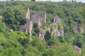
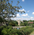
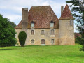
(1) At a T-junction, turn left. Pass a detached house on the left and continue along a grassy path. Walk for a long stretch between two hedges. Note the Château des Cottets high up on the left. Further on, walk briefly alongside the Gartempe on your left. At a three-way junction (marker 75), follow a track to the right.

Yellow signpost no. 7

(2) At the next junction, follow a small road to the left and cross the hamlet of Lussais. At the junction, continue straight on into a dead-end. At the corner of No. 23, turn left onto a path between two hedges.

(3) At the end, follow a track to the right. Continue further along a shaded path. Walk briefly alongside the Anglin on your left.

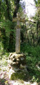
(4) At a junction (stone cross on the right), turn right and climb gently. When you reach an isolated house, follow a small road straight ahead and continue climbing.

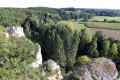
(5) When the road bends to the right, take a path on the left. Immediately ignore a track on the left and veer to the right. Follow the path, taking care of the cliffs on the left. At a fork, veer left and head downhill. Continue along the path, which is overgrown with vegetation. Further on, walk past a cemetery on your right and then follow a small road.

Unmarked

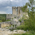
(6) At the junction, turn left and head for the bridge over the Anglin to enjoy a superb view of the castle ruins and the village of Angles-sur-l'Anglin.

(7) Retrace your steps.

Yellow signpost no. 7 + red and white markings

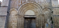
(6) Follow a narrow lane and pass by the foot of Sainte-Croix Church. Turn left along the lane, come out onto a road and follow it to the right. When the road bends left, continue straight ahead down a one-way lane and head uphill.

(8) Cross the D2 (cross), pass a shed on the right and continue straight on. At a detached house, turn left onto a track. Pass a cross on the left and, at the fork that appears immediately, turn left onto a path. Descend slightly, ignore a turn-off on the left and climb back up. Walk for a long time along the shaded path.

Yellow signpost no. 7

(9) You’ll come out onto a small road; follow it to the right. After about fifty metres, ignore a turn-off on the left, turn right with the road and cross the hamlet of Les Liboureaux.

(10) At No. 8, take a track to the left. Pass under some power lines, ignore a path coming from the left and continue along a small road.

(11) At the junction, turn right onto a small road. Further on, walk past a livestock building on your left and then a shed on your right. Turn left and then right at a gate and continue along the road.

(12) Cross the D5 and follow a track opposite. Further on, rejoin the tarmac.

Yellow signpost no. 6

(13) At the stop sign, turn left, cross Avenue de l’Europe on the right-hand side and head downhill. Ignore all the side streets on the left and you will soon reach the starting car park (S/E).

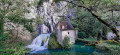
Waypoints

  1. S/E : mi 0 - alt. 246 ft - Place de l'Étoile
  2. 1 : mi 0.68 - alt. 230 ft - La Basse Varenne
  3. 2 : mi 1.97 - alt. 269 ft - Lussais
  4. 3 : mi 2.33 - alt. 233 ft - T-junction
  5. 4 : mi 3.29 - alt. 236 ft - Crossroads - cross
  6. 5 : mi 3.67 - alt. 348 ft - Start of the trail
  7. 6 : mi 4.27 - alt. 230 ft - Église Sainte-Croix (Angles-sur-l'Anglin)
  8. 7 : mi 4.31 - alt. 220 ft - Bridge over the - Anglin (rivière) - Affluent de la Gartempe
  9. 8 : mi 4.64 - alt. 331 ft - Crossing the D2
  10. 9 : mi 5.56 - alt. 351 ft - T-junction
  11. 10 : mi 5.72 - alt. 374 ft - Les Liboureaux
  12. 11 : mi 6.18 - alt. 358 ft - Crossroads
  13. 12 : mi 6.88 - alt. 381 ft - Crossing the D5
  14. 13 : mi 7.57 - alt. 341 ft - Stop sign
  15. S/E : mi 7.82 - alt. 246 ft - Place de l'Étoile

Notes

Hiking boots recommended.

Public toilets at Place de l’Étoile (S/E). Water point inside the cemetery just before (6). Bars, restaurants, a bakery and a mini-market in Saint-Pierre-de-Maillé (S/E).

Route designed and signposted by the Sud-Vienne-Poitou Tourist Office and certified by the Vienne departmental FFR committee. Signposting is only present at major junctions. A detailed map is useful (at the very least the one accompanying this description).

Walk completed by the author on 3 June 2023.

Worth a visit

- Pleasant, shaded walks through hedgerows and meadows.
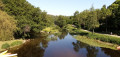
- Views, sometimes fleeting, of the Gartempe and the Anglin.
- Hosanna cross in the cemetery ahead (6).
- Sainte-Croix Church (12th–13th centuries) (6).
- From the bridge over the Anglin (7), superb views of the old fortified castle and the village of Angles-sur-l'Anglin.

In addition to the walk, starting from (7), you can visit the beautiful village of Angles-sur-l'Anglin and the remains of its fortified castle, as well as a reconstruction of the rock carvings at Roc aux Sorciers.

Reviews and comments

4.9 / 5
Based on 4 reviews

Reliability of the description
5 / 5
Ease of following the route
5 / 5
Route interest
4.8 / 5
JOUINOT THIERRY
JOUINOT THIERRY

Overall rating : 5 / 5

Date of your route : Sep 08, 2025
Reliability of the description : ★★★★★ Very good
Ease of following the route : ★★★★★ Very good
Route interest : ★★★★★ Very good
Very busy route : No

A magnificent hike: paths surrounded by dry stone walls covered in vegetation, few busy roads to cross, a visit to Marie Besnard's birthplace, and of course the impressive ruins of Angles (which I already knew).
Remarkable landscapes, heritage and cattle. Don't miss this route if you're in the area.

Thierry

Machine-translated

nicole.l
nicole.l

Overall rating : 5 / 5

Date of your route : May 29, 2025
Reliability of the description : ★★★★★ Very good
Ease of following the route : ★★★★★ Very good
Route interest : ★★★★★ Very good
Very busy route : No

A very fine route, varied between plains and wooded areas, sometimes close to the Gartempe or the Anglin. Beautiful views of Angles-sur-l'Anglin.

Machine-translated

Patrixdemex
Patrixdemex

Overall rating : 4.7 / 5

Date of your route : May 09, 2025
Reliability of the description : ★★★★★ Very good
Ease of following the route : ★★★★★ Very good
Route interest : ★★★★☆ Good
Very busy route : No

We set off from Angle-sur-L'Anglin and completed this route in 3 hours and 40 minutes. The route is easy to follow. The scenery is fairly varied, with no technical difficulties. The only downside in May is that some of the unmaintained paths are overgrown with tall grass. It’s a good idea to wear trousers.
Thanks for the route

Machine-translated

juempi
juempi

Overall rating : 5 / 5

Date of your route : Jun 04, 2024
Reliability of the description : ★★★★★ Very good
Ease of following the route : ★★★★★ Very good
Route interest : ★★★★★ Very good
Very busy route : No

We did this route today – it’s really well put together. We know Angles, so we didn’t stop there, but we did pass through a street where a charming gentleman was selling postcards! We’ll definitely be back, of course 🙂

Machine-translated

Other walks in the area

For more walks, use our search engine .

The GPS track and description are the property of this route's author. Please do not copy them without permission.