


Refine your search for walks in Meranges
Meranges walks


 The Campcardos circular route from the Malniu refuge
 Visorando Member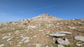
 6.89 mi
 +3,005 ft
 -2,989 ft
 5h 45
5h 45
 Moderate
 Departure from Meranges (Girona)
This hike, which starts in Spain, will take you to the summit of one of the three “2,900-metre peaks” in the Pyrénées-Orientales: Campcardos or Puig Pedros (2,915 m). It offers contrasting landscapes, ranging from high-altitude plateaus reminiscent of steppes to jagged ridges, ponds and balcony-like paths through beautiful forests of mountain pine. The border runs across the summit of Campcardos, making it the highest point in the province of Girona, ahead of Puigmal d’Err (2,910 m).
From the Joaquim Folch i Girona mountain refuge to Latour-de-Carol
 12.57 mi
+951 ft
-4,688 ft
6h 35
12.57 mi
+951 ft
-4,688 ft
6h 35
 Difficult
Departure from Meranges (Girona)
Difficult
Departure from Meranges (Girona)
The final stage of the route linking Ax-les-Thermes to Latour-de-Carol. A downhill stage through the valley, the return leg – pleasant but a little long – with a risk of getting lost as you approach the villages. You should also bear train timetables in mind.
The Refuge and the Estany de Malniu
9.15 mi
+1,506 ft
-1,496 ft
5h 30
Moderate
Departure from Guils de Cerdanya (Girona)
A beautiful, unspoilt route across the border, starting from the Guils Fontanera Nordic ski resort in southern Catalonia, taking us to the Refuge and then on to the Estany de Malniu.
Portella Blanca d’Andorra, Pic Negre d’Envalira and Pic d’Engaït
 14.57 mi
+4,429 ft
-4,419 ft
10h 35
14.57 mi
+4,429 ft
-4,419 ft
10h 35
 Very difficult
Departure from Porta (Pyrénées-Orientales)
Very difficult
Departure from Porta (Pyrénées-Orientales)
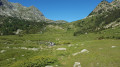
A hike leading to the French-Spanish-Andorran borders via the Chemin des Bonshommes and the final stage ofthe GR®7. It offers an alternative to the classic ascent of Pic Negre d’Envalira and Pic d’Engaït (from Pas de la Casa, which is shorter) through the magnificent Ribera de Campcardós valley.
La Porteille Blanche d'Andorra
 11.09 mi
+3,379 ft
-3,350 ft
8h 00
Difficult
Departure from Porta (Pyrénées-Orientales)
11.09 mi
+3,379 ft
-3,350 ft
8h 00
Difficult
Departure from Porta (Pyrénées-Orientales)
A fairly long and challenging hike leading to the Porteille Blanche d'Andorre tripoint on the French-Spanish-Andorran border.
Throughout the hike, you will follow the legendary Bonshommes trail (GR®107) which runs alongside the wild Campcardos valley.
From Pas de la Case to the Joaquim Folch i Girona Refuge
 8.68 mi
+4,058 ft
-3,114 ft
7h 30
Difficult
Departure from Porta (Pyrénées-Orientales)
8.68 mi
+4,058 ft
-3,114 ft
7h 30
Difficult
Departure from Porta (Pyrénées-Orientales)
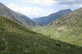
The fourth stage of the route linking Ax-les-Thermes to Latour-de-Carol. A beautiful high-mountain stage with no significant difficulties but featuring some elevation gain.
This stage sets off from Pas de la Case, followed by two small passes and then, a little further down, the Portella Blanca – the ‘white gate’ – which opens onto the descent into the Engaït valley before a final pass. It ends with the descent to the Jhaquim Floch i Girona refuge, which is in poor condition but offers a safe shelter.
Lakes of Cirque dels Pessons
6.37 mi
+1,726 ft
-1,696 ft
4h 25
Difficult
Departure from Encamp (Andorra)
Difficult hike, best done in good weather as many areas are unmarked.
Montmalús Peak
 5.61 mi
+2,349 ft
-2,343 ft
4h 40
Difficult
Departure from Encamp (Andorra)
5.61 mi
+2,349 ft
-2,343 ft
4h 40
Difficult
Departure from Encamp (Andorra)
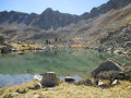
The first part of this hike consists of a long, steady climb up to the Collada de Montmalús and then on to the peak itself, offering exceptional views of the high Andorran peaks and the Cirque dels Pessons. On the descent, an off-trail section allows you to discover three beautiful, unnamed lakes, which are rarely or never visited, save perhaps by a few trout anglers. You will, however, need to take care when tackling the rather rugged and difficult terrain.
Circular route from Porté-Puymorens station to L’Estany de Font Viva
10.78 mi
+1,385 ft
-1,385 ft
6h 10
Difficult
Departure from Porta (Pyrénées-Orientales)
From the SNCF station to the Estany de Font Viva overlooking the valley. Enjoy a circular walk taking in the village, the forest, a stream, a torrent, the magnificent Étang de la Fontaine Vive and Lac d’el Passet. Make the most of the Carol-Cerdagne valley.
Tour of the Cirque dels Pessons lakes
 6.44 mi
+1,699 ft
-1,703 ft
4h 25
Difficult
Departure from Encamp (Andorra)
6.44 mi
+1,699 ft
-1,703 ft
4h 25
Difficult
Departure from Encamp (Andorra)
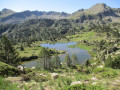
This hike allows you to discover most of the lakes in the Cirque des Pessons while avoiding the crowds of hikers thanks to two off-trail sections that are therefore very little or not at all frequented. No fewer than sixteen lakes are on the itinerary, some identified and others unnamed. A wild landscape with rounded rocks shaped by ancient glaciers, streams and crystal-clear lakes, mountain pines... all this makes for an unforgettable experience, despite the difficulty of some sections.
Water path in Bolvir
 Association / Club / Walk leader
 3.22 mi
+240 ft
-246 ft
1h 40
3.22 mi
+240 ft
-246 ft
1h 40
 Easy
Departure from Bolvir (Girona)
Easy
Departure from Bolvir (Girona)
Classic walking roundtrip through the sorroundings of Bolvir, a village in Baixa Cerdanya, Catalonia.
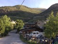
Mas de Franc - Porté-Puymorens
 7.22 mi
+2,395 ft
-2,247 ft
5h 25
Difficult
Departure from Enveitg (Pyrénées-Orientales)
7.22 mi
+2,395 ft
-2,247 ft
5h 25
Difficult
Departure from Enveitg (Pyrénées-Orientales)
Part of the long (9-day) itinerary around Carlit, hiking from refuge to refuge, based on the Peyrics tour and using various marked trails.
Porté Puymorens - Refuge des Bésines
 10.33 mi
+3,419 ft
-1,919 ft
7h 45
Difficult
Departure from Porté-Puymorens (Pyrénées-Orientales)
10.33 mi
+3,419 ft
-1,919 ft
7h 45
Difficult
Departure from Porté-Puymorens (Pyrénées-Orientales)
It is part of the long (9-day) itinerary around the Carlit, travelling from refuge to refuge, based on the Peyrics tour and using various marked trails.
Hamlets of Enveitg
 6.30 mi
+1,115 ft
-1,112 ft
3h 50
Moderate
Departure from Enveitg (Pyrénées-Orientales)
6.30 mi
+1,115 ft
-1,112 ft
3h 50
Moderate
Departure from Enveitg (Pyrénées-Orientales)
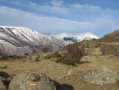
A beautiful, unspoilt getaway that will allow you to discover three hamlets belonging to Enveitg.
The Puymorens or Pimorent mines
 5.06 mi
+774 ft
-768 ft
3h 00
Easy
Departure from Porté-Puymorens (Pyrénées-Orientales)
5.06 mi
+774 ft
-768 ft
3h 00
Easy
Departure from Porté-Puymorens (Pyrénées-Orientales)
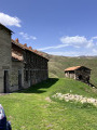
A pleasant, family-friendly route leading to the historic mining site of Puymorens, with stunning panoramic views throughout the walk.
Puig de Coma d'Or from the Col de Puymorens
10.20 mi
+3,533 ft
-3,527 ft
7h 45
Difficult
Departure from Porté-Puymorens (Pyrénées-Orientales)
This hike, which is not particularly difficult apart from its distance and significant elevation gain, leads to Puig de la Coma d'Or for a spectacular finale. You can see the whole of Lanoux as well as Carlit, the next destination. You feel very small in the midst of this immensity, and respect is called for... I think.
Around Ur
 5.87 mi
+381 ft
-404 ft
3h 00
Easy
Departure from Ur (Pyrénées-Orientales)
5.87 mi
+381 ft
-404 ft
3h 00
Easy
Departure from Ur (Pyrénées-Orientales)
This cross-border route will take you to Llivia. Take the opportunity to make a short detour to visit this Spanish enclave.
Font Viva lake
 3.19 mi
+673 ft
-656 ft
2h 05
Easy
Departure from Porté-Puymorens (Pyrénées-Orientales)
3.19 mi
+673 ft
-656 ft
2h 05
Easy
Departure from Porté-Puymorens (Pyrénées-Orientales)
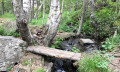
The village of Portè is a well-known holiday destination in the Alta Cerdanya. Many routes are available in its surroundings, hiking the mountains or connecting the nearby lakes. This is probably the most classical one, visiting the Font Viva lake, under the shadows of the Carlit peak (2921 m.). There, you may find many water sources and falls, pines and flowers, wild and domestic animals.
Font Vive circular route to Étang de Lanoux
7.50 mi
+1,670 ft
-1,663 ft
4h 55
Moderate
Departure from Porté-Puymorens (Pyrénées-Orientales)
A lovely hike of moderate difficulty. Stunning views of the surrounding mountains, particularly along the section of the GR®7, which is a flat, balcony-like path on the flank of the Puig de Font Vive. The Étang de Lanoux is the ideal spot for a midday break and a picnic.
Font Vive pond
 3.25 mi
+663 ft
-673 ft
2h 05
Easy
Departure from Porté-Puymorens (Pyrénées-Orientales)
3.25 mi
+663 ft
-673 ft
2h 05
Easy
Departure from Porté-Puymorens (Pyrénées-Orientales)
A lovely little loop along the stream and through the forest.
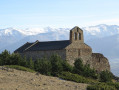
Santa Maria de Belloc Chapel
 3.16 mi
+748 ft
-745 ft
2h 05
Easy
Departure from Dorres (Pyrénées-Orientales)
3.16 mi
+748 ft
-745 ft
2h 05
Easy
Departure from Dorres (Pyrénées-Orientales)
This route will take you to one of the most beautiful viewpoints in the Pyrénées Orientales, at the Santa Maria de Belloc Chapel, along a path that exudes well-being.
Pédourès Pond and Siscar Pond loop.
 8.80 mi
+3,310 ft
-3,304 ft
6h 55
Difficult
Departure from L'Hospitalet-près-l'Andorre (Ariège)
8.80 mi
+3,310 ft
-3,304 ft
6h 55
Difficult
Departure from L'Hospitalet-près-l'Andorre (Ariège)
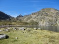
A beautiful hike in Haute Ariège, at the gateway to Andorra. The route includes five lakes and small lakes in a high mountain landscape dotted with streams.
L'Hospitalet near Andorra - Refuge des Bésines
 4.50 mi
+2,359 ft
-180 ft
4h 10
Moderate
Departure from L'Hospitalet-près-l'Andorre (Ariège)
4.50 mi
+2,359 ft
-180 ft
4h 10
Moderate
Departure from L'Hospitalet-près-l'Andorre (Ariège)
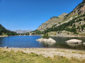
Part of the long route (9 stages) around Carlit, hiking from refuge to refuge, based on the Tour des Pérics and using various marked trails,GRP® andGR® in the area.
Initial stage designed to ease you gently into the hike.
Tour of Carlit
65.26 mi
+17,405 ft
-17,497 ft
9 days
Difficult
Departure from L'Hospitalet-près-l'Andorre (Ariège)
Long itinerary around Carlit, hiking from refuge to refuge, based on the Peyrics tour and using various marked trails.Two possible variations to modify the circuit: from 9 stages to 7 stages
Ascent of the Carlit: 1 day and return to Les Bouillouses Return via the Lanoux lake: 1 extra day, passing by the foot of the Carlit and the Bésines refuge, or direct return from Porté to L'Hospitalet.
Hike completed in July-August 2017
The Étang des Bésines and its refuge
 7.95 mi
+2,037 ft
-2,024 ft
5h 25
Moderate
Departure from L'Hospitalet-près-l'Andorre (Ariège)
7.95 mi
+2,037 ft
-2,024 ft
5h 25
Moderate
Departure from L'Hospitalet-près-l'Andorre (Ariège)
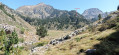
A high-altitude forest walk to one of the most famous lakes in the Haute-Ariège.
This walk through a very wooded and therefore very shady area takes you to a large lake before starting the climb to an ideally located refuge. From this refuge, you can then reach others, En Beys and Les Bouillouses.
Pic de Nérassol via the Étang du Siscar and the Étang de Pédourrés
10.81 mi
+3,950 ft
-3,940 ft
8h 25
Difficult
Departure from L'Hospitalet-près-l'Andorre (Ariège)
Ascent to the Pic de Nérassol via the Ruisseau du Siscar valley and the lake of the same name. Descent to the Étang de Pédourrés and return via the Jasse de Brounic. A day trip is possible, with a return journey from Toulouse by train.
Étang de Couart
 9.70 mi
+3,159 ft
-3,130 ft
7h 15
Difficult
Departure from L'Hospitalet-près-l'Andorre (Ariège)
9.70 mi
+3,159 ft
-3,130 ft
7h 15
Difficult
Departure from L'Hospitalet-près-l'Andorre (Ariège)
Ascent to the Étang de Couart via the Jasse de Brounic and the Étang de Pédourrés.
From L’Hospitalet-près-l’Andore to Mérens-les-Vals via Porteille des Bésines
 10.31 mi
+3,353 ft
-4,577 ft
7h 40
Difficult
Departure from L'Hospitalet-près-l'Andorre (Ariège)
10.31 mi
+3,353 ft
-4,577 ft
7h 40
Difficult
Departure from L'Hospitalet-près-l'Andorre (Ariège)
A hike from station to station with 900 m of ascent and nearly 1,300 m of descent, passing through the Refuge des Bésines and the eponymous Porteille, and following theGR®107CandGR®10trails.
Puig de Coma d'Or loop from L'Hospitalet-près-l'Andorre
 14.68 mi
+5,115 ft
-5,115 ft
7 hrs
Very difficult
Departure from L'Hospitalet-près-l'Andorre (Ariège)
14.68 mi
+5,115 ft
-5,115 ft
7 hrs
Very difficult
Departure from L'Hospitalet-près-l'Andorre (Ariège)
A magnificent, demanding day hike in the high mountains towards Puig de Coma d'Or (2,826 m), offering a splendid 360° panorama of the Catalan, Ariège and Andorran Pyrenees. Loop starting from L'Hospitalet-près-l'Andorre station, directly accessible by TER from Toulouse.
An overnight stay at the Refuge des Bésines is possible to split this demanding hike into two less difficult hikes.
Ensagents Refuge and Lakes
 6.08 mi
+2,192 ft
-2,192 ft
4h 40
Moderate
Departure from Encamp (Andorra)
6.08 mi
+2,192 ft
-2,192 ft
4h 40
Moderate
Departure from Encamp (Andorra)
A fairly demanding hike through mountain pines and rhododendrons to reach the refuge and then the Étangs d'Ensagents, set in a predominantly mineral environment. The calm, the omnipresent water and the beauty of the landscapes more than compensate for the considerable effort required to negotiate a few very steep passages. A breath of fresh air just a few kilometres from the consumer frenzy of Pas de la Case.
Estany de la Cabana Sorda and return via Val d'Inclès
 8.61 mi
+2,503 ft
-2,503 ft
6h 10
Difficult
Departure from Canillo (Andorra)
8.61 mi
+2,503 ft
-2,503 ft
6h 10
Difficult
Departure from Canillo (Andorra)
This beautiful and demanding hike allows you to discover several high-altitude lakes in an exceptional environment, including Estany del Querol, Estany de la Cabana Sorda and Estany d'Anrodat, to name but the most important. Other small lakes, some of which are unfortunately drying up, dot the route. After a particularly challenging descent, the return journey takes you along the Chemin de l'Ubac d'Inclès, which allows you to discover this beautiful valley as you walk alongside the Riu d'Inclès, close to pastures where cows, donkeys and horses graze in the summer. However, you will need to save your strength for the climb back up to the car park, which can be very tiring at the end of the walk.
Tosa de Siscaro and Pic de la Cabaneta via the Vall d'Incles
 7.69 mi
+3,360 ft
-3,330 ft
6h 30
Difficult
Departure from Canillo (Andorra)
7.69 mi
+3,360 ft
-3,330 ft
6h 30
Difficult
Departure from Canillo (Andorra)
With its torrent, Spanish stone pines and rhododendrons, the Vall d’Incles is a small, protected gem, far from the crowds thronging at Pas de la Casa or Andorra la Vella. The ascent of Pic de la Cabaneta follows the Siscaro ponds before tackling the very steep climb leading to the ridge and then to Tosa de Siscaro, which lies at the same altitude as its better-known neighbour. Sustained effort is rewarded with an exceptional panorama.
Refuge des Bésines - Barrage des Bouillouses
 10.15 mi
+2,152 ft
-2,434 ft
6h 35
Moderate
Departure from Mérens-les-Vals (Ariège)
10.15 mi
+2,152 ft
-2,434 ft
6h 35
Moderate
Departure from Mérens-les-Vals (Ariège)
Modification on 12 September 2022: validated on Sunday 11 September 2022.
Fourth and final stage of the Tour Des Pérics. The scenery is consistently stunning.
This is a fairly long stage, with cars being collected by shuttle buses.
See practical information on the Tour des Pérics.
Refuge des Bésines - L'Hospitalet near Andorra
 4.42 mi
+121 ft
-2,297 ft
2h 10
Easy
Departure from Mérens-les-Vals (Ariège)
4.42 mi
+121 ft
-2,297 ft
2h 10
Easy
Departure from Mérens-les-Vals (Ariège)
Part of the long (9-day) itinerary around Carlit, hiking from refuge to refuge, based on the Peyrics tour and using various marked trails.
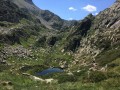
Refuge des Bésines - Refuge d'En Beys
 4.85 mi
+1,532 ft
-1,978 ft
3h 35
Difficult
Departure from Mérens-les-Vals (Ariège)
4.85 mi
+1,532 ft
-1,978 ft
3h 35
Difficult
Departure from Mérens-les-Vals (Ariège)
Part of the long (9-day) itinerary around Carlit, hiking from refuge to refuge, based on the Peyrics tour and using various marked trails.
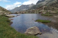
Refuge des Bésines - Refuge d'en Beys
 8.43 mi
+3,015 ft
-3,435 ft
6h 30
Difficult
Departure from Mérens-les-Vals (Ariège)
8.43 mi
+3,015 ft
-3,435 ft
6h 30
Difficult
Departure from Mérens-les-Vals (Ariège)
The third stage takes you through Cerdagne, in the Eastern Pyrenees.The return trip along the ridge (3) to (4) should be done in the absence of fog, rain or frost.I have classified this hike as difficult due to the ridge crossing from (4) to (5) and the descent through the rocks from the Faury pond (10) to the En Beys refuge (E).There are numerous places to stop for a break at the lakes along the way.Be careful of the multiple marked trails:GR®®10-GR®®107-GR®®107-GR®®107(variant) andGRP®® Tour des Pérics -GRP®® Tour des Montagnes d'Ax. Follow the description, the GPX track and the signs on the ground carefully.
⚠️ From (8) to (E)you are in the Orlu National Hunting and Wildlife Reserve, where regulations must be observed. See practical information.
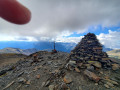
Pic de L'Estanyo from Canillo (Andorra)
 11.32 mi
+4,754 ft
-4,760 ft
9h 20
Difficult
Departure from Canillo (Andorra)
11.32 mi
+4,754 ft
-4,760 ft
9h 20
Difficult
Departure from Canillo (Andorra)
Pic de l'Estanyo is the second highest peak in Andorra (2,915 m). The view of the other peaks in Andorra is magnificent. It is accessible from Sorteny or Ransol for the most well-known routes. It can also be accessed from Canillo, which is the subject of this guide.
This is a long hike with a significant elevation gain. The trail is generally well marked up to Estany Gran, then you have to follow the cairns and the trail where it exists.