From the Joaquim Folch i Girona mountain refuge to Latour-de-Carol

The final stage of the route linking Ax-les-Thermes to Latour-de-Carol. A downhill stage through the valley, the return leg – pleasant but a little long – with a risk of getting lost as you approach the villages. You should also bear train timetables in mind.

This walk is part of a multi-day hike: From Ax-les-Thermes to La Tour de Carol

Details

1607263
Creation:
Last update:
Last review:
  • Walking
    Activity: Walking
  • ↔
    Distance: 12.57 mi
  • ◔
    Average duration: 6h 35 
  • ▲
    Difficulty: Difficult

  • ⚐
    Back to start: No
  • ↗
    Ascent: + 951 ft
  • ↘
    Descent: - 4,688 ft

  • ▲
    Highest point: 7,802 ft
  • ▼
    Lowest point: 3,993 ft
  • ⚐ Country: Spain
  • ⚐
    Area: Pyrenees
  • ⚐ City: Meranges 
  • ⚑
    Start: N 42.48096° / E 1.745605°
  • ⚑
    End: N 42.460053° / E 1.903667°
  • ❏
    IGN map(s): Ref. 2249OT, 2249OTR
  • Hour-by-hour weather

Photos

Description of the walk

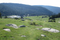
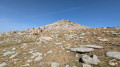
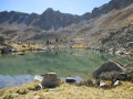
(S) Set off from the refuge on the GR®11, which descends gently, heading south-east (red and white markings). The route runs almost along the hillside. Finally, head down towards the Estany del Rugi o Sec and reach the Malniu Refuge.

(1) Continue eastwards on the GR®11, which is not well signposted and sometimes overlaps with other yellow-marked trails.
Please note: very shortly after the refuge, a cross indicates that you should not continue on the GR®11. This is incorrect; do not follow it and carry on along the GR®.

The GR®11 trail is less visible for a few hundred metres; find your way by following the yellow markings. Continue along the path that climbs up to the junction signposting Estany de Malniu on the left. Turn right towards Guils, Guers and Bolvir onto the yellow-marked path heading north-east; very soon, the GR®11 route reappears, though it is marked more or less clearly.

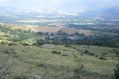
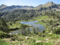
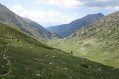
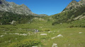
Carry on south-east through the lush green valley until you reach a track used by cars.

(2) Follow the track to the left, heading north-east, to reach the approach to the Refugi de la Feixa.

(3) Just before the refuge, continue to follow the clearly markedGR®11, which branches off to the right between the fields.

(4) Cross a track running at right angles (be careful, there are herds of livestock). The signposting is poor but reappears further on, allowing you to follow the path without difficulty to reach the village of Guils de Cerdanya.

(5) Continue along theGR®11as you leave the village and head for the village of Saneja. At the entrance to the village, leave theGR®11and turn left towards the north-east.

(6) At the top of the village, change direction and take the dirt track leading off to the left, north-west. This dirt track has no name, but you can’t go wrong – it’s flat and leads very pleasantly to Iravals. Cross the D34B and continue through the village. Cross the D34B, the railway line and the Riu de Querol.

(7) Turn right onto the D34B, which leads to Latour-de-Carol, to reach the international station (E) via Rue de la Gare, which is poorly signposted (D34A) . Avoid taking the N20, as it takes a detour and is too dangerous.

Waypoints

  1. S : mi 0 - alt. 7,802 ft - Joaquim Folch i Girona Mountain Hut
  2. 1 : mi 2.82 - alt. 6,995 ft - Malniu Mountain Hut
  3. 2 : mi 4.23 - alt. 7,211 ft - Track
  4. 3 : mi 4.9 - alt. 7,152 ft - Refugi de la Feixa
  5. 4 : mi 6.61 - alt. 6,286 ft - Junction with a track
  6. 5 : mi 8.61 - alt. 4,567 ft - Guils de Cerdanya
  7. 6 : mi 10.21 - alt. 4,019 ft - Sanéja: start of the path to Latour-de-Carol
  8. 7 : mi 11.72 - alt. 4,072 ft - Iravals - Carol (rivière) - Affluent du Sègre
  9. E : mi 12.57 - alt. 4,039 ft - Latour-de-Carol railway station (Enveitg)

Notes

A pleasant final stage, in low mountain terrain, though a little long. You must, however, complete it in time to arrive in Latour-de-Carol by 5.21 pm – the time of the last train – otherwise the next one leaves the following morning at 7.21 am.

There is plenty of water along this stage, but the presence of herds means you should take precautions.

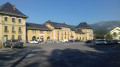
(5) Guils de Cerdanya. You can have lunch at the restaurant if you’re on schedule; drinking water is available opposite the restaurant.

Important
There is a more direct route, shown on the OSM map, which leads straight from Guils de Cerdanya to Latour-de-Carol without passing through Saneja; when I did the walk, it didn’t seem to be signposted and felt rather haphazard, but it follows the GRT 71, which should now be signposted. To take this route:
- turn left as you leave the village, then after two bends to the right, take the path branching off to the right at the first junction,
- follow it and, after the first right-hand bend, do not turn left at the junction but carry on, then take the path leading off to the left,
- this leads to Iravals,
- ignore the final junction leading off to the left and rejoin the route described above.
However, whilst this route is more direct, there is a risk of getting lost as there are no signposts; the simplest option is to follow the GR® 11 to the village of Saneja and then head for Latour-de-Carol. The route is signposted as the GR® 11 as far as the village of Saneja; after that, the path is clearer (at the junction with the tarmac road leading uphill).

Worth a visit

(5) Guils de Cerdanya: a very pretty, well-restored village.
(6) There is a very pleasant campsite in Saneja if the stage is too long and you are running out of time to catch the last train.

Always be cautious and plan ahead when you're outdoors. Visorando and the author of this route cannot be held responsible for any accidents occurring on this route.

The GR® and PR® markings are the intellectual property of the Fédération Française de Randonnée Pédestre.

Other walks in the area

For more walks, use our search engine .

The GPS track and description are the property of this route's author. Please do not copy them without permission.