From L’Hospitalet-près-l’Andore to Mérens-les-Vals via Porteille des Bésines

A hike from station to station with 900 m of ascent and nearly 1,300 m of descent, passing through the Refuge des Bésines and the eponymous Porteille, and following theGR®107CandGR®10trails.

Details

1369999
Creation:
Last update:
Last review:
  • Walking
    Activity: Walking
  • ↔
    Distance: 10.31 mi
  • ◔
    Average duration: 7h 40 
  • ▲
    Difficulty: Difficult

  • ⚐
    Back to start: No
  • ↗
    Ascent: + 3,353 ft
  • ↘
    Descent: - 4,577 ft

  • ▲
    Highest point: 7,648 ft
  • ▼
    Lowest point: 3,448 ft

Photos

Description of the walk

Start from L’Hospitalet SNCF station (1,434 m).

(S) Walk up from the car park towards the village. Take care when crossing the RN22, which descends from the Col du Puymaurens.
Head down the main street and turn left immediately to reach the actual start of the path at the foot of the mountain.

(1) TheGR®107trail climbs to the left up the mountainside. Take care when crossing the RN22 again.
After two hairpin bends and crossing the first stream, you’ll reach a junction

(2) Continue straight on along theGR®107C, still along the mountainside with a fine view of the Ariège valley, both upstream and downstream. At the Crête du Tos Bessateil, the path turns noticeably to the right, due east, and heads into the valley of the Ruisseau des Bésines.
Continue the gentler climb, following the ridge more or less straight ahead, to the Bésines dam.

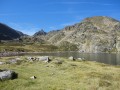
(3) Walk round the Étang des Bésines on the right over relatively flat ground.
Cross several streams feeding into the pond, then a footbridge.

(4) As the path begins to climb again, turn left at a Fork in the road, moving away from the stream and continuing uphill. At the foot of the refuge, rejoin theGR®10and follow it to the left for a short climb to the Refuge des Bésines.

(5) Set off again, following theGR®10GRP® Tour de la Montage d’Ax towards Mérens (estimated walking time: 4 hours 10 minutes).

(6) TheGR®10route shown on the IGN map no longer exists. Turn left onto a path towards the Ruisseau des Bésines, which leads onto another path climbing up from the Étang des Bésines.

(7) Continue along the Ruisseau des Bésines. The gradient and altitude make the final stretch of the climb difficult, as it takes place over scree.

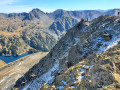
(8) A mandatory break at the Porteille (pass) des Bésines, with views over both valleys.
Begin the relatively stony descent to the charming Étang de l’Estagnas.

(9) Continue down the very rugged and steep path, running along a ledge 10 to 20 metres above the Estagnas torrent.

(10) Once you reach La Présasse, return to a less steep path that branches off to the left. Follow the path which runs very close to the Ruisseau du Nabre, first on the left, then on the right bank after crossing a footbridge.
Pass the Saut du Nabre waterfall on your left. Continue the descent, still on theGR®10(andGRP®).

(11) At a fork in the road, stay on theGR®10GRP® to the left and pass close to a sulphurous spring. Follow the path down to the hamlet of Vives, where you’ll come to a stretch of road.

(12) At a wash house just past the bridge over the Ruisseau de Saint-Touret, turn left and carefully cross the Route de Vives (RD322) several times.

(13) At the foot of the church, cut across another bend in the D322 and continue along the path. Return to the right bank of the Nabre. Stay as close to the river as possible and follow the D322. Turn left then right to pass under the railway line. Reach the N20.

(14) Turn right, walk along the pavement beside the main road and, a few hundred metres further on, turn into Rue de la Gare, which leads to Mérens-les-Vals SNCF station (1,056 m) (E).

Waypoints

  1. S : mi 0 - alt. 4,685 ft - Gare d'Andorre-L'Hospitalet
  2. 1 : mi 0.2 - alt. 4,715 ft - Start of the GR107 trail
  3. 2 : mi 0.93 - alt. 5,220 ft - Junction GR107 – GR107C
  4. 3 : mi 3.56 - alt. 6,467 ft - Étang des Bésines
  5. 4 : mi 4.33 - alt. 6,545 ft - Fork in the road
  6. 5 : mi 4.55 - alt. 6,854 ft - GR10 – GRP junction - Refuge des Bésines
  7. 6 : mi 4.85 - alt. 6,909 ft - Junction
  8. 7 : mi 5.04 - alt. 6,854 ft - Crossroads
  9. 8 : mi 5.77 - alt. 7,605 ft - Porteille des Bésines
  10. 9 : mi 6.28 - alt. 6,745 ft - Étang de l'Estagnas
  11. 10 : mi 6.71 - alt. 6,155 ft - La Présasse
  12. 11 : mi 9.06 - alt. 4,304 ft - Sulfureuse Spring
  13. 12 : mi 9.49 - alt. 3,885 ft - Washing house
  14. 13 : mi 9.62 - alt. 3,780 ft - Église Saint-Pierre (Mérens-d'en-Haut)
  15. 14 : mi 10.08 - alt. 3,461 ft - N20 road - Ariège (rivière)
  16. E : mi 10.31 - alt. 3,461 ft - Gare de Mérens-les-Vals

Notes

The Refuge des Bésines is en route, offering meals, drinks and a lodge if required.
Stopover lodge du Nabre farmhouse – Merens

There is a railway station at both the start and finish, making it easy to return to the starting point via a short train journey through a circular tunnel (quite rare in France), or to travel from further afield (Toulouse, Foix) without the hassle of driving to the starting point and back again.

Timetable for the Toulouse – Latour-de-Carol-Enveitg line
pdf

High-altitude hike: ensure you have the necessary equipment; avoid this hike in the event of thunderstorms.
Check snow conditions at the pass outside the summer season.

Worth a visit

Étang des Bésines
Porteille des Bésines
Marmots
Mérens horses
The Saut du Nabre
Iron-rich spring
Nabre Mountain Hut

Always be cautious and plan ahead when you're outdoors. Visorando and the author of this route cannot be held responsible for any accidents occurring on this route.

The GR® and PR® markings are the intellectual property of the Fédération Française de Randonnée Pédestre.

Reviews and comments

5 / 5
Based on 2 reviews

Reliability of the description
5 / 5
Ease of following the route
5 / 5
Route interest
5 / 5
User 17096891

Overall rating : 5 / 5

Date of your route : Apr 09, 2023
Reliability of the description : ★★★★★ Very good
Ease of following the route : ★★★★★ Very good
Route interest : ★★★★★ Very good
Very busy route : No

This is a lovely hike; the views are magnificent, but it does require a good level of fitness. We (four people aged between 25 and 58) completed this hike over two days. We spent a night in the mountain hut. The walk from L’Hospitalet to the Refuge des Besines took us four hours, and the walk from the Refuge des Besines to Merens-les-Vals took us four and a half hours. There was snow at the top, so our heavier rucksacks slowed us down. I’d like to do it again in September.

Machine-translated

Est_
Est_

Overall rating : 5 / 5

Date of your route : Jun 05, 2022
Reliability of the description : ★★★★★ Very good
Ease of following the route : ★★★★★ Very good
Route interest : ★★★★★ Very good
Very busy route : No

A brilliant day’s hike,

the GR trail is well signposted, with the chance to top up on water and coffee at the Bésines refuge, which is always a nice touch!

We did it in early June; there was just one patch of snow left, which was easy to get round, as we reached the Porteille des Bésines.

The number of visitors was reasonable for a Whitsun weekend, though that’s always a matter of opinion.

The lakes along the route are magnificent, and the swarms of mosquitoes at the Étang des Bésines are impressive.

Machine-translated

Other walks in the area

For more walks, use our search engine .

The GPS track and description are the property of this route's author. Please do not copy them without permission.