Country:

 City:
City:


At Grau Roig, park in the lower car park, opposite the rescue centre.
(S/E) Head towards the rescue centre, take the narrow path along the edge of the stream and make your way to the large open area where the various chairlift departures are located.
(1) Turn right onto a wide dirt track which runs alongside a restaurant on your left, then begins a very steep climb in wide hairpin bends. You’ll reach a hairpin bend.
Yellow and red markings
Carry on straight ahead and you’ll soon reach the Estany Primer dels Pessons.
Yellow and red markings + Yellow Circle
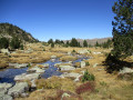
(2) Head left towards the clearly visible signpost and take the path that runs alongside the pond, between weathered rocks and rhododendrons. You’ll reach another signpost situated a few metres before a large wooden sign bearing the inscription “Montmalús”.
GR®7Andorra White and Red Markings
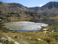
(3) Continue straight ahead. Ford the outflow from the pond (markings are poor at this point) and climb up a wide gully to cross the rocky outcrop that acts as a barrier to the Estany de Coma Estremera. Go round the lake to the left, heading towards the top station of the chairlift and the signpost nearby.
Yellow Circle markings
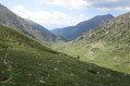
(4) Leave theGR® and follow the correct path heading due south, then begin the long climb towards the Collada de Montmalús.
(5) Look out for the cairn on the left-hand side marking the start of the off-trail section which you will take on the descent, and continue straight on. The slope becomes much steeper and offers little respite until the final stretch, where a few welcome hairpin bends allow you to reach the pass.
Cairns
Leave the marked trail and take the narrow path on the right leading to the summit. You’ll need to use your hands on a short rocky section, then continue at a more leisurely pace to Montmalús.
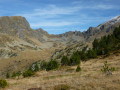
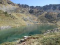
(6) Exceptional 360° views of the high Andorran peaks. To the north-west, make a note of the three unnamed lakes, which are the destination for the descent. Turn back, cross the pass once more and descend to the cairn you spotted on the way up.
Off the trail
(5) Leave the path and head south-east, climbing a small grassy ridge to quickly reach a small basin, which you cross straight across, keeping a large rock on your right. Then choose your route carefully across the gently sloping terrain, favouring the easier grassy sections to reach the first lake quickly.
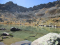
Walk along the left-hand side of the pond. Continue on almost level ground amongst rocks, grassy patches and rhododendrons until you reach the halfway point, then veer left to pass the small ledge leading to the second pond. Cross a flat, very spongy section on the right, reach the banks of the pond and head towards the spillway.
Wade across it, then head up diagonally to the south-east, aiming for the weak point on the small ridge. The route isn’t always obvious, and you’ll need to navigate carefully to make the most of the grassy sections.
Reach the third pond, descend to the bank and follow it as closely as possible: a small scree slope will require you to make a short detour to the left. Continue until you are about twenty metres from the spillway.
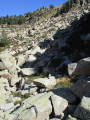
(7) On your left, look out for a small rocky gully interspersed with a few sparse grassy ledges, descending in line with a stream flowing out of the pond. Descend a few metres, cross the stream and continue towards a large pile of boulders, which you should preferably cross on the right, having to use your hands several times.
You’ll come to a grassy section which you should descend, keeping the same direction, until you reach an easily recognisable, long, flat and spongy area. Turn left to cross it, then, once at the end, veer right and you’ll reach another scree slope.
Keep to the right to cross it, reach a sudden drop in the slope and veer right to find a faint track on a very steep descent leading to the foot of a large rock face. It is then essential to spot a small but well-placed cairn, clearly visible directly below the face, marking the start of a route between very large boulders.
(8) Take the time to visualise the route using the following cairns as guides. The path is difficult and you will once again need to use your hands several times. After a short, flatter section with grassy patches, you’ll reach the final scree slope, which you must cross – this time without cairns – by veering to the right and heading for the large grassy area that marks the end of the tricky sections.
(9) Follow the flat path northwards, keeping more or less parallel to the stream flowing down from the second lake you passed earlier. Some sections require you to choose your route carefully to avoid getting your feet wet. Head for the wide, stony track straight ahead, which you’ll reach just after a signpost pointing in the opposite direction towards the Montmalús route.
(10) Turn right and begin the descent, which is steep in places, leading to a flat area where there is a restaurant open during the ski season. Turn left, cross the bridge over the Riu dels Collels and head for the chairlift departure area.
(1) Carry straight on, heading towards the rescue centre, and reach the departure car park (S/E).

 Visorando Member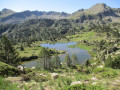

 Moderate