


 Country:

 City:
City:


Coming from the south via the N320, at the entrance to Porté-Puymorens, take the road towards the campsite, then follow the signs to Font Vive. It is a small road running through the valley (right bank). At one point, there will be a toll to continue (€8 per car at the time of publication). Drive to the last car park (P3).
(S/E) Take the path to the north, known as the ‘Circular Walk of the Font Vive Lake’. It climbs quite steeply straight away through the forest, heading due north.
(1) As you emerge from the forest, stay on the track and turn left onto a fairly flat, open stretch, until you reach a junction of paths.
(2) Turn right towards Étang de Font Vive.
(3) Caution: tricky section. Leave the main path and turn left onto an unmarked track, which is fairly visible at first but becomes less so as it crosses a small meadow (a cairn). Curve gently northwards and climb straight up (the path becomes very visible again), leaving a small stream on your left. This will take you up the hillside to the GR®7.
(4) Turn right onto it, walking almost level along the mountainside. Admire the Étang de Font Vive below. Further on, you can see the Étang du Lanoux dam. You’ll come to a small bridge which crosses the river for the first time.
(5) You’ll reach a track suitable for vehicles. Follow this track to a second, wider concrete bridge.
(6) Cross the bridge, leave the GR® and the track at this point, and follow a path that climbs due north before curving north-east to join the track visible further up.
(7) Finish by taking the track on the left, go over the dam and arrive at the edge of the Étang du Lanoux. Admire the view. To the east, the Carlit.
(8) Retrace your steps back to the concrete bridge.
(6) Follow the track down to the left. Continue along the well-marked path which descends through the forest to the Cabane de Coma Joan, in a clearing.
(9) Cross the clearing and continue down the path. You’ll reach a series of hairpin bends in a fairly open area. Descend the bends and arrive below at the junction of this path with the one coming from Lake Font Vive.
(10) Continue downwards, reach a junction of paths at the very bottom and arrive at the river which the route has followed on the right-hand side since the previous junction.
(11) Turn right, cross the bridge over the Rec de Lanós and reach the car park (S/E).
 Association / Club / Walk leader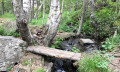
 Easy
Easy 
 Visorando Member
 Difficult
 Very difficult
