From Pas de la Case to the Joaquim Folch i Girona Refuge

The fourth stage of the route linking Ax-les-Thermes to Latour-de-Carol. A beautiful high-mountain stage with no significant difficulties but featuring some elevation gain.
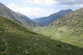
This stage sets off from Pas de la Case, followed by two small passes and then, a little further down, the Portella Blanca – the ‘white gate’ – which opens onto the descent into the Engaït valley before a final pass. It ends with the descent to the Jhaquim Floch i Girona refuge, which is in poor condition but offers a safe shelter.

This walk is part of a multi-day hike: From Ax-les-Thermes to La Tour de Carol

Details

1607264
Creation:
Last update:
Last review:
  • Walking
    Activity: Walking
  • ↔
    Distance: 8.68 mi
  • ◔
    Average duration: 7h 30 
  • ▲
    Difficulty: Difficult

  • ⚐
    Back to start: No
  • ↗
    Ascent: + 4,058 ft
  • ↘
    Descent: - 3,114 ft

  • ▲
    Highest point: 8,816 ft
  • ▼
    Lowest point: 6,821 ft
  • ⚐ Country: France
  • ⚐
    Area: Pyrenees
  • ⚐ City: Porta (66760)
  • ⚑
    Start: N 42.543708° / E 1.733851°
  • ⚑
    End: N 42.480937° / E 1.74569°
  • ❏
    IGN map(s): Ref. 2249OT, 2249OTR
  • Hour-by-hour weather

Photos

Description of the walk

(S) From Pas de la Case, head due south towards Estany de les Abelletes, following the border as closely as possible. To do this, follow Avenue d’Encamp; at the first junction, turn left (both roads have the same name), then, at the second junction, turn right and continue to Estany de les Abelletes.

(1) Go round it on the right, following the well-marked path which climbs gradually, still within the ski area, and heads towards the Coll dels Isards.

(2) Continue along the path towards a second pass, also called Coll dels Isards, which is clearly visible. You’ll reach it after climbing about 100 metres in altitude, having passed through a sort of hollow between the two passes.

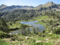
(3) Leave Andorra and cross into France. Continue along the same path and enter the Camperardos Valley alongside the Estany Negre or Estany de les Passaderes.

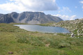
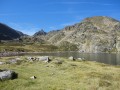
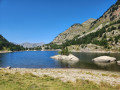
(4) Walk along the eastern side of this small lake, then head slightly lower down (south-south-west) towards the Portella Blanca d’Andorra, which is effectively a sort of undulating white pass that is very clearly visible and extremely easy to cross.

(5) There, join the GR®107, which heads first westwards and then south-westwards on a gentle descent. You’ll first cross back into Andorra and then quickly enter Spain (Catalonia). Continue on a pleasant descent through the Vall d’Engaït until you reach a junction with the GR®11, near the Cabana dels Esparvers.

(6) Leave theGR®107and follow the GR®11 to the left, heading due east towards the Portella d’Engorgs, situated 600 metres above. The path is very well signposted, but the climb is steep.

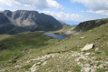
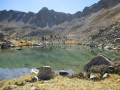
(7) Begin the descent, which is a little tricky at first over scree but becomes easier once you’ve cleared the first steep section. Continue, passing along the edge of the Estany dels Minyons and the Estany dels Aparellats. You will then reach the Joaquim Folch i Girona Refuge (E).

Waypoints

  1. S : mi 0 - alt. 6,854 ft - Pas de la Case
  2. 1 : mi 1.07 - alt. 7,405 ft - Estany de les Abelletes
  3. 2 : mi 1.94 - alt. 8,360 ft - Fals Coll dels Isards
  4. 3 : mi 2.19 - alt. 8,671 ft - Coll dels Isards
  5. 4 : mi 2.51 - alt. 8,415 ft - Estany Negre
  6. 5 : mi 3.24 - alt. 8,255 ft - Portella Blanca d’Andora
  7. 6 : mi 5.59 - alt. 6,821 ft - GR11 junction
  8. 7 : mi 7.32 - alt. 8,796 ft - Portella d’Engorgs
  9. E : mi 8.68 - alt. 7,799 ft - Joaquim Floch i Girona Mountain Hut

Notes

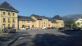
(S) The start of this stage is not easy to locate amongst these clusters of buildings; it is situated on the border between Andorra and France. This border is not marked by a ridge but by the spillway of the Estany de les Abelletes, the Ariège river, and is therefore at the bottom of the valley. It’s quite misleading, especially as the presence of herds makes it difficult to get around. The aim is therefore to find this lake, straddling the border, by following the ski runs and keeping as far to the left as possible – or as far east as possible – of the ski lifts. You’ll naturally reach it by following a dirt track (Avenue d’Encamp); once you’ve found the lake, the route is clearly signposted.
If you run into difficulties, either follow the Ariège stream or take the A-road; at the first hairpin bend to the right, take the Chemin d’Encamp, which also leads to the lake.

During this stage, there is plenty of water along the route, but also numerous herds. It is therefore advisable to set off with sufficient supplies and water purification tablets for when collecting water near the herds.

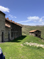
Joachim Folch i Girona Mountain Hut: In July 2018, this hut was in poor condition, particularly due to dirt, but it offers a safe shelter. It was also difficult to camp nearby because of the presence of numerous herds of cows.

For the most intrepid walkers, it is advisable to walk for a further two hours – provided you are fit enough (as there is a risk of accidents due to fatigue) – to reach the Malniu Refuge, which is a much more pleasant manned refuge where you can camp nearby (at a designated campsite, away from the herds).

Worth a visit

The Estany des Abelletes is close to the Source de l’Ariège, situated just above it in the Cirque de Font Nègre.

Always be cautious and plan ahead when you're outdoors. Visorando and the author of this route cannot be held responsible for any accidents occurring on this route.

The GR® and PR® markings are the intellectual property of the Fédération Française de Randonnée Pédestre.

Reviews and comments

gypaetus
gypaetus

Hello,
This is a hike that can be done in five stages, called Ax les Termes to Latour de Carol. You can find it on your computer, as I don't think the tablet or smartphone app shows multi-day hikes.
Here is the link: https://www.visorando.com/randonnee-d-ax...
If I could do it again today, I would choose the option for the first day of leaving my vehicle at the barns in the Savignac valley (point 4 of the first day) and then going to camp near the Embizon pond (a walk also described on visorando). It's wilder. You would then have to come back to collect your vehicle, perhaps by taxi.
It's then easy to pick up the route again.
I would also try to avoid Pas de la Case, which is too commercial but still very convenient, as well as the Joaquim Floch y Girona refuge, which is in poor condition; this is the option chosen by walkers who have done the route.
It is possible to camp near the ponds above (watch out for herds) or descend directly to Porta via the GR 7 at Portella Bianca. There is a nice hut at the start of the descent.
If you do so, you are welcome to return.

Best regards,

Machine-translated

panyella
panyella

Could you please send me your entire CV? Thank you.

Machine-translated

Other walks in the area

For more walks, use our search engine .

The GPS track and description are the property of this route's author. Please do not copy them without permission.