


Refine your search for walks in Mainxe
Mainxe walks


 Amidst the Cognac vineyards and the beautiful mansions of Mainxe
 Visorando Member
 6.38 mi
 +79 ft
 -79 ft
 3h 00
3h 00
 Moderate
 Departure from Mainxe (Charente)
A walk through the vineyards, featuring beautiful houses and a stunning dovecote.
Route de la Tonnelle in Saint-Même-les-Carrières
2.91 mi
+115 ft
-115 ft
1h 25
 Easy
Departure from Saint-Même-les-Carrières (Charente)
Easy
Departure from Saint-Même-les-Carrières (Charente)
A pleasant walk through the vineyards with a gentle gradient.
Circuit Romain in Segonzac
 Local authority
 8.92 mi
+482 ft
-459 ft
4h 30
Moderate
Departure from Segonzac (Charente)
8.92 mi
+482 ft
-459 ft
4h 30
Moderate
Departure from Segonzac (Charente)
Segonzac: the root of its name means 'strength, courage' in Gaulish.
Archaeological digs have revealed a Neolithic inhabitation (approx. 5000 B.C)
The Hundred Years' War persuaded the construction of numerous underground passages, which enabled the inhabitants to take refuge from extreme violence.
Protestantism has, without a doubt, left its mark in the area, particularly with the Segonzacais. The first Reformed church was founded in 1558. Troubles occurred in 1562 and the parish church was burnt down. Today's Temple is the third constructed since the Edict of Nantes.
According to a legend at the start of the 17th century, it was at Segonzac that a vintner named Chevalier de la Croix Maron invented double distillation.
Crêtes de Segonzac circuit
 6.08 mi
+358 ft
-341 ft
3h 05
Moderate
Departure from Segonzac (Charente)
6.08 mi
+358 ft
-341 ft
3h 05
Moderate
Departure from Segonzac (Charente)
The Gaul root of its name means 'strength, courage'. The Hundred Years War persuaded the construction of numerous underground passages, which enabled the inhabitants to take refuge from extreme violence. Without a doubt Protestantism has left its mark in the area, particularly with the Segonzacais. The first Reformed church was founded in 1558. Troubles occurred in 1562 and the parish church was burnt down. Today's Temple church is the third constructed since the Edict of Nantes.
From the Château de Bourg-Charente to the banks of the Charente
 6.62 mi
+174 ft
-174 ft
3h 10
Moderate
Departure from Bourg-Charente (Charente)
6.62 mi
+174 ft
-174 ft
3h 10
Moderate
Departure from Bourg-Charente (Charente)
Beautiful views of Château de Bourg and the Cognac vineyards. A very pleasant return journey along the banks of the Charente.
Cognac vineyards starting from Gensac-la-Pallue
 5.79 mi
+56 ft
-56 ft
2h 45
Easy
Departure from Gensac-la-Pallue (Charente)
5.79 mi
+56 ft
-56 ft
2h 45
Easy
Departure from Gensac-la-Pallue (Charente)
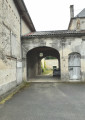
A route with very little elevation gain; the path is very easy to walk on, even in wet weather. At the start, you’ll pass the trout farming ponds. And nearby are some beautiful wine-growing estates.
Route du Gouffre au Marais
 10.28 mi
+56 ft
-56 ft
4h 45
Moderate
Departure from Gensac-la-Pallue (Charente)
10.28 mi
+56 ft
-56 ft
4h 45
Moderate
Departure from Gensac-la-Pallue (Charente)
Gensac-la-Pallue is notable for its marshes, to which the locals are deeply attached. La Pallue comes from ‘palus’: marshes. This wetland was once an extension of a branch of the Charente. La Pallue, an enclave within the parish of Gensac, became an independent commune during the Revolution. The two communes of Gensac and La Pallue were merged in 1857, with the exception of the villages of Roissac.
Gouffre to the Marshes Route (medium-length circular route)
 7.92 mi
+56 ft
-56 ft
3h 40
Easy
Departure from Gensac-la-Pallue (Charente)
7.92 mi
+56 ft
-56 ft
3h 40
Easy
Departure from Gensac-la-Pallue (Charente)
Gensac-la-Pallue is characterised by its marshes, to which the locals are very attached. The name ‘La Pallue’ comes from ‘palus’ (marshes). This wetland was once the extension of a branch of the River Charente. La Pallue, an enclave within the parish of Gensac, became an independent commune during the French Revolution. The two communes of Gensac and La Pallue were merged in 1857, with the exception of the villages of Roissac.
Route of Fountains and Washhouses – Orange-marked variant
3.31 mi
+190 ft
-190 ft
1h 40
Easy
Departure from Saint-Preuil (Charente)
This route offers the chance to discover small-scale rural heritage (fountains, wash houses). Exploring this route also allows you to appreciate the area’s scenic, floral and wildlife features.
Circuit of Open-air Wash Houses and Water Sources
 12.11 mi
+840 ft
-843 ft
6h 20
Moderate
Departure from Saint-Preuil (Charente)
12.11 mi
+840 ft
-843 ft
6h 20
Moderate
Departure from Saint-Preuil (Charente)
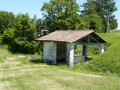
This circuit gives you the chance to discover rural heritage (springs, water sources, open air wash houses); and at each place, a description of its history is displayed. The route also highlights the architectural and historical heritage of the 13th century (Eglise Saint-Prohet, the Place Jacquaire, the protestant stele, the Chateau de Segeville) plus the various hamlets in the locality, flora and fauna.
Route of Fountains and Washhouses – Purple-marked variant
 7.95 mi
+482 ft
-512 ft
4h 05
Moderate
Departure from Saint-Preuil (Charente)
7.95 mi
+482 ft
-512 ft
4h 05
Moderate
Departure from Saint-Preuil (Charente)
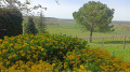
This route allows you to discover the area’s small-scale rural heritage (fountains, wash houses). Each water point features a historical and/or anecdotal description. The route also incorporates architectural and historical heritage (the 13th-century Saint-Projet Church, Place Jacquaire, Ségeville Castle and the scattered hamlets of the commune).
Exploring this route also allows you to appreciate the area’s scenic, floral and wildlife attractions.
The banks of the Charente from the Vinade Bridge
5.58 mi
+39 ft
-39 ft
2h 35
Easy
Departure from Bassac (Charente)
A ride along the Charente, passing through two picturesque little villages, Lautrait and Triac.
The banks of the Charente and Saint-Étienne Abbey in Bassac
 3.67 mi
+26 ft
-26 ft
1h 45
Easy
Departure from Bassac (Charente)
3.67 mi
+26 ft
-26 ft
1h 45
Easy
Departure from Bassac (Charente)
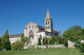
Walk along the banks of the Charente, passing through the village of Bassigeau and returning to Bassac.
The Bouteville Mill Route
 5.24 mi
+354 ft
-354 ft
2h 45
Easy
Departure from Bouteville (Charente)
5.24 mi
+354 ft
-354 ft
2h 45
Easy
Departure from Bouteville (Charente)
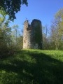
This route takes you uphill to the old mill before winding your way through the surrounding vineyards.
Bouteville Vineyard Route
 4.88 mi
+194 ft
-194 ft
2h 25
Easy
Departure from Bouteville (Charente)
4.88 mi
+194 ft
-194 ft
2h 25
Easy
Departure from Bouteville (Charente)
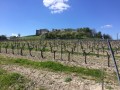
A route that runs mostly through the vineyards, which are ubiquitous in the commune of Bouteville, situated in the prestigious Grande Champagne region of the Cognac region. Almost all the winegrowers in Bouteville are also ‘distillers’.
From Bassac Abbey to the Prince of Condé’s Pyramid
 6.76 mi
+59 ft
-59 ft
3h 10
Moderate
Departure from Bassac (Charente)
6.76 mi
+59 ft
-59 ft
3h 10
Moderate
Departure from Bassac (Charente)
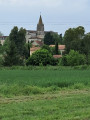
A long walk along the banks of the Charente to the Pyramide du Prince de Condé, where the prince’s story is explained. Another significant date is 16 December 1942, involving British Royal Marine commandos and Operation Frankton. A chapter in our history that deserves a great deal of explanation,
Path through the meadows of Saint-Amant-de-Graves
 3.98 mi
+26 ft
-26 ft
1h 50
Easy
Departure from Graves-Saint-Amant (Charente)
3.98 mi
+26 ft
-26 ft
1h 50
Easy
Departure from Graves-Saint-Amant (Charente)
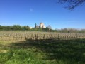
This route takes you through the meadows of the Charente near Graves. Beautiful churches and meadows with a variety of crops punctuate this lovely walk.
Chemin des Chaumes around Saint-Amant-de-Graves
 8.64 mi
+256 ft
-256 ft
4h 10
Moderate
Departure from Graves-Saint-Amant (Charente)
8.64 mi
+256 ft
-256 ft
4h 10
Moderate
Departure from Graves-Saint-Amant (Charente)
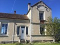
Meadows around the Charente river to the forest a little higher up. Beautiful landscapes and a variety of pleasant environments to walk through.
Côt Route
 10.86 mi
+463 ft
-453 ft
5h 25
10.86 mi
+463 ft
-453 ft
5h 25
 Difficult
Departure from Juillac-le-Coq (Charente)
Difficult
Departure from Juillac-le-Coq (Charente)
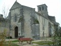
Juillac-Le-Coq is crossed by the Mothe stream, a tributary of the Charente. The village has a population of around 667. Wine-growing is its main industry.
The Côt Route (short circular route)
3.77 mi
+69 ft
-69 ft
1h 45
Easy
Departure from Juillac-le-Coq (Charente)
Juillac-Le-Coq is crossed by the Mothe stream, a tributary of the Charente. The village has a population of around 667. Wine-growing is its main industry.
The Cuckoo Trail
 3.19 mi
+230 ft
-223 ft
1h 40
Easy
Departure from Bonneuil (Charente)
3.19 mi
+230 ft
-223 ft
1h 40
Easy
Departure from Bonneuil (Charente)
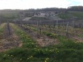
A route alternating between open landscapes and woodland. Very pleasant to walk.
The Chemin du Champ de Mars in Bonneuil
 5.40 mi
+348 ft
-348 ft
2h 45
Easy
Departure from Bonneuil (Charente)
5.40 mi
+348 ft
-348 ft
2h 45
Easy
Departure from Bonneuil (Charente)
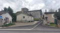
Much of this walk takes place in the forest, which is pleasant in summer. The rest of the route is through the vineyards, offering something for everyone.
Saint-Brice - Sentier de l'Abbaye
 6.63 mi
+243 ft
-240 ft
3h 15
Moderate
Departure from Saint-Brice (Charente)
6.63 mi
+243 ft
-240 ft
3h 15
Moderate
Departure from Saint-Brice (Charente)
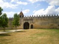
Thanks to the natural beauty of its location and the richness of its heritage, Saint-Brice is one of the most picturesque areas of Cognac region. At the heart of the Charente and Soloire rivers valley, man has erected many symbolic buildings: dolmens, churches, abbeys, castles and manors, all expertly crafted.
Circuit des Trois Pierres
 5.91 mi
+125 ft
-125 ft
2h 50
Easy
Departure from Angeac-Champagne (Charente)
5.91 mi
+125 ft
-125 ft
2h 50
Easy
Departure from Angeac-Champagne (Charente)
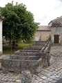
A lovely walk through the Charentais vineyards, passing beautiful buildings and around the village of Roissac.
Angeac- Champagne counts numerous prosperous-looking Charentais houses, witness to the wealth which lies in the local economy producing cognac, its principal occupation. The entrances to the estates are marked by a gate or porch way: there are at least 50. They are unique and typical of our local heritage. At Roissac village they embellish the main street.
Route between flax and vineyards (short circular route)
5.55 mi
+256 ft
-246 ft
2h 45
Easy
Departure from Lignières-Sonneville (Charente)
Lignière-Sonneville is a village with the rolling hills typical of the Grande Champagne region, formed by the merger of Lignières and Sonneville in 1845. Nestled in the heart of the Grande Champagne, it has a population of 613.
Route between Lin and Vigne
 12.70 mi
+843 ft
-820 ft
6h 35
Difficult
Departure from Lignières-Sonneville (Charente)
12.70 mi
+843 ft
-820 ft
6h 35
Difficult
Departure from Lignières-Sonneville (Charente)
Lignière-Sonneville is a village with the rolling hills typical of the Grande Champagne region, formed by the merger of Lignières and Sonneville in 1845. Nestled in the heart of the Grande Champagne, it has a population of 613.
The Bellevue route: between hillsides and valleys
4.17 mi
+138 ft
-141 ft
2h 00
Easy
Departure from Verrières (Charente) (Charente)
The commune is bordered to the south by the Né valley, towards which its land slopes gently. Vineyards, the main crop, cover more than two-thirds of the commune’s area and produce excellent, refined Grande Champagne brandies.
Circuit de la Motte
 1.24 mi
+102 ft
-105 ft
0h 40
Easy
Departure from Ambleville (Charente)
1.24 mi
+102 ft
-105 ft
0h 40
Easy
Departure from Ambleville (Charente)
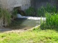
The commune of Ambleville is crossed by the Collinaud, a stream tributary of the River Né, which includes wash-houses typically found in this area of Grande Champagne. During your walk you will have the chance to discover La Motte, a hamlet in this commune. Take the time to admire the rolling countryside and La Motte wash-house.
This walk can be enjoyed with all the family, because children will find it fun to cross the Collinaud by way of the stepping stones.
Route des Petaux
 6.71 mi
+361 ft
-384 ft
3h 25
Moderate
Departure from Ambleville (Charente)
6.71 mi
+361 ft
-384 ft
3h 25
Moderate
Departure from Ambleville (Charente)
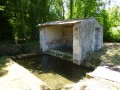
The village is crossed by the Collinaud, a tributary of the Né. Primarily focused on wine-growing, Ambleville also has fertile land for growing cereals.
The Petaux Route (short circular route)
 4.13 mi
+207 ft
-200 ft
2h 05
Easy
Departure from Ambleville (Charente)
4.13 mi
+207 ft
-200 ft
2h 05
Easy
Departure from Ambleville (Charente)
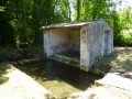
The Collinaud, a tributary of the Né, flows through the village. Whilst Ambleville is primarily focused on wine-growing, it also has fertile land suitable for growing cereals.
Le Grand Fé
5.64 mi
+390 ft
-397 ft
2h 55
Easy
Departure from Touzac (Charente)
A blue-marked route through the heart of the Grande Champagne vineyards, offering a rolling landscape.
Paths through sparse woodland
 8.12 mi
+95 ft
-98 ft
3h 50
Moderate
Departure from Sigogne (Charente)
8.12 mi
+95 ft
-98 ft
3h 50
Moderate
Departure from Sigogne (Charente)
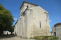
A route to explore the Charente wine-growing landscape of the Fins Bois and traces of the past (Gallo-Roman era, 12th-century church, lime kiln, porches of Charente properties).
The Gallo-Roman tracks of Éraville
5.31 mi
+207 ft
-203 ft
2h 35
Easy
Departure from Éraville (Charente)
Path, marked in red, following ancient Roman roads.
"Step by Step" through the village centre of Saint-Fort-sur-le-Né
 2.62 mi
+98 ft
-72 ft
1h 15
Easy
Departure from Saint-Fort-sur-le-Né (Charente)
2.62 mi
+98 ft
-72 ft
1h 15
Easy
Departure from Saint-Fort-sur-le-Né (Charente)
Situated at an altitude of 25 metres, the River Né and the Motte stream are the main watercourses flowing through the commune of Saint-Fort-sur-le-Né.
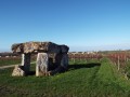
From certain vantage points, there are excellent views of the village, the dolmen, the vineyards, the Grande Champagne countryside and the other surrounding villages.
Each season offers a chance to discover its own unique charms.
Malaville Fountains Trail
6.56 mi
+364 ft
-371 ft
3h 20
Moderate
Departure from Malaville (Charente)
A route that follows the old railway line for part of the way and, for the rest, offers a walk through the vineyards with some very beautiful views.
Circuit du Dolmen
 7.20 mi
+236 ft
-236 ft
3h 30
Moderate
Departure from Saint-Fort-sur-le-Né (Charente)
7.20 mi
+236 ft
-236 ft
3h 30
Moderate
Departure from Saint-Fort-sur-le-Né (Charente)
Situated at 25m altitude - the river Né and the Motte stream are the principal water courses which cross the locality.
In certain places there are excellent views towards and from the village, the Dolmen, of the vineyards, the landscape of the Grande Champagne and surrounding villages. In every season you can discover a certain charm and appeal in St. Fort.