The Bellevue route: between hillsides and valleys

The commune is bordered to the south by the Né valley, towards which its land slopes gently. Vineyards, the main crop, cover more than two-thirds of the commune’s area and produce excellent, refined Grande Champagne brandies.

Details

n°442219
Creation:
Last update:
Last review:
  • Walking
    Activity: Walking
  • ↔
    Distance: 4.17 mi
  • ◔
    Average duration: 2h 00 
  • ▲
    Difficulty: Easy

  • ⚐
    Back to start: Yes
  • ↗
    Ascent: + 138 ft
  • ↘
    Descent: - 141 ft

  • ▲
    Highest point: 318 ft
  • ▼
    Lowest point: 167 ft

Description of the walk

The route starts from the motorhome parking area near the town hall. The route is marked in yellow, with an alternative route marked in green.

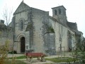
(S/E) Head downhill and cross the D44 road towards the church. Turn left immediately after the church.

(1) Turn right at the three-way junction and continue straight on along a grassy path. Follow the edge of the small wood on the left and, at the junction, turn right towards the hamlet known as ‘Chez Giraud’. Continue straight on as you leave the hamlet and turn left at the crossroads.

(2) Head right onto the limestone track and, at the crossroads, turn right towards the houses.

(3) After the houses, turn left, then take the first path on the right. Once you reach the tree (marker 85), take the limestone path on the right and walk for about 300 metres.

(4) Take the grassy path on the left towards the woodland just before the end of the limestone path.
Walk through the woods and carry on straight ahead. Once you’ve left the woods, cross the road and continue along the path opposite.

(5) After about 200 metres, take a path on the left and walk round the mill. Retrace your steps and
carry on to the left (west-south-west). When you reach the county road, take the path that branches off to the right at an acute angle through the vineyards.

(6) At the T-junction, turn left onto a limestone track towards the village. Join the D44 and follow it to the right. Then take the first street on your left to return to the motorhome park (S/E).

Waypoints

  1. S/E : mi 0 - alt. 213 ft - Motorhome park
  2. 1 : mi 0.24 - alt. 167 ft - On the right, at the three-way junction
  3. 2 : mi 1.19 - alt. 282 ft - Limestone path on the right
  4. 3 : mi 2.02 - alt. 305 ft - On the left
  5. 4 : mi 2.67 - alt. 308 ft - On the left, a grassy path
  6. 5 : mi 3.18 - alt. 292 ft - Junction for the mill
  7. 6 : mi 3.57 - alt. 223 ft - Les Maines au Mur
  8. S/E : mi 4.17 - alt. 213 ft - Motorhome park

Notes

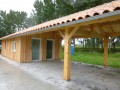
At the start of the route, a motorhome park, a hikers’ rest area and picnic tables are available.

Worth a visit

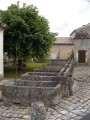
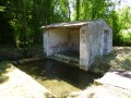
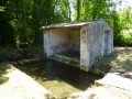
Places to see along the walk: the Bellevue Mill, the wash house and fountain at a place called La Font, and a viewpoint before the hamlet of Chez Giraud.
Another Blue-marked walking route.

Reviews and comments

4.2 / 5
Based on 2 reviews

Reliability of the description
4 / 5
Ease of following the route
4.5 / 5
Route interest
4 / 5
chipie33290
chipie33290

Overall rating : 5 / 5

Date of your route : Dec 23, 2024
Reliability of the description : Not used / Not applicable
Ease of following the route : ★★★★★ Very good
Route interest : ★★★★★ Very good
Very busy route : No

A short route along the ridges with lovely views and a chance to explore the mill.
Easy and signposted.
Thanks to Grand Cognac for uploading the walks to Visorando

Machine-translated

moulipat
moulipat

Overall rating : 3.7 / 5

Date of your route : Sep 06, 2017
Reliability of the description : ★★★★☆ Good
Ease of following the route : ★★★★☆ Good
Route interest : ★★★☆☆ Average

It’s a walk through the heart of the Grande Champagne region – lots of vineyards, a beautiful view, a lovely mill – and it’s suitable for a day out with children.

Machine-translated

Other walks in the area

For more walks, use our search engine .

The GPS track and description are the property of this route's author. Please do not copy them without permission.