Cognac vineyards starting from Gensac-la-Pallue

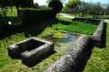
A route with very little elevation gain; the path is very easy to walk on, even in wet weather. At the start, you’ll pass the trout farming ponds. And nearby are some beautiful wine-growing estates.

Details

n°9413718
Creation:
Last update:
Last review:
  • Walking
    Activity: Walking
  • ↔
    Distance: 5.79 mi
  • ◔
    Average duration: 2h 45 
  • ▲
    Difficulty: Easy

  • ⚐
    Back to start: Yes
  • ↗
    Ascent: + 56 ft
  • ↘
    Descent: - 56 ft

  • ▲
    Highest point: 115 ft
  • ▼
    Lowest point: 52 ft

Photos

Description of the walk

Park in the church square in Gensac-la-Pallue.

(S/E) Walk past the church – it’s on your right – along Chemin du Gouffre, past the fish farm, and follow the path to the road. Cross the road, take Rue du Mesnil opposite, and follow it to the T-junction.

(1) Turn right and then immediately left onto a wide track towards Ball-trap. Continue to the T-junction and the Garenne de Tilloux woodland.

(2) Turn right onto the grassy track and go all the way round the woodland; it’s on your left. At the northern edge, at the T-junction, turn right and, about 75 metres further on, turn left, walking alongside the vineyards. You’ll come to a small road. Continue to the T-junction.

(3) Turn left; after about a hundred metres, turn right onto a wide track. When you reach the railway line, cross it carefully and turn left. Follow the track, gradually moving away from the line through the vineyards. Join the track again, then turn right once more to rejoin the D158 road.

(4) Cross it and take the main track opposite. Follow this main track, ignoring all turn-offs to the right and left, until you reach a small road running parallel to the N141.

(5) Turn left onto Route de Soubérac and follow the four-lane N141. Shortly afterwards, do not take the small road on your left between the vineyards towards Gensac, but follow the road that curves to the left. Then take thefirst road on the left into the village, Rue des Chênes, following the sign for Grateau (0.3 km). Continue to the T-junction, turn right onto Route de Grateau, then left onto Chemin des Rentes. Then turn left onto a grassy track and follow it to the sewage treatment works and the railway line.

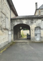
(6) Cross the railway line very carefully. Go straight up the embankment and cross over, then go back down the embankment on the other side of the railway line and take the path opposite, between the woodland and the vineyard, follow it to the next village, Les Barbotins; when you reach the T-junction and the buildings, turn right, and at the end turn left; follow the narrow lane which bends to the right; at the T-junction turn right; follow the cul-de-sac towards the beautiful porch, then turn left and immediately right onto the small path leading to the bridge.

(7) Follow this path towards the bridge and cross the Ri de Gensac stream via the bridge. Continue along the path until you reach the road. When you reach the road, turn left and follow the road as it curves to the right. At the T-junction, turn right onto Chemin du Gouffre, which leads back to the car park at Place de l’Église (S/E).

Waypoints

  1. S/E : mi 0 - alt. 59 ft - Car park - Église Saint-Martin (Gensac-la-Pallue)
  2. 1 : mi 0.33 - alt. 59 ft - Towards Ball-trap
  3. 2 : mi 0.89 - alt. 79 ft - Edge of the woodland
  4. 3 : mi 1.69 - alt. 89 ft - Chez Bonnaud
  5. 4 : mi 2.76 - alt. 92 ft - Path through the vineyards
  6. 5 : mi 3.73 - alt. 115 ft - Path through the vineyards
  7. 6 : mi 4.61 - alt. 56 ft - Souberac
  8. 7 : mi 5.44 - alt. 59 ft - Head towards the metal bridge
  9. S/E : mi 5.79 - alt. 59 ft - Car park - Église Saint-Martin (Gensac-la-Pallue)

Notes

Important note between (3) and (4) and then at (6): take great care when crossing the railway line, as you will be walking on the tracks. To do this, listen carefully for any sound of an approaching train before crossing.

Reviews and comments

2.8 / 5
Based on 5 reviews

Reliability of the description
2.8 / 5
Ease of following the route
3 / 5
Route interest
2.6 / 5
Francis16
Francis16

Overall rating : 3.7 / 5

Date of your route : Oct 03, 2023
Reliability of the description : ★★★★☆ Good
Ease of following the route : ★★★☆☆ Average
Route interest : ★★★★☆ Good
Very busy route : No

The route is very poorly signposted; you’ll need to use your smartphone’s GPS to find your way.

Machine-translated

Francis16
Francis16

Overall rating : 3.7 / 5

Date of your route : Oct 03, 2023
Reliability of the description : ★★★★☆ Good
Ease of following the route : ★★★★☆ Good
Route interest : ★★★☆☆ Average
Very busy route : No

Launch the app to guide you, as the route is very poorly signposted. The railway crossing is in a very poor state of repair. A narrow path through the nettles makes you wonder whether you’re actually on the right track. Otherwise, the route is quite pleasant.

Machine-translated

B Baillon
B Baillon

Overall rating : 1.5 / 5

Date of your route : May 27, 2022
Reliability of the description : ★☆☆☆☆ Very disappointing
Ease of following the route : Not used / Not applicable
Route interest : ★★☆☆☆ Disappointing
Very busy route : No

We did not continue along the route due to a lack of signposting, so we turned back after trying other routes

Machine-translated

j-p-sicaud
j-p-sicaud

It seems to me that the walks published by Visorando aren’t SIGNPOSTED. It might be a bit tricky in the vineyards, but with the app on a mobile phone, I reckon it’s possible to follow the route. And I’ll say it again: at the sewage treatment works, you have to climb up the embankment to cross the railway line, but there’s no crossing, so you have to cut across the tracks. Do so with great care. I’m thinking of going back out there to have a look. But once I’ve completed my walks, I’ll get someone who isn’t familiar with the area to try them out. If there’s a problem, I’ll amend the route. I’m sorry, but I’m not going to go and mark the route out – I don’t think I’m allowed to.

Machine-translated

Jeannot16
Jeannot16

Overall rating : 1 / 5

Date of your route : Jan 24, 2022
Reliability of the description : ★☆☆☆☆ Very disappointing
Ease of following the route : ★☆☆☆☆ Very disappointing
Route interest : ★☆☆☆☆ Very disappointing
Very busy route : No

No signs of waymarking.
Inaccurate description in the summary.
A hike to forget.

Machine-translated

j-p-sicaud
j-p-sicaud

Yes, the path isn’t very visible, but I did make it clear that you had to climb the embankment to cross the railway line.

Machine-translated

j-p-sicaud
j-p-sicaud

Yes, you can’t really see the path very well, but I did make it clear that you had to climb the embankment to cross the tracks.

Machine-translated

brigitte harly
brigitte harly

Overall rating : 3.7 / 5

Date of your route : Jun 29, 2021
Reliability of the description : ★★★★☆ Good
Ease of following the route : ★★★★☆ Good
Route interest : ★★★☆☆ Average
Very busy route : No

Hello,

I did this route last Saturday, 26 June. The start and finish were lovely and very pleasant; this route is best done when it’s not too hot, especially the sections through the vineyards.

Just a quick note: we took a wrong turn near the sewage treatment works – the path crossing the railway line isn’t very clear.

Kind regards

Brigitte

Machine-translated

Other walks in the area

For more walks, use our search engine .

The GPS track and description are the property of this route's author. Please do not copy them without permission.