From Bassac Abbey to the Prince of Condé’s Pyramid

A long walk along the banks of the Charente to the Pyramide du Prince de Condé, where the prince’s story is explained. Another significant date is 16 December 1942, involving British Royal Marine commandos and Operation Frankton. A chapter in our history that deserves a great deal of explanation,

Details

50004673
Creation:
Last update:
Last review:
  • Walking
    Activity: Walking
  • ↔
    Distance: 6.76 mi
  • ◔
    Average duration: 3h 10 
  • ▲
    Difficulty: Moderate

  • ⚐
    Back to start: Yes
  • ↗
    Ascent: + 59 ft
  • ↘
    Descent: - 59 ft

  • ▲
    Highest point: 128 ft
  • ▼
    Lowest point: 43 ft
  • ⚐ Country: France
  • ⚐ City: Bassac (16120)
  • ⚑
    Start/End: N 45.66248° / W 0.104227°
  • ❏
    IGN map(s): Ref. 1632SB
  • Hour-by-hour weather

Photos

Description of the walk

Park at Place Rambaud de Laroque, near the town hall.

(S/E) Turn left onto the D22 (Route de Condé).

(1) Look out for the small road on your left – this will be your return route – and carry on straight ahead. Pass the cemetery, then turn right onto Rue de la Ferrière. Drive through the hamlet of Bassigeau until you reach a T-junction.

(2) Turn right, cross the bridge over the Guirlande and follow the path which bends sharply to the right (90°) before reaching the Charente. Head towards the riverbank and follow it as closely as possible.

(3) Carry on straight ahead along the path, ignoring the path branching off to the right towards Bassac. Pass close to the Saintonge lock and arrive at the Pont de la Vinade rest area.

(4) Carry on, passing under the bridge, and join the D90. Go straight on, then follow the departmental road which branches off diagonally to the right: ignore the towpath. Continue to the T-junction with the D22, turn right to follow this road – taking care – and head for the Pyramide du Prince de Condé. You can stop here for a break.

(5) Leave the site at the bottom without taking the road; go down the wooden steps and turn left onto the path. Follow this path to the road, turn right and carry on to the junction with the D18.

(6) Proceed straight ahead with care, do the same at the next junction and enter the hamlet of Cheville.

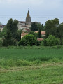
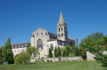
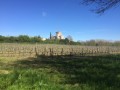
(7) Turn right onto Rue du Canton, then right again onto Rue du Rigolet. Go straight on at the next junction, onto a small road called Chemin des Champs. Follow this small road as it winds through the vineyards, taking a moment to admire Saint-Étienne Abbey in the distance. You’ll come back onto Rue de Condé.

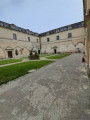
(1) Turn right to reach the abbey, arrive at the town hall square and turn left, taking the path to the visitors’ car park. Visit the gardens.

(8) Retrace your steps back to the town hall square, then turn left to cross to the other side and finish the tour.

(9) Then head back to the car park (S/E).

Waypoints

  1. S/E : mi 0 - alt. 69 ft - Car park
  2. 1 : mi 0.25 - alt. 59 ft - Junction of the circular loop
  3. 2 : mi 0.66 - alt. 52 ft - Bassigeau, on the right – the River Charente
  4. 3 : mi 1.9 - alt. 46 ft - Junction, go straight on
  5. 4 : mi 2.74 - alt. 43 ft - Vinade Bridge
  6. 5 : mi 3.37 - alt. 69 ft - Pyramid of the Prince of Condé
  7. 6 : mi 4.11 - alt. 82 ft - D18
  8. 7 : mi 4.82 - alt. 128 ft - Cheville
  9. 8 : mi 6.36 - alt. 56 ft - Abbey Gardens
  10. 9 : mi 6.62 - alt. 72 ft - Saint-Étienne Abbey
  11. S/E : mi 6.76 - alt. 69 ft - Car park

Worth a visit

Reviews and comments

4.1 / 5
Based on 4 reviews

Reliability of the description
4 / 5
Ease of following the route
4.3 / 5
Route interest
4 / 5
Lesrandonneursdupasse

Overall rating : 4.7 / 5

Date of your route : Oct 06, 2024
Reliability of the description : ★★★★★ Very good
Ease of following the route : ★★★★☆ Good
Route interest : ★★★★★ Very good
Very busy route : No

A lovely walk with some fascinating historical discoveries 👍👍

Machine-translated

BBglili
BBglili

Overall rating : 3.7 / 5

Date of your route : Jul 01, 2024
Reliability of the description : ★★★★☆ Good
Ease of following the route : ★★★★☆ Good
Route interest : ★★★☆☆ Average
Very busy route : No

A route with some very pleasant sections, such as the well-shaded banks of the Charente, but also other sections through fields of maize or vineyards.
There’s a picnic spot at the Condé Pyramid, which is well-equipped and very pleasant.

Machine-translated

Panthera
Panthera

Hello,
Thank you for taking this into account, but the 17 m elevation gain isn’t feasible either.
Actually, it’s 59 metres; in my original message, there was a comma error.
Kind regards

Machine-translated

jean-louis phlippoteau

Overall rating : 4 / 5

Date of your route : Jun 05, 2024
Reliability of the description : ★★★★☆ Good
Ease of following the route : ★★★★☆ Good
Route interest : ★★★★☆ Good
Very busy route : No

I would just like to point out that the route is advertised as being 10.88 km long. However, the recording of the route taken shows only 9.94 km.

Machine-translated

FLOCH
FLOCH ★

Hello, and thank you for your feedback.
The elevation gain must have been revised: it is currently listed as 17 m on the details page.

Machine-translated

madydou
madydou ★

Hello,
Thank you for the comment.
The elevation gain has just been recalculated.
Everything is in order.

Machine-translated

Panthera
Panthera

Overall rating : 4 / 5

Date of your route : May 24, 2024
Reliability of the description : ★★★☆☆ Average
Ease of following the route : ★★★★★ Very good
Route interest : ★★★★☆ Good
Very busy route : No

Just a quick note to say you should check your elevation gain, because a 595m climb can be quite daunting.
Especially along the riverbank – 59.5 metres is a more accurate figure.

Machine-translated

Other walks in the area

For more walks, use our search engine .

The GPS track and description are the property of this route's author. Please do not copy them without permission.