"Step by Step" through the village centre of Saint-Fort-sur-le-Né

Situated at an altitude of 25 metres, the River Né and the Motte stream are the main watercourses flowing through the commune of Saint-Fort-sur-le-Né.
From certain vantage points, there are excellent views of the village, the dolmen, the vineyards, the Grande Champagne countryside and the other surrounding villages.
Each season offers a chance to discover its own unique charms.

Details

322451
Creation:
Last update:
Last review:
  • Walking
    Activity: Walking
  • ↔
    Distance: 2.62 mi
  • ◔
    Average duration: 1h 15 
  • ▲
    Difficulty: Easy

  • ⚐
    Back to start: Yes
  • ↗
    Ascent: + 98 ft
  • ↘
    Descent: - 72 ft

  • ▲
    Highest point: 180 ft
  • ▼
    Lowest point: 72 ft

Photos

Description of the walk

(S/E) The route starts in front of the town hall in Saint-Fort-sur-le-Né.
Leave the town hall on your left and head straight down. Take the small path on your left and continue until you reach the road.
Join the D736 by heading to the right.
Carry on straight ahead for several metres, then turn left at the Halte Randonneurs.

::1: :Carry on straight ahead, leaving the D736, and head towards the hamlet of Les Brissons.

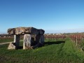
(2) Turn left towards the dolmen, which is signposted. Follow this limestone path up to the dolmen on your right: take a round trip to enjoy the magnificent scenery.
On your way back down from the dolmen, continue along the path, turning right, and carry on until you reach a road.

(3) Take a hairpin bend to the left towards the D736. Cross it and carry on straight ahead.
Take the second road on the right and carry on straight ahead to go round the hamlet. The vineyards are on the right.
Turn right towards the cemetery to reach a slope

(4) Enjoy the superb view.
Retrace your steps, heading straight down to the church.
Carry on downhill to reach the starting point (S/E).

Waypoints

  1. S/E : mi 0 - alt. 108 ft - Saint-Fort-sur-le Town Hall - Né (rivière)
  2. 1 : mi 0.29 - alt. 72 ft - Go straight on when leaving the D736
  3. 2 : mi 0.6 - alt. 92 ft - Turn left towards the dolmen
  4. 3 : mi 1.25 - alt. 121 ft - Turn left towards the D736
  5. 4 : mi 2.23 - alt. 180 ft - Viewpoint
  6. S/E : mi 2.62 - alt. 108 ft - Saint-Fort Town Hall

Notes

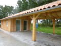
A hikers’ rest area and a picnic area are available for your use during your route.
A map showing the start of the 11.5 km “Route du Dolmen” (blue markings) is available at the same location.

Worth a visit

The town hall and the lodge.
Formerly the Hôtel de France.

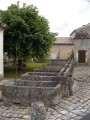
Walkers’ Rest.
In the Né Valley, nature lovers will appreciate this peaceful and relaxing spot. Ideal for picnics, it is also the starting point for the village’s walking trail, which is well worth exploring.

La Pierre Levée Dolmen:
set amongst the vineyards, it bears witness to the Neolithic era. Cited as the finest in the region, it is remarkable for its size; its granite capstone weighs 40 tonnes, is 7 metres long and 4.70 metres wide.

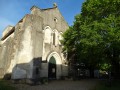
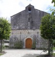
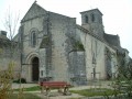
Saint-Anne’s Church
Formerly known as Saint-Fortunat, this Romanesque church was built in the 12th century.

Nearby…

Le Ménis and La Vallade
Hamlets within the commune, featuring beautiful buildings from bygone eras.

The Moulin des Plantes
Built in the 18th century, featuring a donkey-width passageway.

Reviews and comments

5 / 5
Based on 2 reviews

Reliability of the description
5 / 5
Ease of following the route
5 / 5
Route interest
5 / 5
chipie33290
chipie33290

Overall rating : 5 / 5

Date of your route : May 26, 2024
Reliability of the description : Not used / Not applicable
Ease of following the route : ★★★★★ Very good
Route interest : ★★★★★ Very good
Very busy route : No

A short, very easy route to explore the village’s heritage.
A brilliant idea, thank you

Machine-translated

hrvj
hrvj

Overall rating : 5 / 5

Date of your route : Feb 06, 2023
Reliability of the description : ★★★★★ Very good
Ease of following the route : ★★★★★ Very good
Route interest : ★★★★★ Very good
Very busy route : No

bgjk btl

Machine-translated

Other walks in the area

For more walks, use our search engine .

The GPS track and description are the property of this route's author. Please do not copy them without permission.