Route of Fountains and Washhouses – Orange-marked variant

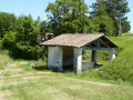
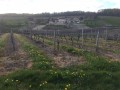
This route offers the chance to discover small-scale rural heritage (fountains, wash houses). Exploring this route also allows you to appreciate the area’s scenic, floral and wildlife features.

Details

413938
Creation:
Last update:
Last review:
  • Walking
    Activity: Walking
  • ↔
    Distance: 3.31 mi
  • ◔
    Average duration: 1h 40 
  • ▲
    Difficulty: Easy

  • ⚐
    Back to start: Yes
  • ↗
    Ascent: + 190 ft
  • ↘
    Descent: - 190 ft

  • ▲
    Highest point: 472 ft
  • ▼
    Lowest point: 266 ft

Description of the walk

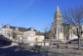
The route starts from the hikers’ rest area next to Saint-Preuil Church.

Orange signposting

(S/E) With your back to the car park, turn right, then follow the white path straight ahead for approximately 800m.

(1) Turn left at the first stop, “La Fuie”, and continue along the white path. At the three-way junction, take the left-hand path.

(2) When you reach the second stop, “Font-qui-Bouille”, turn right into the field of walnut trees. Cross it straight ahead, skirting the woodland, then head uphill to your right.

(3) At the first path on your left, enter the woodland and walk through it for a short distance (200m), then follow the path on your left to discover the “Font Loubat” spring. Follow the path uphill past the fountain. On leaving the woodland, take the path on the right and follow it uphill for a few metres.

(4) Take the hairpin bend to the left at the junction and carry on. At the crossroads as you leave the woods, turn right. Walk past the “Font de Gours” fountain, then turn left, skirting the edge of the woods.

(5) At the corner, head back down to the left to rejoin the country lane and continue along it to the left.

(6) At the five-way junction, take the second turning on the right and join the D90. Turn left and continue along the RD, taking care, until you reach the village of Saint-Preuil. Head left towards the church to reach the village centre and the car park (S/E).


Waypoints

  1. S/E : mi 0 - alt. 299 ft - Hikers’ Rest Area
  2. 1 : mi 0.59 - alt. 338 ft - La Fuie, on the left
  3. 2 : mi 0.9 - alt. 367 ft - Font-qui-Bouille, on the right
  4. 3 : mi 1.02 - alt. 390 ft - Enter the woods on the left
  5. 4 : mi 1.58 - alt. 430 ft - Crossroads, turn left
  6. 5 : mi 2.74 - alt. 338 ft - At the corner, on the left
  7. 6 : mi 2.93 - alt. 302 ft - Five-way junction, take the second right
  8. S/E : mi 3.31 - alt. 299 ft - Hikers’ Rest Area

Notes

At the start, a hikers’ shelter is available for your use. For groups, please contact the town hall to collect the keys to the shelter – subject to a contribution towards costs – on 05 45 83 41 49.

A picnic table, a map of the route showing its alternative routes, and public toilets are provided on site.

Worth a visit

This route offers three possible alternatives:

22km route, marked in red. This route also takes in the area’s architectural and historical heritage (the 13th-century Saint-Projet Church, Place Jacquaire, the Protestant memorial, Ségeville Castle and the scattered hamlets of the commune).
Exploring this route also allows you to appreciate the area’s scenic, floral and wildlife attractions.

10km route, marked in yellow. A route with little shade, offering panoramic views along the ridge and an orientation table. From the ‘Halte Randonneurs’, follow the small road below the church car park to Font de Gours.

22km alternative route, marked in purple. A wooded and shaded route.

All this information can be found on the map at the start point at the Halte Randonneurs.

Reviews and comments

3.8 / 5
Based on 5 reviews

Reliability of the description
3.4 / 5
Ease of following the route
3.4 / 5
Route interest
4.6 / 5
GPILOTTE
GPILOTTE

Overall rating : 4 / 5

Date of your route : Apr 04, 2023
Reliability of the description : ★★★★☆ Good
Ease of following the route : ★★★★☆ Good
Route interest : ★★★★☆ Good
Very busy route : No

A very enjoyable route, but best done in dry weather
otherwise, make sure you wear wellies

Machine-translated

GCTourisme
GCTourisme

Hello,
Thank you for your feedback.
The signposting for this route is due to be redone very soon by the Departmental Committee.
Kind regards
The Grand Cognac Tourism Office

Machine-translated

henri57
henri57 ★

Hello,

Did the description and layout cause any problems? If so, how can we resolve them? Could you suggest some solutions?

Kind regards

Machine-translated

EtienneQR
EtienneQR

Overall rating : 2 / 5

Date of your route : Apr 08, 2019
Reliability of the description : ★☆☆☆☆ Very disappointing
Ease of following the route : ★☆☆☆☆ Very disappointing
Route interest : ★★★★☆ Good

Fortunately, the weather and the scenery – the forest, vineyards, wash houses and village – were all just as we’d hoped. This walk is very pleasant.
A lot of work needs to go into the description and the maps!

Machine-translated

Lyra78
Lyra78

Overall rating : 4.7 / 5

Date of your route : Apr 01, 2018
Reliability of the description : ★★★★★ Very good
Ease of following the route : ★★★★☆ Good
Route interest : ★★★★★ Very good

A lovely walk through woods and vineyards.
However, do make sure you wear waterproof shoes in wet weather!

Machine-translated

bibi
bibi ★

Thank you for your feedback. Is the description detailed enough? Where should I add to it, and how?
Kind regards

Machine-translated

dianaloris
dianaloris

Overall rating : 4 / 5

Date of your route : Aug 20, 2017
Reliability of the description : ★★★☆☆ Average
Ease of following the route : ★★★★☆ Good
Route interest : ★★★★★ Very good

A very pleasant walk through rolling vineyards and woodland; however, the signposting leaves a lot to be desired and clearly wasn’t done by walkers… it’s best to have a map or GPS when walking through the vineyards. Daniel

Machine-translated

josiane farchaud
josiane farchaud

Overall rating : 4.3 / 5

Date of your route : Dec 05, 2016
Reliability of the description : ★★★★☆ Good
Ease of following the route : ★★★★☆ Good
Route interest : ★★★★★ Very good

an impressive career

Machine-translated

Other walks in the area

For more walks, use our search engine .

The GPS track and description are the property of this route's author. Please do not copy them without permission.