Route du Gouffre au Marais

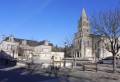
Gensac-la-Pallue is notable for its marshes, to which the locals are deeply attached. La Pallue comes from ‘palus’: marshes. This wetland was once an extension of a branch of the Charente. La Pallue, an enclave within the parish of Gensac, became an independent commune during the Revolution. The two communes of Gensac and La Pallue were merged in 1857, with the exception of the villages of Roissac.

Details

n°295947
Creation:
Last update:
Last review:
  • Walking
    Activity: Walking
  • ↔
    Distance: 10.28 mi
  • ◔
    Average duration: 4h 45 
  • ▲
    Difficulty: Moderate

  • ⚐
    Back to start: Yes
  • ↗
    Ascent: + 56 ft
  • ↘
    Descent: - 56 ft

  • ▲
    Highest point: 115 ft
  • ▼
    Lowest point: 52 ft

Photos

Description of the walk

Start: Place de la Mairie. Yellow signposts.

(S/E) Head towards the street and turn left. Walk past the post office and take the cul-de-sac on your right. Follow the path to the right at the end of the car park and carry on straight ahead. Turn left onto Rue de l’Église and carry on straight ahead. Go round Place de l’Église on the left and carry on straight ahead onto Chemin du Gouffre.

(1) Turn left and carry on straight ahead along Chemin des Ramonets. After the bend, take the limestone track on your right. At the next junction, turn right and then left towards the road.

(2) Turn right and, at the crossroads, follow the road on your right. Carry on straight ahead and take the second street on the left (Rue du Mesnil). Turn right and immediately take the limestone path on your left. Carry on straight ahead until you reach the edge of the woods. Go round the woods on the right, following the path. Continue along the path, keeping to the right of the woods.

(3) Turn right at the junction and cross a road to take the path directly in front of you. Carry on straight ahead through the trees.
Turn left at the fork. Walk through the woods.

(4) Take the path on your right to walk alongside the trees on the right-hand side. Follow the path towards the houses. Pass a path coming from the left and, 100 metres further on, one on the right. Cross the RD95 and take the path opposite, continuing straight on for about 1 km through the vineyards.

(5) Turn right, then left, and stay on the path until you reach the road. Cross the road and go round the building on the right. Cross another road and take the limestone path directly opposite you. Carry on straight ahead and stay on the main track for about 1 km

(6) Go straight on at the junction and continue straight ahead along the track for 1 km 300.

(7) Cross the RD148 and take the limestone track in front of you. At the junction, continue along the dirt track for 750 metres until you reach a limestone track.

(8) Cross the limestone track and take the track in front of you, following the trees. Carry on straight ahead and cross the ‘Chemin Boisné’ road. Take the road in front of you and continue along the limestone track, then the dirt track, for a distance of approximately 900 metres. Take the track furthest to the left where the trees are.

(9) Turn right onto the RD150 and carry on straight ahead. Take the first limestone track on your right towards the woods. Continue along the track for 1 km towards the RD150.

(10) Turn right onto the road and continue straight on. Turn left at the fourth junction. Turn right at the end of the street onto the Route du Cognac. Continue along the road and, further on, turn right onto the Impasse de Chardon. Turn left onto the Chemin du Grand Marais and continue straight on.

(11) At the junction, take the left-hand-most street to rejoin the Route du Cognac. Turn right and carry on straight ahead to reach the village centre. Continue straight ahead to return to the Place de la Mairie (S/E).

Waypoints

  1. S/E : mi 0 - alt. 59 ft - Place de la Mairie
  2. 1 : mi 0.23 - alt. 59 ft - Chemin des Ramonets
  3. 2 : mi 0.54 - alt. 59 ft - Turn right
  4. 3 : mi 2.02 - alt. 89 ft - Turn right at the junction
  5. 4 : mi 2.83 - alt. 75 ft - Path on the right
  6. 5 : mi 4.09 - alt. 108 ft - Turn right at the fork
  7. 6 : mi 5.3 - alt. 102 ft - Go straight on
  8. 7 : mi 6.15 - alt. 82 ft - Crossing the RD148
  9. 8 : mi 6.82 - alt. 59 ft - Cross the path
  10. 9 : mi 7.94 - alt. 56 ft - Turn right
  11. 10 : mi 8.86 - alt. 62 ft - Turn right
  12. 11 : mi 9.89 - alt. 56 ft - Take the street
  13. S/E : mi 10.28 - alt. 59 ft - Place de la Mairie

Notes

Picnic tables are available at the start.

Worth a visit

Reviews and comments

3.7 / 5
Based on 3 reviews

Reliability of the description
3.7 / 5
Ease of following the route
4.3 / 5
Route interest
3 / 5
User 24386567
• Edited:

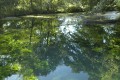
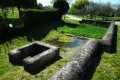
The signposting is poor at the start. Once you’ve turned onto Rue Ramonet, you need to turn right onto a grassy path and cross a metal footbridge spanning three parallel streams: the Ris de Gensac… It’s a picturesque spot… The signposting on this stretch is too vague, and as the footbridge isn’t marked, you find yourself hesitating… Simply giving directions isn’t always enough, because as I didn’t spot the reference to the footbridge and the path wasn’t really white, I decided to turn back after crossing it and reaching the road, too unsure whether I was on the right section.... In the middle of a heatwave, I decided to settle for an hour’s walk around the village hall… Next time!

Machine-translated

La fronde
La fronde

Overall rating : 3.3 / 5

Date of your route : Dec 01, 2024
Reliability of the description : ★★★☆☆ Average
Ease of following the route : ★★★★☆ Good
Route interest : ★★★☆☆ Average
Very busy route : No

A few interesting passages.

Machine-translated

yaya 16
yaya 16

Overall rating : 3.3 / 5

Date of your route : May 17, 2017
Reliability of the description : ★★★★☆ Good
Ease of following the route : ★★★★☆ Good
Route interest : ★★☆☆☆ Disappointing

Hello,
This is the least appealing route of all our trips; there isn’t much to see, there are far too many straights, and nothing but vineyards!!!

Machine-translated

Yves80
Yves80

Overall rating : 4.3 / 5

Date of your route : Dec 12, 2016
Reliability of the description : ★★★★☆ Good
Ease of following the route : ★★★★★ Very good
Route interest : ★★★★☆ Good

Hello, it was a lovely walk; 14 of us completed the route – I was the organiser. Kind regards

Machine-translated

Other walks in the area

For more walks, use our search engine .

The GPS track and description are the property of this route's author. Please do not copy them without permission.