The Bouteville Mill Route

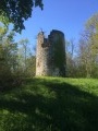
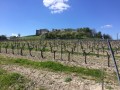
This route takes you uphill to the old mill before winding your way through the surrounding vineyards.

Details

245448
Creation:
Last update:
Last review:
  • Walking
    Activity: Walking
  • ↔
    Distance: 5.24 mi
  • ◔
    Average duration: 2h 45 
  • ▲
    Difficulty: Easy

  • ⚐
    Back to start: Yes
  • ↗
    Ascent: + 354 ft
  • ↘
    Descent: - 354 ft

  • ▲
    Highest point: 469 ft
  • ▼
    Lowest point: 171 ft
  • ⚐ Country: France
  • ⚐ City: Bouteville (16120)
  • ⚑
    Start/End: N 45.5994° / W 0.134803°
  • ❏
    IGN map(s): Ref. 1632SB
  • Hour-by-hour weather

Photos

Description of the walk

Yellow markings

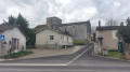
(S/E) From the castle car park, head back towards the crossroads and turn right onto the Grand’Rue, which winds its way down through the village. Pass the war memorial, then the small wash house; head slightly uphill and, when the road bends to the right, leave it and take a good track on the left which climbs quite steeply.

(1) Cross the first road and continue straight on, climbing through the vineyards. When you reach the road again, take it to the right, go down a little before leaving it to take a good track on the right.

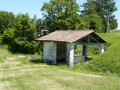
(2) Turn left immediately under the power line, then follow this track which runs alongside a small copse and then a vineyard. At the next junction, continue straight ahead along the track which leads into the forest. Pass by the mill, then begin to descend through the vineyards.

(3) Cross the D95 road and continue along the path, which veers slightly to the right, heading north-east. Keep heading in this direction until you reach the tarmac road at Masdebaud.

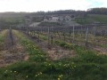
(4) Take the road on the right for just over two hundred metres before leaving it, near some cherry trees, to join a track amongst the vineyards. This track winds through the vineyards; stay on the main track heading south. The track becomes increasingly well-defined, eventually leading to a road which you should take on the left.

(5) Leave the road at the first bend, taking a track on the right. Walk a few dozen metres before turning right again, near a small cottage. The track, which is quite wide but sometimes overgrown with grass, runs through the vineyards and other crops. Carry on along this track until you reach a large tree; continue to the left to cross over a stream, then veer slightly to the right onto a track suitable for vehicles.

(6) When you reach the first houses, carry on straight ahead along Impasse du Coiffeur to reach Grand’rue de Bouteville. Turn left to cross the village and reach the crossroads, where you’ll need to turn sharp left to head back towards the castle car park (S/E).

Waypoints

  1. S/E : mi 0 - alt. 331 ft - Castle car park
  2. 1 : mi 0.59 - alt. 335 ft - Crossing the road
  3. 2 : mi 1.06 - alt. 459 ft - Turn right, then left, following the power line
  4. 3 : mi 1.73 - alt. 295 ft - Crossing the road
  5. 4 : mi 2.46 - alt. 203 ft - Small road
  6. 5 : mi 3.71 - alt. 171 ft - The road bends; leave the road here
  7. 6 : mi 4.72 - alt. 226 ft - Houses, tarmac
  8. S/E : mi 5.24 - alt. 331 ft - Castle car park

Reviews and comments

4.1 / 5
Based on 3 reviews

Reliability of the description
4 / 5
Ease of following the route
4 / 5
Route interest
4.3 / 5
sebastien36230
sebastien36230

Overall rating : 4 / 5

Date of your route : Aug 23, 2025
Reliability of the description : ★★★★☆ Good
Ease of following the route : ★★★★☆ Good
Route interest : ★★★★☆ Good
Very busy route : No

This route could be done in reverse to enjoy a bird's-eye view of the village before arriving.

Machine-translated

Bedochaud Serge
Bedochaud Serge

Overall rating : 4.7 / 5

Date of your route : Oct 17, 2022
Reliability of the description : ★★★★☆ Good
Ease of following the route : ★★★★★ Very good
Route interest : ★★★★★ Very good
Very busy route : No

Hello,
For us, it’s a lovely walk. It means I’ll be able to suggest it to my walking club, with just a slight tweak and a bit of an extension.
It’s a walk I’ll recommend if anyone asks me where to go for a walk.
Thank you for this walk
Serge

Machine-translated

Zrainmaker
Zrainmaker

Overall rating : 3.7 / 5

Date of your route : Aug 30, 2020
Reliability of the description : ★★★★☆ Good
Ease of following the route : ★★★☆☆ Average
Route interest : ★★★★☆ Good
Very busy route : No

A lovely walk for a Sunday afternoon, to let your Sunday lunch settle gently.
Take care from section No. 4 onwards, as it’s easy to miss the two cherry trees; carry on along the road and turn right instead of taking the vineyard path.
If possible, use the IGN satellite map. It offers better visibility.
Enjoy yourself.

Machine-translated

Other walks in the area

For more walks, use our search engine .

The GPS track and description are the property of this route's author. Please do not copy them without permission.