Country:
 City:
City:


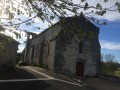
Park in Éraville near the 12th-century Saint-Pierre Church.
(S/E) From the church – note its bell wall, which houses a bell dating from 185 – walk up Rue de Spicheren, passing No. 13. After the bend, take the path on the right. Cross the Chemin de la Combe à Robinet and continue until you reach a tarmac road.
(1) Turn left onto this road, called Chemin Boisné, and take the path on the right, by the hedge. Cross the Route de l’Enclave, walk 300 metres and turn right to enter the woods. As you emerge from the woods, walk past the shed and continue straight on until you reach the D84.
(2) Cross the departmental road with care and take the dirt track. At the crossroads, turn right onto Chemin Boisné (an ancient Roman road that linked Saintes to Périgueux).
(3) At the next junction, turn left to reach the village of Chez Ferchaux.
(4) Cross the village road and turn left at the Judas tree; continue for 100 metres and turn right to join the road, where you then turn right.
(5) At the junction, opposite the road to Chez Ferchau, turn left onto a path and continue straight ahead. Cross the local road and join another path.
(6) Follow this path to the left towards the departmental road (D84), cross it to reach the hamlet of Chez Pontais.
(7) Leave the hamlet on your left and take the white track on the right known as ‘la Faye’ (a pre-Roman track). Continue to the large electricity pylon and head downhill to the left.
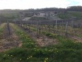
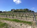
(8) At the end of the vineyards, turn left and carry on straight ahead to the church (S/E)


 Visorando Member
 Moderate
 Local authority