Gouffre to the Marshes Route (medium-length circular route)

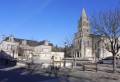
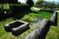
Gensac-la-Pallue is characterised by its marshes, to which the locals are very attached. The name ‘La Pallue’ comes from ‘palus’ (marshes). This wetland was once the extension of a branch of the River Charente. La Pallue, an enclave within the parish of Gensac, became an independent commune during the French Revolution. The two communes of Gensac and La Pallue were merged in 1857, with the exception of the villages of Roissac.

Details

n°401354
Creation:
Last update:
Last review:
  • Walking
    Activity: Walking
  • ↔
    Distance: 7.92 mi
  • ◔
    Average duration: 3h 40 
  • ▲
    Difficulty: Easy

  • ⚐
    Back to start: Yes
  • ↗
    Ascent: + 56 ft
  • ↘
    Descent: - 56 ft

  • ▲
    Highest point: 115 ft
  • ▼
    Lowest point: 52 ft

Photos

Description of the walk

Start at Place de la Mairie. Green signposting (alternative routes: yellow signposting 16 km and blue signposting 6 km).

(S/E) Head towards the street and turn left. Walk past the post office and take the cul-de-sac on your right. Follow the path to the right at the end of the car park and carry on straight ahead. Turn left onto Rue de l’Église, go round Place de l’Église on the left and continue along Chemin du Gouffre.

(1) Turn left and carry on straight ahead along Chemin des Ramonets. .

(2) After the bend, turn right onto the green path to cross the Renaud Bridge. At the next junction, turn right and then left to join the road.

(3) Turn right and, at the crossroads, follow the road on your right. Carry on straight ahead and take the second street on the left (Rue du Mesnil).

(4) At the junction, turn right and immediately take the limestone path on your left. Carry on straight ahead until you reach the edge of the woods. Go round the woods on the right, taking the path that runs alongside them, and turn left at a 90° angle at the edge.

(5) Turn right at the junction and cross a road to continue along the path opposite. Carry straight on through the trees. Turn left at the T-junction and enter the woods.

(6) Take the path on your right to follow the edge of the woodland. Follow the path towards the houses. Pass a path coming from the left and, 100 metres further on, the one on the right. Cross the RD95 and take the path opposite straight ahead, for a distance of about 1 km, through the vineyards.

(7) Turn right, then left, and stay on the path to reach the road. Cross the road and go round the building on the right. Cross another road and take the limestone path opposite. Carry on straight ahead and stay on the main track for about 1 km.

(8) At the crossroads where four paths meet, head straight ahead and carry on straight for 1.3 km.

(9) Cross the RD148 at a clump of trees and take the limestone track opposite. At the junction, turn right and carry on straight ahead. Cross the road, take the limestone track opposite, and carry on straight ahead.

(10) At the junction, take the road on your right to join the Route du Cognac. Turn right and carry on straight ahead to reach the village centre and return to the Place de la Mairie (S/E).

Waypoints

  1. S/E : mi 0 - alt. 59 ft - Place de la Mairie
  2. 1 : mi 0.23 - alt. 59 ft - Chemin des Ramonets
  3. 2 : mi 0.38 - alt. 56 ft - Renaud Bridge
  4. 3 : mi 0.54 - alt. 59 ft - Turn right
  5. 4 : mi 0.92 - alt. 59 ft - Crossroads
  6. 5 : mi 2.02 - alt. 89 ft - Turn right at the junction
  7. 6 : mi 2.83 - alt. 75 ft - Path on the right
  8. 7 : mi 4.09 - alt. 108 ft - Turn right at the fork
  9. 8 : mi 5.31 - alt. 102 ft - Crossroads
  10. 9 : mi 6.15 - alt. 82 ft - Crossing the RD148
  11. 10 : mi 7.53 - alt. 56 ft - Street on the right
  12. S/E : mi 7.92 - alt. 59 ft - Place de la Mairie

Notes

Free car park with an electric charging point.
Public toilets at the start or finish.
Picnic tables and bins are available at the start (or finish), past the shops, to the right of the War Memorial.

Worth a visit

Reviews and comments

4.2 / 5
Based on 2 reviews

Reliability of the description
4.5 / 5
Ease of following the route
3 / 5
Route interest
5 / 5
henri57
henri57 ★

Hello,

Thank you for taking the time to give your opinion.

‘Route on map’ does not refer to assessing the signposting, but rather to checking that the route shown on the map matches the actual terrain.

See you soon

Machine-translated

babette162
babette162

Overall rating : 4.3 / 5

Date of your route : Apr 02, 2019
Reliability of the description : ★★★★★ Very good
Ease of following the route : ★★★☆☆ Average
Route interest : ★★★★★ Very good

Hello
A lovely walk through woods and vineyards, but there isn’t quite enough signposting to prevent you from going astray in the vineyards
Kind regards

Machine-translated

fginette
fginette

Overall rating : 4 / 5

Date of your route : Feb 20, 2017
Reliability of the description : ★★★★☆ Good
Ease of following the route : ★★★☆☆ Average
Route interest : ★★★★★ Very good

The signposting is sometimes a bit patchy, but it’s a pleasant walk whatever the season.

Machine-translated

Other walks in the area

For more walks, use our search engine .

The GPS track and description are the property of this route's author. Please do not copy them without permission.