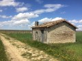
The banks of the Charente from the Vinade Bridge

A ride along the Charente, passing through two picturesque little villages, Lautrait and Triac.

Details

66958307
Creation:
Last update:
Last review:
  • Walking
    Activity: Walking
  • ↔
    Distance: 5.58 mi
  • ◔
    Average duration: 2h 35 
  • ▲
    Difficulty: Easy

  • ⚐
    Back to start: Yes
  • ↗
    Ascent: + 39 ft
  • ↘
    Descent: - 39 ft

  • ▲
    Highest point: 85 ft
  • ▼
    Lowest point: 43 ft
  • ⚐ Country: France
  • ⚐ City: Bassac (16120)
  • ⚑
    Start/End: N 45.666794° / W 0.119547°
  • ❏
    IGN map(s): Ref. 1632SB
  • Hour-by-hour weather

Description of the walk

Park at the Vinade Bridge (D18); parking is available.

(S/E) Pass under the road bridge, following the road for about 200 m.

(1) Turn left onto the white track (FlowVélo) running alongside the Charente, and you’ll come to a track on the right which will be your return route.

(2) Continue along the FlowVélo path, cross a stream and reach a fork in the path.

(3) Turn right towards the N141, follow it and you’ll come out onto the D22.

(4) Cross it carefully before the small bridge, then take the tarmac path opposite, running alongside the Ruisseau de la Gorre, and arrive at the village of Lautrait.

(5) Turn left at the crossroads in the village and head down Rue de la Mairie. Turn right into the first street and continue straight on along Rue de Velennes until the end, after passing through a housing estate.

(6) Turn right onto the unpaved track which leads to a road.

(7) Turn right onto the road towards Triac, keep to the right at the sewage treatment plant, and you’ll come out onto Rue de la Croix (D90).

(8) Turn left, go a few metres, then make the first turn right then left to cross, with care, Rue de la Pyramide de Condé (D22), and continue along the path that leads to the banks of the Charente, at the junction you passed on the way out.

(2) Turn left onto FlowVélo and, following the route in the opposite direction to the outward journey, head for the Pont de Vinade car park (S/E).

Waypoints

  1. S/E : mi 0 - alt. 46 ft - Pont de Vinade car park
  2. 1 : mi 0.11 - alt. 46 ft - Junction on FlowVélo - Pont de Vinade
  3. 2 : mi 0.58 - alt. 46 ft - Junction marking the end of the circular loop - Charente (fleuve)
  4. 3 : mi 1.72 - alt. 43 ft - Junction towards the N141
  5. 4 : mi 2.56 - alt. 49 ft - Cross the D22
  6. 5 : mi 3.24 - alt. 75 ft - Entrance to the village of Lautrait
  7. 6 : mi 3.64 - alt. 82 ft - Path on the right after the housing estate
  8. 7 : mi 4.06 - alt. 82 ft - Junction towards Triac
  9. 8 : mi 4.49 - alt. 66 ft - Junction with Rue de la Croix
  10. S/E : mi 5.58 - alt. 46 ft - Pont de Vinade car park - Charente (fleuve)

Notes

Take care when crossing departmental roads.

Worth a visit

The Vinade Bridge, a magnificent structure in a magnificent setting.
Pass through the village of Lautrait with its old Charente-style houses.

Reviews and comments

4.1 / 5
Based on 4 reviews

Reliability of the description
4.5 / 5
Ease of following the route
4.3 / 5
Route interest
3.5 / 5
moulipat
moulipat

Overall rating : 4.3 / 5

Date of your route : Oct 20, 2025
Reliability of the description : ★★★★★ Very good
Ease of following the route : ★★★★★ Very good
Route interest : ★★★☆☆ Average
Very busy route : No

A pleasant walk for all ages along the riverbank, slightly less so along the RN141, and the rest of the walk takes you through lots of vineyards, which is normal in the Cognac region

Machine-translated

LAIRAIN
LAIRAIN

Overall rating : 3.7 / 5

Date of your route : Feb 17, 2025
Reliability of the description : ★★★★☆ Good
Ease of following the route : ★★★☆☆ Average
Route interest : ★★★★☆ Good
Very busy route : No

The only problem is that the signposting is never the same – you really do have to follow the route on the map

Machine-translated

lionel lamouroux
lionel lamouroux

Overall rating : 3.7 / 5

Date of your route : Jan 06, 2025
Reliability of the description : ★★★★☆ Good
Ease of following the route : ★★★★☆ Good
Route interest : ★★★☆☆ Average
Very busy route : Yes

A very pleasant walk, though unfortunately Bassac Abbey was closed.

Machine-translated

poisson87
poisson87

Overall rating : 4.7 / 5

Date of your route : Dec 23, 2024
Reliability of the description : ★★★★★ Very good
Ease of following the route : ★★★★★ Very good
Route interest : ★★★★☆ Good
Very busy route : No

Despite the damp weather, your feet stay dry

Machine-translated

Other walks in the area

For more walks, use our search engine .

The GPS track and description are the property of this route's author. Please do not copy them without permission.